- Cherry Spring, Texas
-
Cherry Spring, Texas Location within the state of Texas
 Cherry Spring, Texas
Coordinates: 30°29′00″N 99°00′33″W / 30.4833333°N 99.00917°WCoordinates: 30°29′00″N 99°00′33″W / 30.4833333°N 99.00917°W Country United States State Texas County Gillespie Elevation 1,791 ft (546 m) Population (2000) - Total 25 Time zone Central (CST) (UTC-6) - Summer (DST) CDT (UTC-5) ZIP code Area code(s) 830 FIPS code 48-14572[1] GNIS feature ID 1379538[2] Cherry Spring is an unincorporated farming and ranching community established in 1852 in Gillespie County, in the U.S. state of Texas. It is located on Cherry Spring Creek, which runs from north of Fredericksburg to Llano.[3] The creek was also sometimes known as Cherry Springs Creek by residents. The community is located on the old Pinta Trail.[4] [5] The school was added to the National Register of Historic Places Listings in Gillespie County, Texas on May 6, 2005, NRHP Reference #:05000389.[6] The school was designated a Recorded Texas Historic Landmark in 1985.[7]
Current population is 75. Elevation 1,791 feet.[8]
Contents
Settlers and Community
On December 15, 1847, a petition was submitted to create Gillespie County. In 1848, the legislature formed Gillespie County from Bexar and Travis counties.
For more details on this topic, see List of Petitioners to Create Gillespie County, Texas.While the signers were overwhelmingly German immigrants, names also on the petition were Castillo, Pena, Munos, and a handful of non-German Anglo names.
The community was originally settled by German immigrants Dietrich Rode, a director of the original Zion Lutheran Church in Fredericksburg,[9][10] and William Kothe in 1852.[11] Rode also served as a Luthern lay minister in his home at Cherry Springs, leading to the establishment of Christ Luthern Church.[12] The still active church has some 200 members. Mr. Rode’s original home [13] still stands near the church.
The 1860 Census of Gillespie County listed 117 people in Cherry Spring.[14]
John O. Meusebach brokered the Meusebach-Comanche Treaty in 1847, making area settlers safe from Comanche raids. However, Kiowa, and Apache depredations were still committed against the settlers. The most famous white captive of the area was Herman Lehmann.[15] Lehmann later ran the cattle drive stop that became the Cherry Springs Dance Hall.
John O. Meusebach was buried in Cherry Spring in the family cemetery after his death in 1897.[16]
Cherry Spring Schools
Das Alte Schulhaus, the Old Cherry Spring School, served the children of the community 1860-1878, before being converted for church services. The land had been donated by German nobleman Wilhelm Marschall von Bieberstein.[17] From 1878 to 1885, classes for children of German immigrants were held in private homes. The second Cherry Spring School was built in 1885 on land donated by H. Bratherich. Teachers would often board with area residents. The end of each school year in May was a community celebratory event with baseball, barbecue, a play, and an oompah band.[18] The school consolidated with Fredericksburg ISD in 1962. The building is now used as the Cherry Spring Community Club. Added to the National Register of Historic Places Listings on May 6, 2005.[19]
See also
- Cherry Springs Dance Hall
- Crabapple, Texas
- Doss, Texas
- Enchanted Rock
- Fredericksburg, Texas
- Harper, Texas
- Loyal Valley, Texas
- Luckenbach, Texas
- Sisterdale, Texas
- Texas Hill Country
References
- ^ "American FactFinder". United States Census Bureau. http://factfinder.census.gov. Retrieved 2008-01-31.
- ^ "US Board on Geographic Names". United States Geological Survey. 2007-10-25. http://geonames.usgs.gov. Retrieved 2008-01-31.
- ^ Cherry Spring Creek from the Handbook of Texas Online. Retrieved 30 April 2010. Texas State Historical Association
- ^ Nixon, Nina L: Pinta Trail (El Camino Pinta) from the Handbook of Texas Online. Retrieved 30 April 2010. Texas State Historical Association
- ^ "El Camino Pinta". City of San Antonio. http://www.sanantonio.gov/planning/neighborhoods/north%20central/Appendix%20J.PDF. Retrieved 30 April 2010.City of San Antonio
- ^ "National Register Information System". National Register of Historic Places. National Park Service. 2010-07-09. http://nrhp.focus.nps.gov/natreg/docs/All_Data.html.
- ^ "Old Cherry Spring School". Texas Historic Markers. William Nienke, Sam Morrow. http://www.9key.com/markers/marker_detail.asp?atlas_number=5171010016&search_term=old+cherry+spring+school. Retrieved 30 April 2010.
- ^ "Geographical Names Information System, Cherry Spring". U.S. Dept of the Interior. http://geonames.usgs.gov/pls/gnispublic/f?p=135:3:970146285889853::NO:3:P3_FID,P3_TITLE:1379538,Cherry%20Spring. Retrieved 30 April 2010. U.S. Dept of the Interior
- ^ "Deidrich Rode Complex". Voice of the Texas Hills. http://www.voicesofthetexashills.org/vthhbldg0169.htm. Retrieved 18 November 2010.
- ^ Perry, Garland. "Rode, Deidrich". Handbook of Texas Online. Texas State Historical Association. http://www.tshaonline.org/handbook/online/articles/fro98. Retrieved 18 November 2010.
- ^ Kohout, Martin Donell: Cherry Spring from the Handbook of Texas Online. Retrieved 30 April 2010. Texas State Historical Association
- ^ "Christ Luthern Church". http://www.christ-lutheran-church.com/christlutheran.html. Retrieved 30 April 2010.
- ^ Western Ghost Towns. "Cherry Spring". http://oak.cats.ohiou.edu/~gulino/ghosttown/cherry_spring_tx.htm. Retrieved 30 April 2010.
- ^ "Gillespie County Census 1860". http://www.txgenweb2.org/txgillespie/1860-8.html. Retrieved 30 April 2010.
- ^ Lehmann, Herman; Hunter, J Marvin; Giese, Dale F (1993). Nine Years Among the Indians, 1870-1879: The Story of the Captivity and Life of a Texan Among the Indians. University of New Mexico Press. ISBN 978-0826314178.
- ^ "Meusebach, John O., Grave". http://www.findagrave.com/cgi-bin/fg.cgi?page=gr&GSln=meusebach&GSfn=john&GSbyrel=in&GSdyrel=in&GSob=n&GRid=35575597&l. Retrieved 30 April 2010.
- ^ Wilhelm Marschall von Bieberstein at Find a Grave
- ^ "Cherry Spring School and Community Center". Friends of Gillespie County Country Schools. http://www.historicschools.org/cherryspring.htm. Retrieved 30 April 2010.
- ^ "Cherry Springs Schools". Texas Historical Commission. http://atlas.thc.state.tx.us/viewform.asp?atlas_num=5171010017&site_name=Cherry%20Spring%20Schoolhouse&class=5000. Retrieved 24 September 2011.
External links
U.S. National Register of Historic Places Topics Lists by states Alabama • Alaska • Arizona • Arkansas • California • Colorado • Connecticut • Delaware • Florida • Georgia • Hawaii • Idaho • Illinois • Indiana • Iowa • Kansas • Kentucky • Louisiana • Maine • Maryland • Massachusetts • Michigan • Minnesota • Mississippi • Missouri • Montana • Nebraska • Nevada • New Hampshire • New Jersey • New Mexico • New York • North Carolina • North Dakota • Ohio • Oklahoma • Oregon • Pennsylvania • Rhode Island • South Carolina • South Dakota • Tennessee • Texas • Utah • Vermont • Virginia • Washington • West Virginia • Wisconsin • WyomingLists by territories Lists by associated states Other  Category:National Register of Historic Places •
  Portal:National Register of Historic Places
Municipalities and communities of Gillespie County, Texas County seat: Fredericksburg City 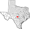
CDPs Unincorporated
communitiesBlumenthal | Cherry Spring | Crabapple | Doss | Grapetown | Luckenbach | Tivydale | Willow City
Ghost towns Albert | Cain City | Eckert | Morris Ranch | Pedernales | Zodiac
Categories:- Populated places in Gillespie County, Texas
- Unincorporated communities in Texas
- German-American history
- Populated places established in 1852
- Recorded Texas Historic Landmarks
- Schools on the National Register of Historic Places in Texas


Wikimedia Foundation. 2010.