- Crabapple, Texas
-
Crabapple, Texas Location within the state of Texas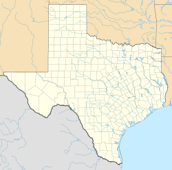
 Crabapple, Texas
Coordinates: 30°26′35″N 98°50′15″W / 30.44306°N 98.8375°WCoordinates: 30°26′35″N 98°50′15″W / 30.44306°N 98.8375°W Country United States State Texas County Gillespie Elevation 1,775 ft (541 m) Time zone Central (CST) (UTC-6) - Summer (DST) CDT (UTC-5) ZIP code Area code(s) 830 FIPS code GNIS feature ID 1379606[1] Crabapple, Texas is an unincorporated farming and ranching community 10.5 miles (16.9 km) north of Fredericksburg in Gillespie County, Texas located on Crabapple Creek,[2] about halfway between Fredericksburg and Enchanted Rock State Park[3] at an elevation of 1,775 feet. [4] The school was designated a Recorded Texas Historic Landmark number 10022 in 1994.[5] The school was added to the National Register of Historic Places in Texas on May 6, 2005, NRHP Reference #:05000390[6].
Contents
Settlers and community
The initial European settlers in Crabapple were German immigrants Friedrich Welgehausen, Jacob Land, Adam Pehl, Mathias Schmidt,[7] Nicolaus Rusche,[8] James Riley, Heinrich Kneese, and Jacob[9] and Adam Fries [10] in the mid 19th Century.[11]
On December 15, 1847, a petition was submitted to create Gillespie County. In 1848, the legislature formed Gillespie County from Bexar and Travis counties.
For more details on this topic, see List of Petitioners to Create Gillespie County, Texas.While the signers were overwhelmingly German immigrants, names also on the petition were Castillo, Pena, Munos, and a handful of non-German Anglo names.
Crabapple School and post office
Farmer Mathias Schmidt donated the land for a Crabapple school, earning the privilege by running a footrace with neighbor Crockett Riley who had also offered to donate land.[12] Area families built the native limestone structure with their own labor. The 1878 school had a single classroom, with an adjoining room for the teacher living quarters. An outer staircase led to a second story storage space. An additional room was added later.
The original schoolhouse also served as a post office from 1887-1910. The first postmaster was John J. Stein.[13] There were a total of nine postmasters before the mail was routed to Willow City in 1910.
A second limestone school was built in 1882 that also served as a Lutheran church, until the St. John's congregation erected its own building in 1887.
Twenty-eight teachers taught at Crabapple School before it consolidated with Fredericksburg Independent School District in 1994.
Balanced Rock
Balanced Rock [14] [15] was a famous local landmark that perched atop Bear Mountain in the Crabapple Community.[16] The natural stone pillar, about the size of a small elephant, precariously balanced on its small tip. It fell prey to vandals[17] who dynamited it off its base in April 1986.
See also
- Cherry Spring
- Cherry Springs Dance Hall
- Doss
- Enchanted Rock
- Fredericksburg
- Loyal Valley
- Sisterdale
- Texas Hill Country
- Willow City
References
- ^ "US Board on Geographic Names". United States Geological Survey. 2007-10-25. http://geonames.usgs.gov. Retrieved 2008-01-31.
- ^ Crabapple Creek from the Handbook of Texas Online. Retrieved 29 April 2010. Texas State Historical Association
- ^ Kennedy, Ira. "Enchanted Rock". Tourin' Texas. http://www.texfiles.com/tourintexas/july2003/enchantedrock/index.htm. Retrieved 29 April 2010. TexFiles
- ^ "Geographical Names Information System, Crabapple". U.S. Dept of the Interior. http://geonames.usgs.gov/pls/gnispublic/f?p=135:3:506600786398600::NO:3:P3_FID,P3_TITLE:1379606,Crabapple. Retrieved 29 April 2010. U.S. Dept of the Interior
- ^ "Crabapple School". Texas Historical Markers. William Nienke, Sam Morrow. http://www.9key.com/markers/marker_detail.asp?atlas_number=5171010022. Retrieved 29 April 2010.
- ^ "National Register Information System". National Register of Historic Places. National Park Service. 2010-07-09. http://nrhp.focus.nps.gov/natreg/docs/All_Data.html.
- ^ "Schmidt, Mathias, Gravestone". Fredericksburg Geneaological Society. http://www.fbgtxgensoc.org/photos/sjl/pages/Schmidt,Mathias_jpg.html. Retrieved 29 April 2010. Fredericksburg Geneaological Society
- ^ "Rusche, Nicolaus, Gravestone". Fredericksburg Geneaological Society. http://www.fbgtxgensoc.org/photos/rus/pages/Rusche,Nicolaus_jpg.html. Retrieved 29 April 2010. Fredericksburg Geneaological Society
- ^ "Fries, Jacob and Emily, Gravestone". Fredericksburg Geneaological Society. http://www.fbgtxgensoc.org/photos/eck/pages/Fries,Jacob&Emily_jpg.html. Retrieved 29 April 2010. Fredericksburg Geneaological Society
- ^ "Fries, Adam, Gravestone". Fredericksburg Geneaological Society. http://www.fbgtxgensoc.org/photos/stm1/pages/Fries,Adam.html. Retrieved 29 April 2010. Fredericksburg Geneaological Society
- ^ Kohout, Martin Donell: Crabapple, Texas from the Handbook of Texas Online. Retrieved 29 April 2010. Texas State Historical Association
- ^ "Crabapple School and Community Center". The Friends of Gillespie County Country Schools. http://www.historicschools.org/crabapple.htm. Retrieved 29 April 2010. The Friends of Gillespie County Country Schools
- ^ "Crabapple Postmasters". Jim Wheat. http://www.rootsweb.ancestry.com/~txpost/gillespie.html. Retrieved 29 April 2010.Jim Wheat
- ^ "Balanced Rock Postcard". Playle's Online Auction. http://www.playle.com/listing.php?PHPSESSID=evb0p1qghdkh2q2hqbifdq81o0&i=ETEXBILL5244. Retrieved 29 April 2010.Playle's Auctions
- ^ "Balanced Rock Pillar". Mountain Zone. http://www.mountainzone.com/mountains/detail.asp?fid=2925056. Retrieved 29 April 2010.
- ^ Kennedy, Ira. "Crabapple Community". Tourin' Texas. http://www.texfiles.com/tourintexas/july2003/crabapple/index.htm. Retrieved 29 April 2010. TexFiles
- ^ "Vandals Blast Balanced Rock". Schenectady Gazette. 26 April 1986. http://news.google.com/newspapers?id=5wkhAAAAIBAJ&sjid=WXIFAAAAIBAJ&pg=2947,6106926&dq=balanced+rock+texas&hl=en.
External links
U.S. National Register of Historic Places Topics Lists by states Alabama • Alaska • Arizona • Arkansas • California • Colorado • Connecticut • Delaware • Florida • Georgia • Hawaii • Idaho • Illinois • Indiana • Iowa • Kansas • Kentucky • Louisiana • Maine • Maryland • Massachusetts • Michigan • Minnesota • Mississippi • Missouri • Montana • Nebraska • Nevada • New Hampshire • New Jersey • New Mexico • New York • North Carolina • North Dakota • Ohio • Oklahoma • Oregon • Pennsylvania • Rhode Island • South Carolina • South Dakota • Tennessee • Texas • Utah • Vermont • Virginia • Washington • West Virginia • Wisconsin • WyomingLists by territories Lists by associated states Other  Category:National Register of Historic Places •
  Portal:National Register of Historic Places
Municipalities and communities of Gillespie County, Texas County seat: Fredericksburg City 
CDPs Unincorporated
communitiesBlumenthal | Cherry Spring | Crabapple | Doss | Grapetown | Luckenbach | Tivydale | Willow City
Ghost towns Albert | Cain City | Eckert | Morris Ranch | Pedernales | Zodiac
Categories:- Unincorporated communities in Texas
- Populated places in Gillespie County, Texas
- German-American history
- Recorded Texas Historic Landmarks


Wikimedia Foundation. 2010.