- National Register of Historic Places listings in Crawford County, Wisconsin
-
Buildings, sites, districts, and objects in Crawford County listed on the National Register of Historic Places
-
- This National Park Service list is complete through NPS recent listings posted November 10, 2011.[1]
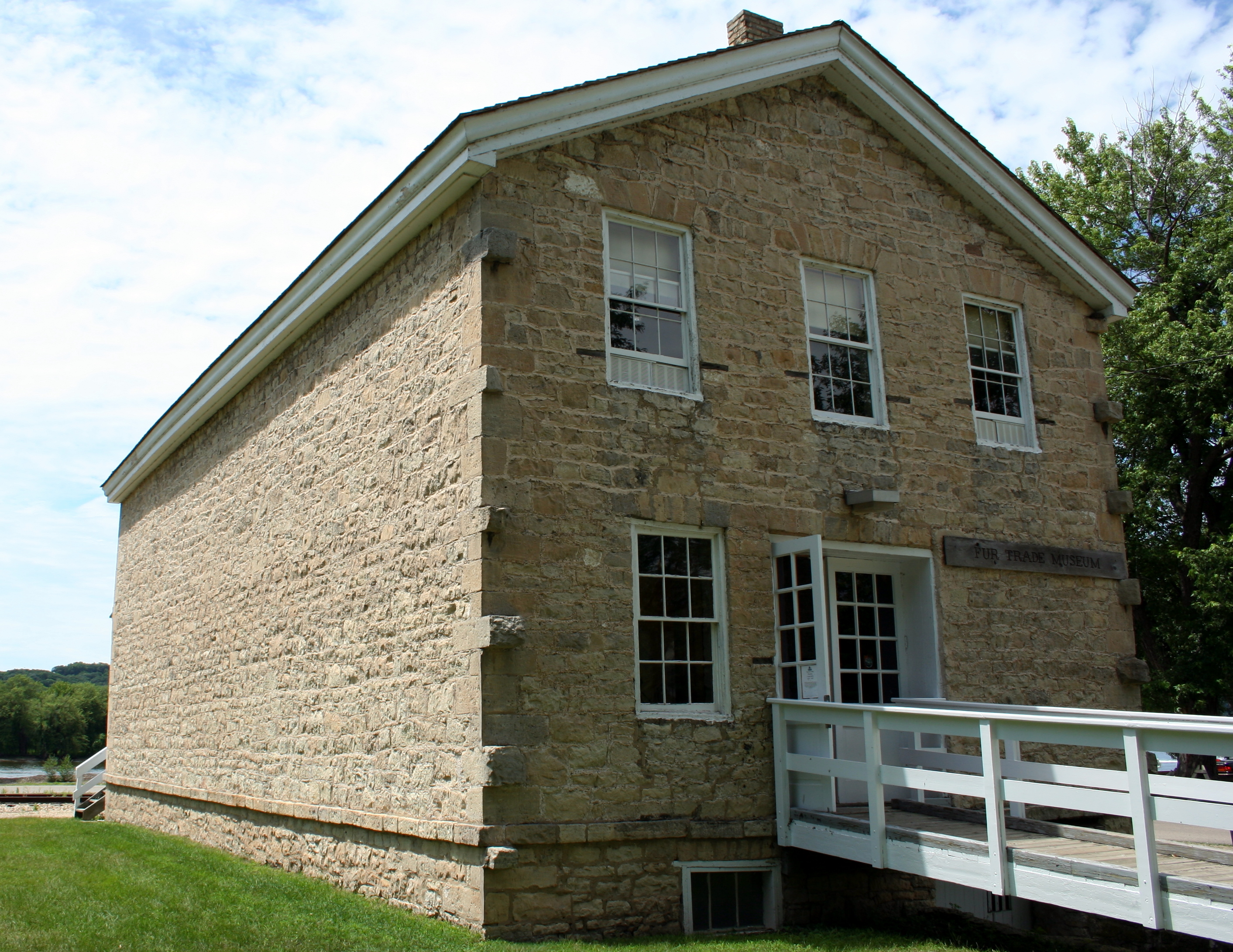
[2] Landmark name [3] Image Date listed Location City or town Summary 1 Astor Fur Warehouse 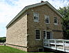
October 15, 1966 Water Street, Saint Feriole Island
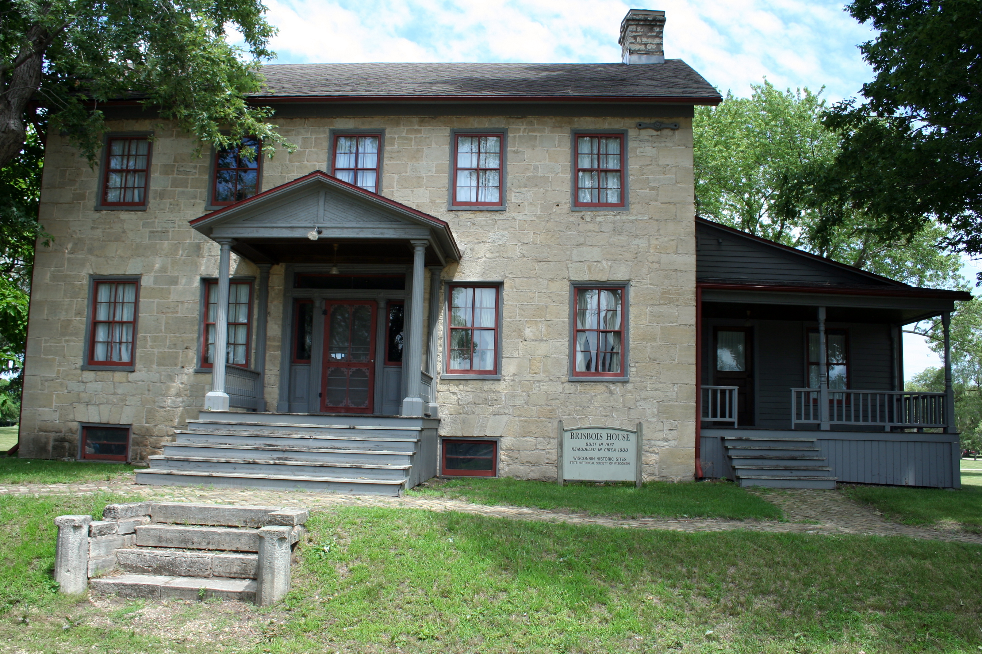
43°03′18″N 91°09′36″W / 43.055°N 91.16°WPrairie du Chien 2 Michael Brisbois House 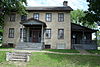
October 15, 1966 Water Street, Saint Feriole Island
43°03′15″N 91°09′35″W / 43.054167°N 91.159722°WPrairie du Chien 3 Carved Cave 
September 27, 1996 Address Restricted Petersburg 4 Cipra Wayside Mound Group February 7, 2007 Address Restricted Wauzeka 5 Commercial Hotel November 15, 2002 201 West Blackhawk Avenue
43°03′06″N 91°08′52″W / 43.051667°N 91.147778°WPrairie du Chien 6 Crawford County Courthouse 
March 9, 1982 220 North Beaumont Road
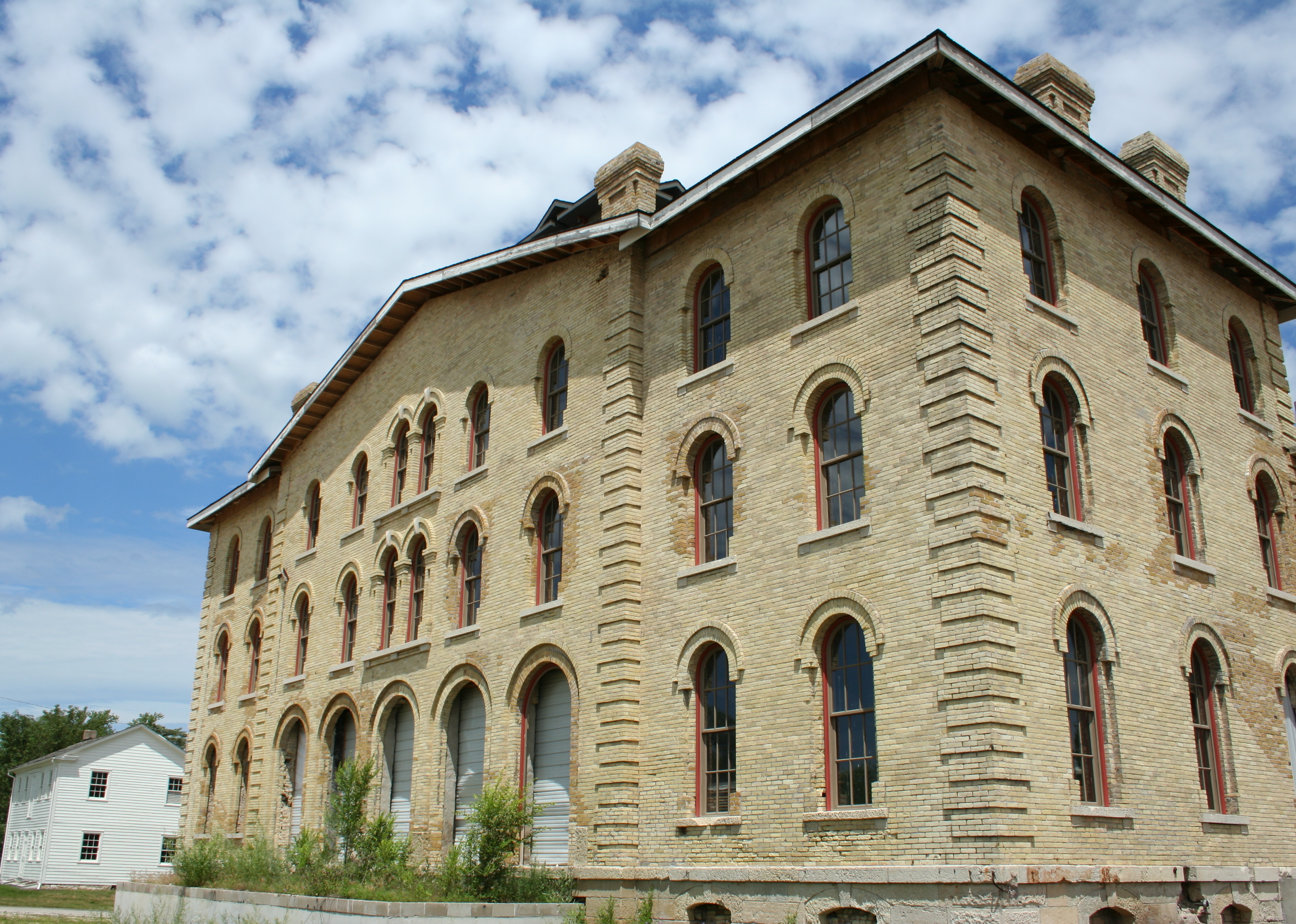
43°03′17″N 91°08′44″W / 43.054722°N 91.145556°WPrairie du Chien 7 Crow Hollow Site March 13, 2002 Address Restricted Petersburg 8 Dousman Hotel 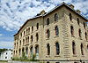
October 15, 1966 Fisher Street and River Road
43°03′14″N 91°09′35″W / 43.053889°N 91.159722°WPrairie du Chien 9 Foley Mound Group July 15, 1974 Address Restricted Lynxville 10 W.H.C. Folsom House December 6, 1984 109 Blackhawk Avenue
43°03′06″N 91°08′49″W / 43.051667°N 91.146944°WPrairie du Chien 11 Fort Crawford Military Hospital 
October 15, 1966 Rice Street and South Beaumont Road
43°02′37″N 91°08′49″W / 43.043611°N 91.146944°WPrairie du Chien 12 Larsen Cave March 5, 2002 Address Restricted Eastman 13 Old Rock School 
December 1, 1983 South Marquette Road at Parrish Street
43°02′01″N 91°08′12″W / 43.033611°N 91.136667°WPrairie du Chien 14 Olson Mound Group February 12, 1974 Address Restricted Seneca 15 Pedretti III December 18, 1978 Address Restricted Prairie du Chien 16 Strange Powers House August 27, 1979 338 North Main Street
43°03′19″N 91°08′54″W / 43.055278°N 91.148333°WPrairie du Chien 17 Prairie du Chien City Hall October 16, 2002 207 West Blackhawk Avenue
43°03′06″N 91°08′53″W / 43.051667°N 91.148056°WPrairie du Chien 18 Prairie Du Chien Post Office 
October 24, 2000 120 South Beaumont Road
43°03′03″N 91°08′46″W / 43.050833°N 91.146111°WPrairie du Chien 19 Alfred Reed Mound Group (47Cr311) September 7, 1982 Address Restricted Prairie du Chien 20 Rolette House 
February 1, 1972 Northeast corner of North Water and Fisher Streets
43°03′14″N 91°09′33″W / 43.053889°N 91.159167°WPrairie du Chien 21 Tainter Cave May 8, 2001 Address Restricted Clayton 22 Unpleasant Ridge December 15, 1997 Address Restricted Boydtown 23 Francois Vertefeuille House 
March 18, 1993 Hwy. K, 0.35 mi. S of jct. with Limery Rd.
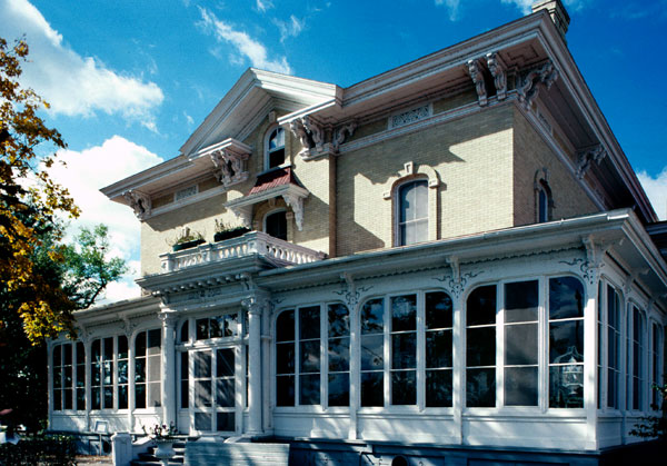
43°04′59″N 91°08′57″W / 43.083056°N 91.149167°WPrairie du Chien 24 Villa Louis 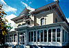
October 15, 1966 Villa Road and Bolvin Street
43°03′21″N 91°09′33″W / 43.055833°N 91.159167°WPrairie du Chien 25 Wall-Smethurst Mound Group June 13, 1974 Address Restricted Lynxville See also
- List of National Historic Landmarks in Wisconsin
- List of Registered Historic Places in Wisconsin
References
- ^ "National Register of Historic Places: Weekly List Actions". National Park Service, United States Department of the Interior. Retrieved on November 10, 2011.
- ^ Numbers represent an ordering by significant words. Various colorings, defined here, differentiate National Historic Landmark sites and National Register of Historic Places Districts from other NRHP buildings, structures, sites or objects.
- ^ "National Register Information System". National Register of Historic Places. National Park Service. . http://nrhp.focus.nps.gov/natreg/docs/All_Data.html.
U.S. National Register of Historic Places Topics Lists by states Alabama • Alaska • Arizona • Arkansas • California • Colorado • Connecticut • Delaware • Florida • Georgia • Hawaii • Idaho • Illinois • Indiana • Iowa • Kansas • Kentucky • Louisiana • Maine • Maryland • Massachusetts • Michigan • Minnesota • Mississippi • Missouri • Montana • Nebraska • Nevada • New Hampshire • New Jersey • New Mexico • New York • North Carolina • North Dakota • Ohio • Oklahoma • Oregon • Pennsylvania • Rhode Island • South Carolina • South Dakota • Tennessee • Texas • Utah • Vermont • Virginia • Washington • West Virginia • Wisconsin • WyomingLists by territories Lists by associated states Other Municipalities and communities of Crawford County, Wisconsin City 
Villages Bell Center | Eastman | Ferryville | Gays Mills | Lynxville | Mount Sterling | Soldiers Grove | Steuben | Wauzeka
Towns Unincorporated
communitiesBarnum | Boydtown | Charme | Easter Rock | Fairview | Montgomeryville | Mount Zion | Petersburg | Plugtown | Rising Sun | Rolling Ground | Seneca | Towerville
Categories:- Crawford County, Wisconsin
- Lists of historic places in Wisconsin
-


Wikimedia Foundation. 2010.