- Eastman, Wisconsin
Infobox Settlement
official_name = Eastman, Wisconsin
settlement_type =Town
nickname =
motto =
imagesize =
image_caption =
image_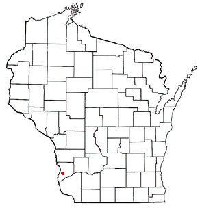
mapsize = 250px
map_caption = Location of Eastman, Wisconsin
mapsize1 =
map_caption1 =subdivision_type = Country
subdivision_name =United States
subdivision_type1 = State
subdivision_name1 =Wisconsin
subdivision_type2 = County
subdivision_name2 = Crawfordgovernment_footnotes =
government_type =
leader_title =
leader_name =
leader_title1 =
leader_name1 =
established_title =
established_date =unit_pref = Imperial
area_footnotes =area_magnitude =
area_total_km2 = 188.0
area_land_km2 = 185.1
area_water_km2 = 3.0
area_total_sq_mi = 72.6
area_land_sq_mi = 71.5
area_water_sq_mi = 1.1population_as_of = 2000
population_footnotes =
population_total = 790
population_density_km2 = 4.3
population_density_sq_mi = 11.1timezone = Central (CST)
utc_offset = -6
timezone_DST = CDT
utc_offset_DST = -5
elevation_footnotes = GR|3
elevation_m = 349
elevation_ft = 1145
latd = 43 |latm = 9 |lats = 28 |latNS = N
longd = 90 |longm = 59 |longs = 50 |longEW = Wpostal_code_type =
postal_code =
area_code =
blank_name = FIPS code
blank_info = 55-21925GR|2
blank1_name = GNIS feature ID
blank1_info = 1583116GR|3
website =
footnotes =Eastman is a village in Crawford County,
Wisconsin ,United States . The population was 437 at the 2000 census. The village is located within the Town of Eastman. Eastman is probably best known for the largest July 4th celebration in Crawford County, the biggest hog roast in the tri-state area and for the high quality fastpitch softball teams and players that have hailed from this small village over the years.Geography
Eastman is located at coor dms|43|9|49|N|91|1|9|W|city (43.163664, -91.019442)GR|1.
According to the
United States Census Bureau , the village has a total area of 3.6square mile s (9.3km² ).None of the area is covered with water.Demographics
As of the
census GR|2 of 2000, there were 437 people, 163 households, and 109 families residing in the village. Thepopulation density was 122.2 people per square mile (47.1/km²). There were 170 housing units at an average density of 47.5/sq mi (18.3/km²). The racial makeup of the village was 97.25% White, 0.23% Native American, 0.23% Asian, and 2.29% from two or more races. 1.83% of the population wereHispanic orLatino of any race.There were 163 households out of which 37.4% had children under the age of 18 living with them, 60.7% were married couples living together, 0.6% had a female householder with no husband present, and 33.1% were non-families. 30.7% of all households were made up of individuals and 16.6% had someone living alone who was 65 years of age or older. The average household size was 2.68 and the average family size was 3.43.
In the village the population was spread out with 31.8% under the age of 18, 8.0% from 18 to 24, 26.5% from 25 to 44, 19.7% from 45 to 64, and 14.0% who were 65 years of age or older. The median age was 34 years. For every 100 females there were 96.8 males. For every 100 females age 18 and over, there were 98.7 males.
The median income for a household in the village was $32,321, and the median income for a family was $41,250. Males had a median income of $29,583 versus $21,250 for females. The
per capita income for the village was $12,922. About 5.7% of families and 10.7% of the population were below thepoverty line , including 8.8% of those under age 18 and 20.6% of those age 65 or over.References
External links
Wikimedia Foundation. 2010.