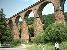
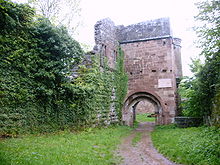
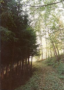
- Odenwald
-
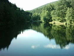
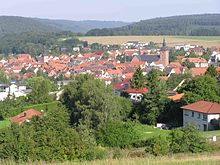
The Eutersee near Hesseneck

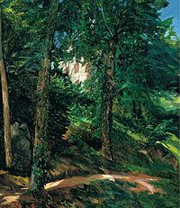 Castle Grounds in Lichtenberg in Odenwald, Wilhelm Trübner, 1900. Colección Carmen Thyssen Bornemisza.
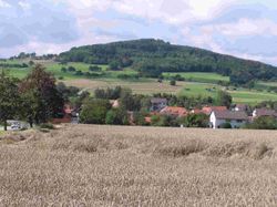
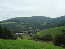
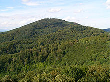
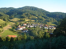
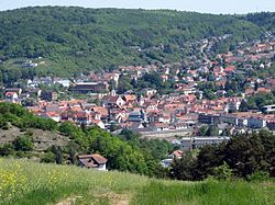
The Odenwald (German pronunciation: [ˈoːdənvalt]) is a low mountain range in Hesse, Bavaria and Baden-Württemberg in Germany.
Contents
Location
Location 
The Odenwald lies between the Upper Rhine Rift Valley with the Bergstraße and the Hessisches Ried (the northeastern section of the Rhine rift) in the west, the Main and the Bauland (a mostly unwooded area with good soils) in the east, the Hanau-Seligenstadt Basin – a subbasin of the Upper Rhine Rift Valley in the Rhine-Main Lowlands – in the north and the Kraichgau in the south. The part south of the Neckar valley is sometimes called the Kleiner Odenwald (“Little Odenwald”).
The northern and western Odenwald belong to southern Hesse, with the south stretching into Baden. In the northeast, a small part lies in Lower Franconia in Bavaria.
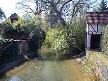
The Gersprenz in Dieburg
Geology
The Odenwald, along with many of Germany’s low mountain ranges, belongs to the Variscan, which more than 300,000,000 years ago in the Devonian ran through great parts of Europe. The cause of this orogeny was the collision of Africa’s and Europe’s forerunner continents.
In the Triassic, about 200,000,000 years ago, the land sank again, forming the so-called “Germanic Basin” in which the metre-thick layers of red sandstone could build up. These were later covered over with layers of muschelkalk from a broad inland sea, then followed by sediments from the Late Triassic (or Keuper). The South German Cuesta Land thus formed.
When the land in the Odenwald was uplifted again about 180,000,000 years ago, more than 100 m of the sedimentary layering, in parts, was eroded away down to the bedrock, as can still be seen in the western Odenwald. The bedrock here is made out of a remarkably great number of different minerals, among them gneiss, granite, diorite, gabbro in the Frankenstein pluton, and so on. In the eastern Odenwald, the red sandstone is all that is left of the sedimentary mixture. Farther east in the Bauland, the muschelkalk deposits still overlie the Early Triassic layers. Furthermore, in the south near Heidelberg, there is still zechstein under the Early Triassic deposits.
Roughly 50 to 60 million years ago, volcanoes formed along the great geological faults. Still bearing witness to this time are the Otzberg, the Daumberg and the Katzenbuckel, all extinct volcanoes in the Odenwald. Furthermore, vulcanism with acidic minerals has left a legacy of rhyolites near Dossenheim.
At roughly the same time, the Central European plate began to tear apart so that the Upper Rhine Rift developed. Even as the Upper Rhine Rift valley still sinks today by just under a millimetre each year, the Odenwald, relatively to that, was uplifted to the height it has today. Along the faults, the small rivers Gersprenz and Weschnitz have, in part, carved their courses.
The Upper Rhine Rift is part of a fracture zone reaching from the Mediterranean Sea to Norway. Right on the edge of the Odenwald, it is roughly 2 500 m deep, but has been filled in to its current height by river and sea sediment, for until about 20,000,000 years ago, the North Sea reached far inland, across the Wetterau Depression into the Rhine Valley.
History
About 2500 BC, there is evidence that the Linear Pottery culture settled along the northern (Gersprenz) and southern (Neckar valley) edges of the Odenwald. About 400 BC, Celts (Gauls) settled throughout southern Germany. Almost all of the Odenwald was covered then with virgin forest, and the outer edges were not settled. Germanic peoples drove the Celts westwards across the Rhine to what is now France.
About AD 100, the older Odenwald line of the Neckar-Odenwald Limes was built under Roman Emperor Trajan (98-117). This stretch of the Empire’s border ran from Fort Wimpfen in the Valley (Kastell Wimpfen im Tal) northwards by way of the Forts of Neckarburken, the lesser forts of Trienz and Robern near Fahrenbach, Fort Oberscheidental, Fort Schloßau, Fort Hesselbach, Fort Würzberg, Fort Eulbach, Fort Hainhaus and Fort Hesselbach to Fort Wörth on the Main. Parts of the Odenwald now lay in Roman-ruled Germania Superior.
About 159, the Limes was shifted about 30 km eastwards to the Miltenberg–Walldürn–Buchen-Osterburken line. In 260, Roman hegemony fell. The Alamanni were also thrusting into the Odenwald and settling the land between the Main and Neckar, after whom came the Franks. In the 5th century, the Franks, under Clovis I, divided the land up into districts.
In the 7th and 8th centuries came Christianization by Irish-Scottish monks (Pirmin, Boniface). On the muschelkalk lands of today’s Bauland, which favoured agriculture, a broad mesh of settlements arose. The parts of the Odenwald farther in from the rivers, though, with their scant new red sandstone soils remained uninhabited. Four Benedictine monasteries were assigned the job of opening the empty woods up by the central Frankish power (Carolingian), Lorsch Abbey from the west, Fulda Monastery from the east and Mosbach Monastery from the south. Amorbach Monastery had the greatest importance for ecclesiastical, cultural and economic development in the eastern Odenwald.
In the 9th century in the southeastern Odenwald near the now more thickly settled Bauland, settlements were established. The muschelkalk-new red sandstone mineral boundary was crossed.
Name
Where the name “Odenwald” came from is an open question and still causes controversy today. Following are some theories about the name’s origin:
- The name comes from Ode (plural in German: Oden), and thus the name means something like “forest of sagas” (as in “Nibelung saga”); Wald is German for “forest”.
- The name might come from Odins Wald (“Odin’s Woods”). The main problem here is that for a long time, or even always, Odin was worshipped in southern Germany under the name Wotan (in Old High German Uuodan; compare Merseburg Incantations). There is, however, a community 80 km to the west in the Nordpfälzer Bergland whose name is Odenbach, and whose mediaeval name is known to have been Odinbach.
- A further theory holds that there is a link between the name Odenwald and the Roman administrative unit Civitas Auderiensium, which among other things included the range’s northern reaches and might have been named after a tribe called the Auderienses.
- It has been postulated that there may be a link with the name Euterbach, a brook that rises in the Odenwald, so that the range’s name would mean “Wooded Range of the Euterbach”. This, of course, at once raises the question of where the name “Euterbach” itself came from.
- There could be some kinship with the word öde, not in the currently understood meaning in German of “desert”, but rather in the meaning “thinly settled”.
- A derivation from Odem (for Atem, German for “breath”) could refer to the wind, which was believed to be any god’s breath.
Legends and mythology
In the Nibelungenlied (see also Nibelung) the dragon slayer Siegfried, on a hunting trip (instead of a failed campaign) leading from the Burgundian city of Worms into the Odenwald, is murdered by Hagen of Tronje. Since no exact spot for this deed has been handed down, countless communities, especially in the Hessian Odenwald, are squabbling over the right to call themselves “Siegfried’s Murder Site”.
Topography
Mountains
Over 600 m
- Katzenbuckel (626 m; lookout tower), Neckar-Odenwald-Kreis, Baden-Württemberg
- Neunkircher Höhe (605 m; Kaiser Tower), Bergstraße district, Hesse
Over 450 m
- Hardberg (593 m), Bergstraße district, Hesse
- Stiefelhöhe (589 m), Hesse/Baden-Württemberg border
- Tromm (577 m; lookout tower), Bergstraße district, Hesse
- Krehberg (576 m; with Krehberg transmitter), Bergstraße district, Hesse
- Königstuhl (567.8 m; observatory, funicular railway), Heidelberg, Baden-Württemberg
- Krähberg (555 m), Odenwaldkreis, Hesse
- Kinzert (554 m), Neckar-Odenwald-Kreis, Baden-Württemberg
- Weißer Stein (550 m; lookout tower), Rhein-Neckar-Kreis, Baden-Württemberg
- Hohe Warte (548 m), Rhein-Neckar-Kreis, Baden-Württemberg
- Spessartskopf (547 m), Bergstraße district, Hesse
- Falkenberg (546 m), Odenwaldkreis, Hesse
- Waldskopf (538 m), Gorxheimertal-Trösel, Bergstraße district, Hesse
- Das Buch (535.30 m; near Lindenfels), Bergstraße district, Hesse
- Wagenberg (535 m), Bergstraße district, Hesse
- Eichelberg (526 m; lookout tower), Rhein-Neckar-Kreis, Baden-Württemberg
- Götzenstein (522 m), Bergstraße district, Hesse
- Melibokus („Malschen“) (517.40 m), Bergstraße district, Hesse
- Morsberg (517 m), Odenwaldkreis, Hesse
- Felsberg (514 m; with Felsenmeer), Bergstraße district, Hesse
- Knodener Kopf (511.20 m), Bergstraße district, Hesse
- Wannenberg (482 m), Miltenberg district, Bavaria
- Daumberg (462 m), Gorxheimertal-Trösel, Bergstraße district, Hesse
Over 300 m
- Heiligenberg (445 m), Heidelberg, Baden-Württemberg
- Knorz (404 m; near Lautern), Bergstraße district, Hesse
- Otzberg (367 m; with Veste Otzberg), Darmstadt-Dieburg, Hesse
- Auerberg (339.70 m; with Schloss Auerbach), Bergstraße district, Hesse
- Breuberg (306 m; with Breuberg Castle), Odenwaldkreis, Hesse
Bodies of water
Flowing water
Countless streams rise in the Odenwald, the longest of which are the following:
- Weschnitz (60 km), tributary to the Rhine
- Mümling (50 km), tributary to the Main
- Gersprenz (47 km), tributary to the Main
- Lauter (43 km), tributary to the Rhine
- Erf (40 km), tributary to the Main
- Elz (Elzbach) (34 km), tributary to the Neckar
- Finkenbach (20.5 km), joins the Ulfenbach in Hirschhorn, runs to the Laxbach, tributary to the Neckar
- Ulfenbach (19.1 km), joins the Finkenbach in Hirschhorn, runs to the Laxbach, tributary to the Neckar
- Grundelbach, (10 km), flows from Trösel to Weinheim
- Modau (42 km), tributary to the Rhine
- Mud (24 km), tributary to the Main
- Steinach (22 km), tributary to the Neckar
Standing water
There are a few bodies of standing water in the Odenwald, among which are the following:
- the Marbach Reservoir
- the Eutersee
Political divisions
Districts (with district seats)
- Bergstraße district (Heppenheim)
- Darmstadt-Dieburg (Dieburg, administration in Darmstadt-Kranichstein)
- Main-Tauber-Kreis (Tauberbischofsheim)
- Miltenberg district (Miltenberg)
- Neckar-Odenwald-Kreis (Mosbach)
- Odenwaldkreis (Erbach)
- Rhein-Neckar-Kreis (Heidelberg)
District-free cities
Transport and tourism
The Odenwald is known as a leisure destination easily accessible from the urban areas of Mannheim and Frankfurt. It is known for its clean thin air and was once known for its health sanitariums. There are many marked hiking paths through the rural areas. Wild blueberries, strawberries and mushrooms are to be found in the forests.
Roads
The planned extension to the Odenwaldautobahn, that is, the A 45 (Dortmund–Aschaffenburg), was never realized. Nevertheless, all these Bundesstraßen run through the Odenwald:
- B 27: Mosbach - Buchen - Tauberbischofsheim
- B 38: Reinheim - Groß-Bieberau - Brensbach - Reichelsheim - Fürth - Mörlenbach - Birkenau - Weinheim
- B 45: Groß-Umstadt - Höchst - Bad König - Michelstadt - Erbach - Beerfelden - Eberbach
- B 47: Bensheim - Lindenfels - Reichelsheim - Michelstadt - Amorbach
- B 426: Darmstadt - Mühltal - Ober-Ramstadt - Reinheim - Otzberg - Groß-Umstadt - Höchst - Breuberg - Obernburg
- B 460: Heppenheim - Fürth - Mossautal - Hüttenthal
Furthermore, the Nibelungenstraße and the Siegfriedstraße run through the Odenwald, partly along the roads listed above.
Railways
- Odenwald Railway from Darmstadt or Hanau by way of Wiebelsbach-Heubach to Eberbach, opened in 1882, since December 2005 run with modern Itino trains
- Weschnitz Valley Railway from Weinheim to Fürth, opened in 1895
- Überwald Railway from Mörlenbach by way of Wald-Michelbach to Wahlen, opened in 1901, abandoned in 1996
- Hetzbach–Beerfelden line from Hetzbach to Beerfelden, opened in 1904, abandoned in 1954
- Mosbach–Mudau line (locally known as the Entenmörder – “Duck Murderer”) from Mosbach to Mudau, former 1000 mm narrow-gauge railway, opened in 1905, abandoned in 1973, since 1980 right-of-way has been converted into a cycling path
- Neckar Valley Railway from Heidelberg by way of Eberbach and Mosbach to Bad Friedrichshall-Jagstfeld, opened in 1879
- Neckarelz–Osterburken line, opened in 1866 as part of the Baden Odenwaldbahn
- Madonnenland Railway from Seckach to Miltenberg
- Gersprenz Valley Railway from Reinheim to Reichelsheim, opened in 1887 and abandoned by 1963
Sightseeing
The Odenwald is home to a great many historic castles and palatial residences.
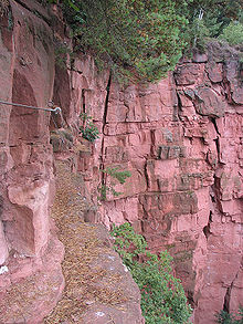
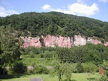
- In Hainstadt, Hesse (a constituent community of Breuberg) in the Mümling valley is a quarry which has been turned into a climbing facility by the Odenwälder Kletterfreunde (“Odenwald Climbing Friends”). There is also a climbing path secured by wire cables. The Odenwald Climbing Friends take care of the paths. The quarry also lies in the DAV’s (Deutsche Alpenverein e. V. – a mountain climbing club) Darmstadt Section feeder area.
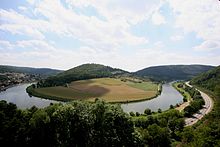 Dilsberg with mountain fort
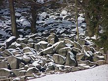
- Beneath the 514 m-high Felsberg and north of Lautertal-Reichenbach is found a Felsenmeer – literally “cliff sea” – consisting of many weathered stones strewn about the ground which have fallen down from the cliff after having come loose from erosion. The Romans used it as a stone quarry.
- In Eberstadt, a constituent community of Buchen, one of southern Germany’s most important dripstone caves was discovered in 1971. It is open to the public.
- Around the Katzenbuckel runs the Kristall-Lehrpfad (“Crystal Teaching Path”), which graphically shows the volcanic development in the Odenwald.
- From Höchst im Odenwald snakes the Obrunnschlucht (gorge) as a romantic fairytale path towards Rimhorn with many model buildings (palaces, castles and mills) along the valley.
- The Odenwald is threaded with a network of more than 10 000 km of hiking trails.
- Because the highways have so many curves, the Odenwald is a popular outing destination for motorcyclists.
Music
About the Odenwald quite a few songs have been written:
- Es steht ein Baum im Odenwald (“There Stands a Tree in the Odenwald”)[1]
- Tief im Odenwald (“Deep in the Odenwald”)[2]
- Der Bauer aus dem Odenwald (“The Farmer from the Odenwald”)[3]
- Es regt sich was im Odenwald (“Things Are Stirring in the Odenwald”)[4]
See also
- Hessian dialects
- Historical territorial allegiances: Electoral Palatinate | Archbishopric of Mainz | Landgraviate of Hesse | Grand Duchy of Hesse | People's State of Hesse | Baden
References
- ^ text and melody on a private webpage.
- ^ text and melody on a private webpage.
- ^ text and melody on a private webpage.
- ^ text and melody on the webpage of the Catholic Student Association Markomannia Münster in the KV.
Further reading
Monographs and anthologies
- Marco Lichtenberger: Saurier aus dem Odenwald. Jens Seeling Verlag. Frankfurt 2007. ISBN 3-938973-04-8
- Winfried Wackerfuss (publisher): Zu Kultur und Geschichte des Odenwaldes. 2. unveränderte Auflage 1982. Breuberg-Bund, Breuberg-Neustadt 1982. ISBN 3-922903-01-0
- Otmar A. Geiger: Sagenhafter Odenwald. Ein Führer durch das Reich der Nibelungen zwischen Worms und Würzburg. Schimper, Schwetzingen 2000. ISBN 3-87742-152-0
- Georg Bungenstab (publisher): Wälder im Odenwald - Wald für die Odenwälder. Dokumente aus 150 Jahren Eberbacher Forstgeschichte. Staatliches Forstamt Eberbach, Eberbach 1999, 288 S.
- Heinz Bischof: Odenwald. 3., überarbeitete Auflage. Goldstadtverlag, Pforzheim 2004. ISBN 3-89550-313-4
- Thomas Biller/Achim Wendt: Burgen und Schlösser im Odenwald. Ein Führer zu Geschichte und Architektur. Schnell & Steiner, Regensburg 2005. ISBN 3-7954-1711-2
- Andreas Stieglitz: Wandern im Odenwald und an der Bergstraße. Aus der Reihe DuMont aktiv. DuMont Reiseverlag, Ostfildern 2005. ISBN 3-7701-5015-5.
- Seipel, Herbert Stephan: Faszination Odenwald. Eine Bilderreise zur Kulturgeschichte des Odenwaldes. Verlag Regionalkultur, Ubstadt-Weiher 2004. ISBN 978-3-89735-140-0
- Keller, Dieter/Keller, Uwe/Türk, Rainer: Der Odenwald zwischen Himmel und Erde. Verlag Regionalkultur, Ubstadt-Weiher 2003. ISBN 978-3-89735-187-5
Periodicals
- Breuberg-Bund (publisher): Beiträge zur Erforschung des Odenwaldes und seiner Randlandschaften. Breuberg-Bund, Breuberg-Neustadt 1977 ff.
- Breuberg-Bund (publisher): Der Odenwald. Vierteljahreszeitschrift des Breuberg-Bundes mit Beiträgen zur Geschichte, Volkskunde, Kunstgeschichte und Geographie des Odenwaldes und seiner Randlandschaften. Breuberg-Bund, Breuberg-Neustadt 1953 ff.
- Kreisarchiv des Odenwaldkreises (publisher): Gelurt. Odenwälder Jahrbuch für Kultur und Geschichte. Odenwaldkreis, Erbach 1994 ff.
- Arbeitsgemeinschaft der Geschichts- und Heimatvereine im Kreis Bergstrasse (publisher): Geschichtsblätter Kreis Bergstraße. Laurissa, Lorsch 1971 ff.
The Odenwald in Literature
- Adolf Schmitthenner: Das deutsche Herz. 3. Auflage. Stadt Hirschhorn, Hirschhorn, 1999. ISBN 3-927409-00-6 (first edition 1927)
- Werner Bergengrün: Das Buch Rodenstein. 3. Auflage. Insel, Frankfurt am Main 2002. ISBN 3-458-33493-9 (first edition 1908)
External links
- Odenwald – Official page of Odenwald-Regional-Gesellschaft (OREG) (German)
- UNESCO Geo-Park – Official page of Geo-Naturpark Bergstraße-Odenwald (German)
- Odenwaldklub – Official page of Odenwaldklub (German)
- Regionalentwicklung Odenwald – Official page of Interessengemeinschaft Odenwald e.V. (IGO) (German)
- This article incorporates information from the German Wikipedia.
Coordinates: 49°35′02″N 9°01′18″E / 49.583993°N 9.021749°E
Arnsberg Forest | Bavarian Forest | Black Forest | Bohemian Forest | Ebbegebirge | Eggegebirge | Eifel | Elbe Sandstone Mountains | Elstergebirge | Fichtelgebirge | Franconian Jura | Franconian Forest | Gladenbach Uplands | Habichtswald | Harz | Hoher Meißner | Hunsrück | Kaiserstuhl | Kellerwald | Kaufungen Forest | Knüll | Kyffhäuser | Lusatian Mountains | Lennegebirge | Lippe Uplands | North Palatine Uplands | Odenwald | Ore Mountains | Palatine Forest | Rhön | Rothaargebirge | Saalhausen Hills | Swabian Jura | Siebengebirge | Solling | Spessart | Taunus | Teutoburg Forest | Thuringian Highland | Thuringian Forest | Upper Palatine Forest | Vogelsberg | Weser Uplands | Wesergebirge | Westerwald | Wiehen Hills | Zittau Hills
 Categories:
- Mountains of Baden-Württemberg
- Mountains of Bavaria
- Mountains of Hesse
- Global Geoparks Network members
- Forests and woodlands of Bavaria
Wikimedia Foundation. 2010.

