- Eifel
-
Not to be confused with Eiffel.
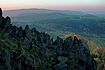
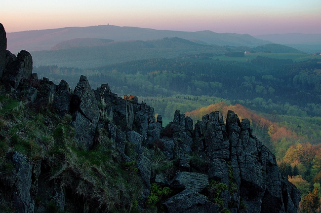
 Eifel scenery
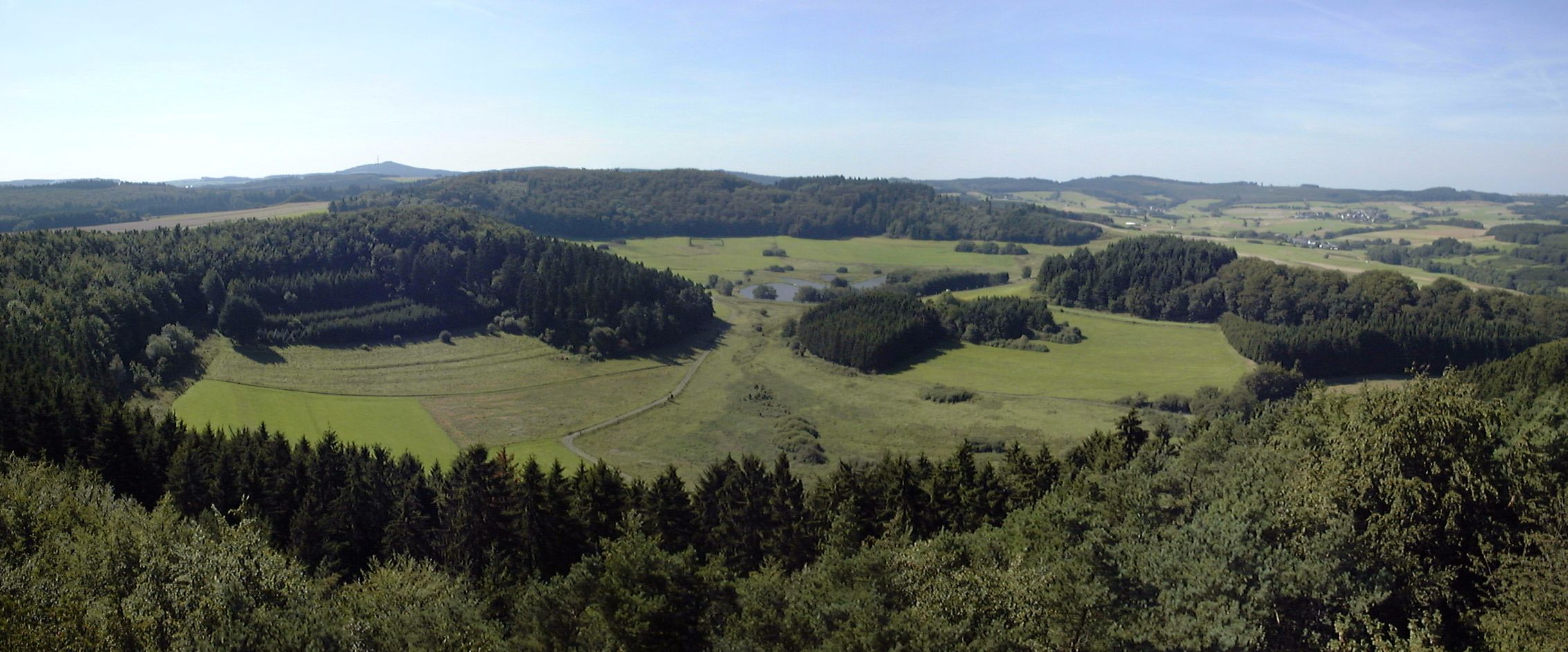
 Panorama of the Laacher See, one of the lakes in the Vulkaneifel
The Eifel is a low mountain range in western Germany and eastern Belgium. It occupies parts of southwestern North Rhine-Westphalia, northwestern Rhineland-Palatinate and the south of the German-speaking Community of Belgium.
The Eifel is part of the Rhenish Massif; within its northern portions lies the Eifel National Park.
Contents
Geography
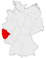
 Location of the Eifel in Germany
The Eifel is bordered by the river Moselle in the south and the Rhine in the east. In the north it is limited by the hills of the High Fens (Hohes Venn), in the west by the Ardennes of Belgium and Luxembourg.
There are several distinct chains within the Eifel.
- The northernmost parts are called Ahr Hills[1] (German: Ahrgebirge) and rise north of the Ahr river in the district of Ahrweiler.
- South of the Ahr is the High Eifel[1] (Hohe Eifel), with the Hohe Acht (747 m) being the highest mountain of the Eifel.
- In the west, on the Belgian border, the hills are known as Schneifel (originally Schnee-Eifel or "Snowy Eifel"), rising up to 698 m. Also in the west, by the Belgian and Luxembourg border, the region is known as Islek (Aquilania).
- The southern half of the Eifel is lower. It is cut by several rivers running north-south towards the Moselle. The largest of these is the Kyll, and the hills on either side of this river are called the Kyllwald.
- In the south the Eifel is concluded by the Voreifel above the Moselle.
Since 2004 about 110 km² of the Eifel within the German state of North Rhine-Westphalia have been protected as the Eifel National Park nature reserve.
Geology
The Eifel and its western continuation into Belgium, the Ardennes, are a part of the Variscan mountain belt and belong to the Rhenish Massif (Rheinisches Schiefergebirge).
The Eifel consists mainly of Devonian slates, sandstones and limestones, laid down in an ocean south of the Old Red Continent[2] and folded and overthrust in the Variscan orogeny. The Eifel geological structures like main folds and overthrusts can be traced in a SW-NE direction far beyond the Rhine valley.
In the Tertiary and Quaternary geological era, the Eifel was a site of extensive volcanic activity. Some of the hills are volcanic vents. The peculiar circle-shaped lakes (maar) of the volcanic regions formed in volcanic craters. The last volcanic eruptions in the Laacher See volcanic site took place around 10,000 years ago and generated a huge volume of volcanic ash, now found in thin ash layers in contemporaneous sediments throughout Europe. The volcanism of the Eifel is thought to be partly caused by the Eifel hotspot, a place where hot material from deep in the mantle rises to the surface, and partly by melt-ascent at deep fractures in the Earth's crust.[3] Research has shown that the volcanism is still active; the Eifel region is rising by 1–2 mm per year. Historically, the Eifel volcanoes had inactive phases of 10,000 to 20,000 years between active phases, suggesting there is a possibility of future eruptions.
Castles
 Castle of Lissingen
 Burg Eltz
Well preserved
- Burg Eltz
- Castle of Lissingen (Burg Lissingen)
- Burg Satzvey
- Burg Dudeldorf
- Burg Eicks
19th and 20th century rebuilds
- Burg Bollendorf
- Genovevaburg
- Burg Vlatten
Ruins
- Burg Gerolstein
- Burg Gödersheim
- Löwen- und Philippsburg
- Manderscheider Burgen
- Burg Monschau
- Burg Nideggen
- Burg Schönecken
- Ulmener Burgen
Mountains and hills
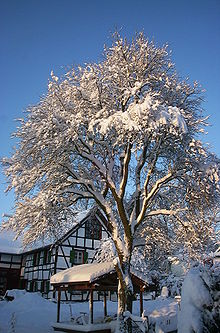 In winter the Eifel is often covered with snow
The mountains and hills of the Eifel include the following (in order of height in metres above sea level):
- Hohe Acht (747 m), High Eifel
- Ernstberg (or Erresberg) (698.8 m), High Eifel
- Schwarzer Mann (697.3 m), Schnee Eifel
- Signal de Botrange (694 m), Hohes Venn
- Weißer Stein (692 m), North Eifel
- Scharteberg (691 m), Vulkan Eifel
- Nürburg (678 m), with the castle of the same name (Nürburg), High Eifel
- Prümscheid (675 m), High Eifel
- Raßberg (667 m), High Eifel
- Steling (658 m), Hohes Venn
- Nerother Kopf (647 m), Vulkan Eifel
- Aremberg (623 m), Ahr Hills
- Dietzenley (617 m), Gerolstein / Vulkan Eifel
- Hardtkopf (596 m), South Eifel
- Michelsberg (588 m), Ahr Hills
- Hochsimmer (587.9 m), East Eifel
- Eigart (565 m), North Eifel
- Rockeskyller Kopf (555 m), Vulkan Eifel
- Hoher List (549 m), Vulkan Eifel
- Wildbretshügel (525.3 m), Rur Eifel, Kermeter
- Kirchberg (520 m), North Eifel
- Häuschen (507 m), North Eifel
- Hochthürmen (499.8 m), North Eifel
- Teufelsley (496 m), North Eifel
- Kellerberg (448 m), Meulenwald
- Stockert (435 m), Münstereifel Forest
- Herkelstein (435 m), North Eifel
- Veitskopf (428 m), Vulkan Eifel
- Burgberg (400.5 m), Rur Eifel, North Eifel
- Sonnenberg (393,3 m), Rur Eifel
- Calmont (378 m), Pre-Eifel
- Bausenberg (340 m), North Eifel
- Landskrone (272 m), Ahr Hills
Points of interest
- The Nürburgring, one of the world's most famous motor racing courses, is located in the Eifel. The northern loop (Nordschleife) of the course is also known as the Green Hell (Grüne Hölle), because of its long, difficult and dangerous path through the local forest.
- An interesting archeological feature of the region is the Eifel Aqueduct, one of the longest aqueducts of the Roman empire, providing the city of Cologne with water.
See also
- The Eifeler Regel in Luxembourgish orthography
- High Eifel
- North Eifel
- South Eifel
- West Eifel
- Belgian Eifel
- Rur Eifel
- Schnee Eifel
- Vulkan Eifel
External links
References
- ^ a b Elkins, T.H. (1972). Germany (3rd ed.). London: Chatto & Windus, 1972. ASIN B0011Z9KJA.
- ^ Meyer,W. 1986. Geologie der Eifel, p.4. Schweizerbart'sche Verlagsbuchhandlung, Stuttgart. ISBN 3-510-65127-8
- ^ Meyer 1986, p.275
Arnsberg Forest | Bavarian Forest | Black Forest | Bohemian Forest | Ebbegebirge | Eggegebirge | Eifel | Elbe Sandstone Mountains | Elstergebirge | Fichtelgebirge | Franconian Jura | Franconian Forest | Gladenbach Uplands | Habichtswald | Harz | Hoher Meißner | Hunsrück | Kaiserstuhl | Kellerwald | Kaufungen Forest | Knüll | Kyffhäuser | Lusatian Mountains | Lennegebirge | Lippe Uplands | North Palatine Uplands | Odenwald | Ore Mountains | Palatine Forest | Rhön | Rothaargebirge | Saalhausen Hills | Swabian Jura | Siebengebirge | Solling | Spessart | Taunus | Teutoburg Forest | Thuringian Highland | Thuringian Forest | Upper Palatine Forest | Vogelsberg | Weser Uplands | Wesergebirge | Westerwald | Wiehen Hills | Zittau Hills
 Categories:
- Eifel
- Regions of North Rhine-Westphalia
- Regions of Germany


Wikimedia Foundation. 2010.