- Clare, Nova Scotia
-
Clare — Municipal district — 
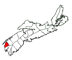
SealLocation of Clare Municipal District
Coordinates: 44°20′00″N 66°07′00″W / 44.333333°N 66.116667°W Country  Canada
Province  Nova Scotia
County Digby Incorporated April 17, 1879 Electoral Districts
Federal
West NovaProvincial Clare Government - Type District of Clare Municipal Council - County seat Little Brook - Warden Jean Melanson Area[1] - Land 852.82 km2 (329.3 sq mi) Population (2006)[1][2] - Total 8,813 - Density 10.3/km2 (26.7/sq mi) - Change 2001-06  2.8%
2.8%- Census Ranking 431 of 5,008 Time zone AST (UTC-4) - Summer (DST) ADT (UTC-3) Area code(s) 902 - 769,837,645,778 Dwellings 4,558 Median Income* $41,450 CDN Website www.clarenovascotia.com *Median household income, 2005 (all households) Clare is a municipal district in western Nova Scotia, Canada.
Primarily an Acadian region, Clare occupies the western half of Digby County. Most of the municipality's settled areas are located along St. Marys Bay, a sub-basin of the Gulf of Maine. The municipality is mainly inhabited by Acadians and conducts its business in both English and French, although the most commonly used language is French. The Municipality of Clare holds the oldest and largest Annual Acadian Festival.
Contents
Demographics
Population trend[3]
Census Population Change (%) 2006 8,813 2.8%2001 9,067 2.5%1996 9,298 3.7%1991 9,654 N/A Mother tongue language (2006)[1]
Language Population Pct (%) French only 5,690 65.78% English only 2,745 31.74% Both English and French 130 1.50% Other languages 85 0.98% Ethnic Groups (2006)[1]
Race Population Pct (%) White 8,555 98.90% Black 85 0.98% Latin American 10 0.12% Communities
- Bangor
- Bear Cove
- Beaver River
- Belliveaus Cove
- Briar Lake
- Cape St. Mary's
- Church Point
- Comeauville
- Concession
- Corberrie
- Easton
- Grosses Coques
- Hassett
- Havelock
- Hectanooga
- Lake Doucette
- Little Brook
- Mavillette
- Maxwellton Station
- Mayflower
- Meteghan
- Meteghan River
- Meteghan Station
- Moody's Corner
- New Edinburgh
- New Tusket
- Richfield
- Salmon River
- Saulnierville
- Saulnierville Station
- Southville
- St. Alphonse de Clare
- St. Benoni
- St. Bernard
- St. Joseph
- St. Martin de Clare
- Weaver Settlement
- Woodvale
Access routes
Highways and numbered routes that run through the district, including external routes that start or finish at the district limits:[4]
- Highways
- Trunk Routes
- Collector Routes:
- External Routes:
- None
Culture
Musical groups from the area include:
- Grand Dérangement
- BeauPhare
- Blou
- Radio Radio
- DPS
- Sweet Tuesday
The song M'en allant par Saulnierville Station by Suroît is a song about the local community of Saulnierville Station.
See also
References
- ^ a b c d 2006 Statistics Canada Community Profile: Clare Municipal District, Nova Scotia
- ^ Statistics Canada Population and dwelling counts, for Canada and census subdivisions (municipalities), 2006 and 2001 censuses - 100% data
- ^ Statistics Canada: 1996, 2001, 2006 census
- ^ Atlantic Canada Back Road Atlas ISBN 978-1-55368-618-7 Page 84
External links
- Municipality of Clare // Baie Sainte Marie
- Municipality of Clare Tourism - Rendez-vous de la Baie cultural & interpretive centre
- Largest Annual Acadian Festival held in Municipality of Clare
- Annual Clare Canoe Trip
- University Sainte Anne
- Official tourism website for Yarmouth & Acadian Shores
- Clare Lions Jr. C Hockey Club
- Good Nature Photography by Angel Flanagan Photography taken around Baie Ste Marie

Annapolis Basin Atlantic Ocean 
Digby Municipal District  Clare Municipal District

Yarmouth Municipal District Argyle Municipal District Categories:- Communities in Digby County, Nova Scotia
- Municipal districts in Nova Scotia
- Acadia
Wikimedia Foundation. 2010.