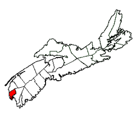
- Yarmouth, Nova Scotia (municipal district)
-
Yarmouth — Municipal district — 
Flag
SealMotto: Justice and Prudence Location of Yarmouth Municipal District Coordinates: 43°52′32″N 66°07′16″W / 43.875597°N 66.1212°W Country  Canada
Province  Nova Scotia
County Yarmouth Incorporated April 17, 1879 Electoral Districts
Federal
West NovaProvincial Yarmouth Government - Type Municipal Council - Municipal Seat Hebron - Warden Leland Anthony - Councillors List of Members- Leland Anthony
- Rick Churchill
- Ken Crosby
- John Cunningham
- Trevor Cunningham
- Murray Goodwin
- Heather (Rose) MacDonald
- MLA Zach Churchill (L) - MP Greg Kerr (C) Area[1] - Land 585.27 km2 (226 sq mi) Population (2006)[1][2] - Total 10,304 - Density 17.6/km2 (45.6/sq mi) - Change 2001-06  1.5%
1.5%- Census Ranking 368 of 5,008 Time zone AST (UTC-4) - Summer (DST) ADT (UTC-3) Area code(s) 902 Dwellings 4,906 Median Income* $44,323 CDN Website www.district.yarmouth.ns.ca *Median household income, 2005 (all households) Yarmouth is a municipal district in Yarmouth County, Nova Scotia.
The district forms the western part of Yarmouth County and uses the legal name The Municipality of the District of Yarmouth. It is one of three municipal units in the county, the other two being the town of Yarmouth and the Argyle municipal district.
Contents
Demographics
Population trend[3]
Census Population Change (%) 2006 10,304  1.5%
1.5%Adjustment 10,466  0.1%
0.1%2001 10,476  2.3%
2.3%1996 10,722  1.0%
1.0%1991 10,827 N/A Mother tongue language (2006)[1]
Language Population Pct (%) English only 9,155 89.89% French only 845 8.30% Other languages 135 1.32% Both English and French 50 0.49% Ethnic Groups (2006)[1]
Race Population Pct (%) White 10,050 98.67% Black 90 0.88% Asian 30 0.29% Education:
- No certificate, diploma or degree: 35.32%
- High school certificate: 18.16%
- Apprenticeship or trade certificate or diploma: 13.43%
- Community college, CEGEP or other non-university certificate or diploma: 20.06%
- University certificate or diploma: 12.96%
Unemployment rate:
- 10.9%
Average house value:
- $141,461
Communities
Communities include:
- Arcadia
- Brazil Lake
- Brenton
- Brooklyn
- Canaan
- Cape Forchu
- Carleton
- Chegoggin
- Chebogue
- Chebogue Point
- Crowell Point
- Darlings Lake
- Dayton
- Deerfield
- Forest Glen
- Gardner's Mill
- Gavelton
- Glenwood
- Greenville
- Hebron
- Ireton
- John's Cove
- Kelley's Cove
- Kemptville
- Lake Annis
- Lake George
- Little River Harbour
- Melbourne
- Morris Island
- Norwood
- Overton
- Pembroke
- Pinkney's Point
- Pleasant Lake
- Pleasant Valley
- Port Maitland
- Quinan
- Raynardton
- Robert's Island
- Rockville
- Sand Beach
- Sandford
- Short Beach
- South Canaan
- South Ohio
- Summerville
- Surette's Island
- Wellington
- Woodstock
- Yarmouth Bar
-
This list is incomplete; you can help by expanding it.
See also
References
External links

Clare Municipal District 
Atlantic Ocean 
Argyle Municipal District  Yarmouth Municipal District

Argyle Municipal District
Coordinates: 43°52′32.15″N 66°07′16.32″W / 43.8755972°N 66.1212°WCategories:- Communities in Yarmouth County, Nova Scotia
- Municipal districts in Nova Scotia
Wikimedia Foundation. 2010.

