- Port Hawkesbury, Nova Scotia
Infobox Settlement
official_name = Pagename
other_name =
native_name =
nickname = Cape Breton's Front Porch
settlement_type = Town
motto =
imagesize =
image_caption =
flag_size =
image_
seal_size =
image_shield =
shield_size =
city_logo =
citylogo_size =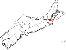
mapsize =
map_caption = Location of Pagename
mapsize1 =
map_caption1 =
image_dot_
dot_mapsize = 250px
dot_map_caption =Location of Pagename
dot_x = |dot_y =
pushpin_
pushpin_label_position =
pushpin_map_caption =
pushpin_mapsize =
subdivision_type = Country
subdivision_name = CAN
subdivision_type1 = Province
subdivision_name1 = NS
subdivision_type2 = Municipality
subdivision_name2 = Inverness County
subdivision_type3 =
subdivision_name3 =
subdivision_type4 =
subdivision_name4 =
government_footnotes =
government_type =
leader_title =Mayor
leader_name =Billy Joe MacLean
leader_title1 = Governing Body
leader_name1 =Port Hawkesbury Town Council
leader_title2 =
leader_name2 =
leader_title3 =
leader_name3 =
leader_title4 =
leader_name4 =
established_title = Founded
established_date =1789
established_title2 = Incorporated
established_date2 =January 22 ,1889
established_title3 =
established_date3 =
area_magnitude =
unit_pref =
area_footnotes =
area_total_km2 = 8.35
area_land_km2 =
area_water_km2 =
area_total_sq_mi =
area_land_sq_mi =
area_water_sq_mi =
area_water_percent =
area_urban_km2 =
area_urban_sq_mi =
area_metro_km2 =
area_metro_sq_mi =
population_as_of = 2006
population_footnotes =
population_note =
population_total = 3,922
population_density_km2 = 443.5
population_density_sq_mi =
population_metro =
population_density_metro_km2 =
population_density_metro_sq_mi =
population_urban =
population_density_urban_km2 =
population_density_urban_sq_mi =
population_blank1_title =
population_blank1 =
population_density_blank1_km2 =
population_density_blank1_sq_mi =
timezone = AST
utc_offset = -4
timezone_DST =
utc_offset_DST =
latd=45 |latm=36 |lats=55 |latNS=N
longd=61 |longm=21 |longs=51 |longEW=W
elevation_footnotes =
elevation_m = 0-54
elevation_ft = 0-177
postal_code_type = Postal code
postal_code = B9A
area_code = 902
blank_name =Telephone Exchange
blank_info =625
blank1_name =Median Earnings*
blank1_info =$41,304
blank2_name = NTS Map
blank2_info = 011F11
blank3_name = GNBC Code
blank3_info = CBELL
website = [http://www.townofporthawkesbury.ca/ http://www.townofporthawkesbury.ca/]
footnotes = *Median household income, 2000 ($) (all households)Part of a series about Places in Nova Scotia Port Hawkesbury (
2006 population 3,922) is a town located on the southwestern end ofCape Breton Island , on the north shore of theStrait of Canso , in the Canadian province ofNova Scotia .The town was originally named Ship Harbour (after the harbour upon which it is located) and is largely a service centre for western Cape Breton Island with many of its residents working in large industries in an industrial park located in the adjacent community of Point Tupper, Richmond County.
Notable people from Port Hawkesbury
*
Aaron Johnson anNHL draft pick now playing with the NHL'sChicago Blackhawks .*Mark Day a
Canadian film and television actor and writer now living inToronto .*
Lynn Coady is aCanadian author. Her best selling novels include; Strange Heaven, Play the Monster Blind and Saints of Big Harbour.*
Henry Nicholas Paint (1830-1921), member of Parliament for Richmond county, merchant and land owner. His family (settling fromGuernsey ) received land grants at Belle Vue on the Strait of Canso in 1817 and at Point Tupper in 1863, and did much to develop the local communities in the area.External links
* [http://porthawkesbury.straitareaonline.com/ Town of Port Hawkesbury]
Wikimedia Foundation. 2010.