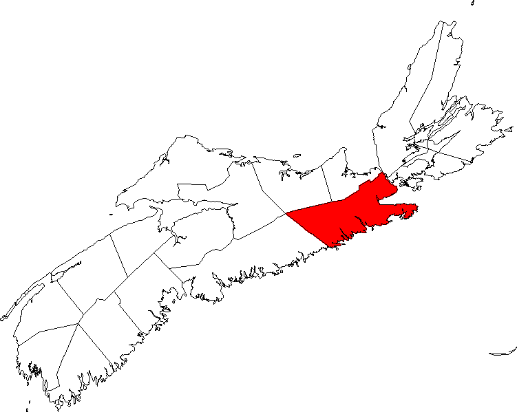
- Guysborough County, Nova Scotia
Infobox Settlement
official_name = Pagename
other_name =
native_name =
nickname =
settlement_type = County
motto =
imagesize =
image_caption =
flag_size =
image_
seal_size =
image_shield =
shield_size =
city_logo =
citylogo_size =
mapsize = 275px
map_caption = Location of Pagename
mapsize1 =
map_caption1 =
image_dot_
dot_mapsize = 250px
dot_map_caption =Location of Pagename
dot_x = |dot_y =
pushpin_
pushpin_label_position =
pushpin_map_caption =
pushpin_mapsize =
subdivision_type = Country
subdivision_name = CAN
subdivision_type1 = Province
subdivision_name1 = NS
subdivision_type2 = Towns
subdivision_name2 = Canso
Mulgrave
subdivision_type3 = Municipal Districts
subdivision_name3 = Guysborough
St. Mary's
subdivision_type4 =
subdivision_name4 =
government_footnotes =
government_type =
leader_title = Warden
leader_name =Lloyd P. Hines
leader_title1 = Governing Body
leader_name1 =
leader_title2 =
leader_name2 =
leader_title3 =
leader_name3 =
leader_title4 =
leader_name4 =
established_title = Incorporated
established_date =April 17 ,1879
established_title2 =
established_date2 =
established_title3 =
established_date3 =
area_magnitude =
unit_pref =
area_footnotes =
area_total_km2 =4044.22
area_land_km2 =
area_water_km2 =
area_total_sq_mi =
area_land_sq_mi =
area_water_sq_mi =
area_water_percent =
area_urban_km2 =
area_urban_sq_mi =
area_metro_km2 =
area_metro_sq_mi =
population_as_of = 2006
population_footnotes =
population_note =
population_total = 9,827
population_density_km2 = 2.4
population_density_sq_mi =
population_metro =
population_density_metro_km2 =
population_density_metro_sq_mi =
population_urban =
population_density_urban_km2 =
population_density_urban_sq_mi =
population_blank1_title =
population_blank1 =
population_density_blank1_km2 =
population_density_blank1_sq_mi =
timezone = AST
utc_offset = -4
timezone_DST =
utc_offset_DST =
latd= |latm= |lats= |latNS=N
longd= |longm= |longs= |longEW=W
elevation_footnotes =
elevation_m =
elevation_ft =
postal_code_type =
postal_code =
area_code = 902
blank_name = Median Earnings*
blank_info =$30,441
blank1_name =
blank1_info =
website =
footnotes = *Median household income, 2000 ($) (all households)Part of a series about Places in Nova Scotia Guysborough County is a
county in the Canadian province ofNova Scotia .Taking its name from the Township of Guysborough, which was named in honour of Sir Guy Carleton, Guysborough County was created when Sydney County (Antigonish County) was divided in
1836 .In
1840 , the Township of St. Mary's, in Guysborough County, was set off as a separate and distinct District. In1863 the dividing line between Halifax and Guysborough Counties was altered and a polling district was added to Guysborough County.In
2007 , plans were announced for theMelford International Terminal , a 1,500,000 TEUmarine terminal on theStrait of Canso in Guysborough County with an expected opening date of 2011. [ [http://www.guysboroughjournal.com/archives/2006-07/2006-07-05-port.htm Port plans revealed] , "The Guysborough Journal",July 5 2007 , RetrievedMay 29 2008 ]Communities
For a list of communities in Guysborough County, see List of communities.
References
External links
* [http://ns1763.ca/guysbco/guysbcondx.html Photographs of historic monuments in Guysborough County]
* [http://www.melford-terminal.com Melford International Terminal]
* [http://www.authenticseacoast.com Authentic Seacoast Properties]
Wikimedia Foundation. 2010.
