- Stewiacke, Nova Scotia
Infobox Settlement
official_name = Pagename
other_name =
native_name =
nickname = Halfway between the North Pole and the Equator
settlement_type = Town
motto =
imagesize =
image_caption =
flag_size =
image_
seal_size =
image_shield =
shield_size =
city_logo =
citylogo_size =
mapsize =
map_caption = Location of Pagename
mapsize1 =
map_caption1 =
image_dot_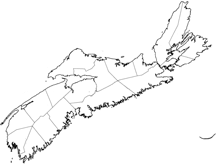
dot_mapsize = 250px
dot_map_caption =Location of Pagename
dot_x = 110 |dot_y = 95
pushpin_
pushpin_label_position =
pushpin_map_caption =
pushpin_mapsize =
subdivision_type = Country
subdivision_name = CAN
subdivision_type1 = Province
subdivision_name1 = NS
subdivision_type2 = Municipality
subdivision_name2 = Colchester County
subdivision_type3 =
subdivision_name3 =
subdivision_type4 =
subdivision_name4 =
government_footnotes =
government_type =
leader_title =Mayor
leader_name = Dereck Rhoddy
leader_title1 = Governing Body
leader_name1 = Stewiacke Town Council
leader_title2 =
leader_name2 =
leader_title3 =
leader_name3 =
leader_title4 =
leader_name4 =
established_title =
established_date =
established_title2 = Incorporated
established_date2 =August 30 ,1906
established_title3 =
established_date3 =
area_magnitude =
unit_pref =
area_footnotes =
area_total_km2 = 17.67
area_land_km2 =
area_water_km2 =
area_total_sq_mi =
area_land_sq_mi =
area_water_sq_mi =
area_water_percent =
area_urban_km2 =
area_urban_sq_mi =
area_metro_km2 =
area_metro_sq_mi =
population_as_of = 2006
population_footnotes =population_note =
population_total = |1,421
population_density_km2 80.4
population_density_sq_mi =
population_metro =
population_density_metro_km2 =
population_density_metro_sq_mi =
population_urban =
population_density_urban_km2 =
population_density_urban_sq_mi =
population_blank1_title =
population_blank1 =
population_density_blank1_km2 =
population_density_blank1_sq_mi =
timezone = AST
utc_offset = -4
timezone_DST = ADT
utc_offset_DST = -3
latd= |latm= |lats= |latNS=N
longd= |longm= |longs= |longEW=W
elevation_footnotes =
elevation_m = 100
elevation_ft =
postal_code_type = Postal code
postal_code = B0N 2J0
area_code = 902
blank_name =Telephone Exchange
blank_info = 639 , 671
blank1_name =Median Earnings*
blank1_info =$26,521
blank2_name = NTS Map
blank2_info = 011E03
blank3_name = GNBC Code
blank3_info = CBKOM
website = http://www.stewiacke.ns.ca
footnotes = *Median household income, 2000 ($) (all households)Part of a series about Places in Nova Scotia Stewiacke (2006 population: 1,422) is a
rural town located in southern Colchester County,Nova Scotia ,Canada . The town was incorporated onAugust 30 ,1906 .The town is located at the confluence of the Stewiacke and
Shubenacadie River and is a service and support centre for local agricultural communities as well as a service exit on Highway 102.In recent decades, the town has found fame with tourists for its Mastodon Ridge development near the highway exit; it is based on a local discovery (actually in Milford) of a
Mastodon skeleton. The Mastodon Ridge Complex features a Nova Scotia Craft store, a children's toy store, a mini golf and museaum which displays several of the mastodon's bones.In the past, the town has also played up its location on the
45th parallel , although 45º N latitude actually falls several kilometres south of the town near neighbouring Shubenacadie.The town's most notorious event of note occurred on Friday
April 12 ,2001 , when a local teenager, at home on a school in-service day, tampered with a railway switch on the CN Rail Halifax-Montreal mainline, causingVIA Rail Canada 's "Ocean" to derail several minutes later when it passed through the centre of the community. Several buildings and rail cars were destroyed and many people were injured, including some severely, although no fatalities resulted.Stewiacke celebrated its centennial anniversary of incorporation on Town Days,
August 4 -6, 2006.External links
* [http://www.stewiacke.net Town of Stewiacke]
* [http://www.centralnovascotia.com Central Nova Tourist Association - official website]
Wikimedia Foundation. 2010.