- Nova Scotia Route 289
-
Route 289
Route information Maintained by Nova Scotia Department of Transportation and Infrastructure Renewal Length: 98 km[1] (61 mi) Major junctions West end:  Route 236 in Green Oaks
 Hwy 102 / Trunk 2 in Brookfield
 Route 336 in Springside


 Hwy 104 (TCH) / Route 348 / Route 374 in New Glasgow
East end: Route 348 in Little HarbourLocation Counties: Colchester / Pictou Highway system Provincial highways in Nova Scotia
←  Route 277
Route 301  →
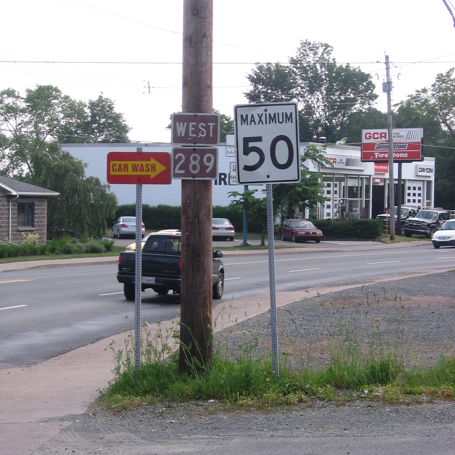
→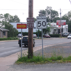 Route 289 in the area of Stellarton Road in New Glasgow. It shares the same route as Nova Scotia Trunk 4 on the west side of New Glasgow.
Route 289 is a collector road in the Canadian province of Nova Scotia.
It is located in the northern and central part of the province, connecting Melmerby Beach Provincial Park in Kings Head with Route 236 near Green Oaks.
Communities
- Green Oaks (approximate terminus)
- Pleasant Valley
- Brookfield
- Middle Stewiacke
- Halfway Brook
- Otter Brook
- Upper Stewiacke
- Stewiacke Cross Roads
- Springside
- Sheepherders Junction
- Lansdowne
- New Lairg
- Rocklin
- Union Centre
- Hazel Glen
- Westville
- New Glasgow
- Academy
- Little Harbour Road
- Little Harbour
See also
References
- ^ Atlantic Canada Back Road Atlas ISBN 978-1-55368-618-7 Pages 54, 68-69
Roads and highways in Nova Scotia 100-series Trunk Routes Collector roads 201 · 202 · 203 · 204 · 205 · 206 · 207 · 208 · 209 · 210 · 211 · 212 · 213 · 214 · 215 · 216 · 217 · 219 · 221 · 223 · 224 · 236 · 239 · 242 · 245 · 246 · 247 · 252 · 253 · 255 · 256 · 276 · 277 · 289 · 301 · 302 · 303 · 304 · 305 · 306 · 307 · 308 · 309 · 311 · 312 · 316 · 318 · 320 · 321 · 322 · 324 · 325 · 326 · 327 · 328 · 329 · 330 · 331 · 332 · 333 · 334 · 335 · 336 · 337 · 340 · 341 · 344 · 347 · 348 · 349 · 354 · 357 · 358 · 359 · 360 · 362 · 366 · 368 · 374 · 376 · 395Scenic routes Categories:- Roads in Colchester County, Nova Scotia
- Roads in Pictou County, Nova Scotia
- Nova Scotia provincial highways
- Nova Scotia road stubs
Wikimedia Foundation. 2010.