- Nova Scotia Trunk 6
-

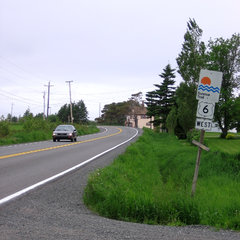 Nova Scotia Trunk 6 in the community of Toney River.
Trunk 6 is part of the Canadian province of Nova Scotia's system of trunk highways. The route runs from Highway 104 exit 3 at Amherst to the rotary at Pictou, a distance of 144 kilometres. It is part of the Sunrise Trail, a designated tourist route.
From Amherst, Trunk 6 goes in an easterly direction to the village of Port Philip, where it meets the Northumberland Strait. The route then follows the strait's shoreline through Pugwash, Wallace and Tatamagouche to the town of Pictou.
Until the construction of Highway 106 in the late 1960s, Trunk 6 continued south to New Glasgow on the Alma Road and Trunk 4.
Contents
Route description
For most of its length Trunk 6 is a two lane highway with a speed limit of 80 km/h. In communities, villages or towns the speed limit may drop to as low as 50 km/h.
Communities
- Amherst (Victoria Street East and Victoria Street West)
- East Amherst
- Shinimicas Bridge
- Port Howe
- Port Philip
- Pugwash
- Wallace
- Tatamagouche
- Pictou
Preceded by
 Hwy 104 (TCH)
Trunk 6
Nova ScotiaSucceeded by
 Hwy 106 (TCH)Route 376
See also
External links
References
- Map of Nova Scotia
Roads and highwaysin Nova Scotia 100-series Trunk Routes Collector roads 201 · 202 · 203 · 204 · 205 · 206 · 207 · 208 · 209 · 210 · 211 · 212 · 213 · 214 · 215 · 216 · 217 · 219 · 221 · 223 · 224 · 236 · 239 · 242 · 245 · 246 · 247 · 252 · 253 · 255 · 256 · 276 · 277 · 289 · 301 · 302 · 303 · 304 · 305 · 306 · 307 · 308 · 309 · 311 · 312 · 316 · 318 · 320 · 321 · 322 · 324 · 325 · 326 · 327 · 328 · 329 · 330 · 331 · 332 · 333 · 334 · 335 · 336 · 337 · 340 · 341 · 344 · 347 · 348 · 349 · 354 · 357 · 358 · 359 · 360 · 362 · 366 · 368 · 374 · 376 · 395Scenic routes
Categories:- Roads in Cumberland County, Nova Scotia
- Roads in Colchester County, Nova Scotia
- Roads in Pictou County, Nova Scotia
- Nova Scotia provincial highways
- Nova Scotia road stubs


Wikimedia Foundation. 2010.