- Amherst, Nova Scotia
Infobox Settlement
official_name = Pagename
other_name =
native_name =
nickname =
settlement_type = Town
motto = Faith in our people, pride in our products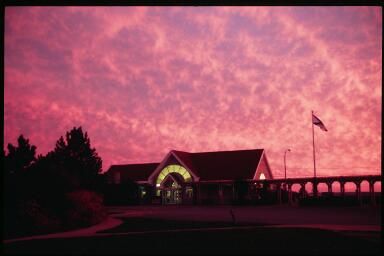
imagesize = 250px
image_caption = The Nova Scotia Visitor Information Centre, located in Fort Lawrence, 3 kilometres west of Amherst.
flag_size =
image_
seal_size =
image_shield = Amherst.jpg
shield_size =
city_logo =
citylogo_size =
mapsize =
map_caption = Location of Pagename
mapsize1 =
map_caption1 =
image_dot_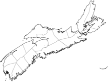
dot_mapsize = 250px
dot_map_caption =Location of Pagename
dot_x =78 |dot_y =58
pushpin_
pushpin_label_position =
pushpin_map_caption =
pushpin_mapsize =
subdivision_type = Country
subdivision_name = CAN
subdivision_type1 = Province
subdivision_name1 = NS
subdivision_type2 = Municipality
subdivision_name2 = Cumberland County
subdivision_type3 =
subdivision_name3 =
subdivision_type4 =
subdivision_name4 =
government_footnotes =
government_type =
leader_title =Mayor
leader_name =Jerry Hallee
leader_title1 = Governing Body
leader_name1 =Amherst Town Council
leader_title2 =Deputy Mayor
leader_name2 =George Baker
leader_title3 =Councillors
leader_name3 =Robert Angel, Ed Chitty, Dale Fawthrop, David March, Terry Rhindress
leader_title4 =
leader_name4 =
established_title = Founded
established_date = 1764
established_title2 = Incorporated
established_date2 =December 18 ,1889
established_title3 =
established_date3 =
area_magnitude =
unit_pref =
area_footnotes =
area_total_km2 = 12.02
area_land_km2 =
area_water_km2 =
area_total_sq_mi =
area_land_sq_mi =
area_water_sq_mi =
area_water_percent =
area_urban_km2 =
area_urban_sq_mi =
area_metro_km2 =
area_metro_sq_mi =
population_as_of = 2006
population_footnotes =
population_note =
population_total = 9505
population_density_km2 = 790.7
population_density_sq_mi =
population_metro =
population_density_metro_km2 =
population_density_metro_sq_mi =
population_urban =
population_density_urban_km2 =
population_density_urban_sq_mi =
population_blank1_title =
population_blank1 =
population_density_blank1_km2 =
population_density_blank1_sq_mi =
timezone = AST
utc_offset = -4
timezone_DST =
utc_offset_DST =
latd=45 |latm=49 |lats= |latNS=N
longd=64 |longm=13 |longs= |longEW=W
elevation_footnotes =
elevation_m = 22.11
elevation_ft =
postal_code_type = Postal code
postal_code = B4H
area_code = 902
blank_name =Telephone Exchange s
blank_info =297, 660-1, 664, 667, 669, 694, 699
blank1_name =Median Earnings*
blank1_info =$38,831
blank2_name = NTS Map
blank2_info = 021H16
blank3_name = GNBC Code
blank3_info = CAAOO
website = [http://www.amherstns.com/ http://www.amherstns.com/]
footnotes = *Median household income, 2000 ($) (all households)
Amherst (2006 population 9,505; UA population 9,547 http://www12.statcan.ca/english/census06/data/popdwell/Table.cfm?T=301&SR=100&S=1&O=A&RPP=100&SRCH=1 Amherst Community Profile versus other Canadian cities] ) is a Canadian town in northwestern Cumberland County,Part of a series about Places in Nova Scotia Nova Scotia .Located at the northeast end of the
Cumberland Basin , an arm of theBay of Fundy , Amherst is strategically situated on the eastern boundary of theTantramar Marshes 3 kilometres east of the interprovincial border withNew Brunswick and 65 kilometres east of the city ofMoncton . It is also located 60 kilometres southwest of the New Brunswick abutment of theConfederation Bridge toPrince Edward Island at Cape Jourimain.Amherst is the
shire town and largest population centre in Cumberland County. According to Dr. Graham P. Hennessey, "TheMicmac name was "Nemcheboogwek" meaning "going up rising ground", in reference to the higher land to the east of the Tantramar Marshes. TheAcadian s who settled here as early as 1672 called the village "Les Planches". It was named Amherst by ColonelJoseph Morse , the first settler, in honour of LordJeffrey Amherst , the commander-in-chief of theBritish Army in North America during theSeven Years' War who is well noted for his use of biological warfare against Aboriginals of theGreat Lakes Region of North America duringPontiac's Rebellion .History
The town was first settled in 1764 by immigrants from
Yorkshire following theexpulsion of the Acadians , with the original settlement being located three kilometres southwest of the present town on the shore of theBay of Fundy .Fact|date=December 2007 These settlers were joined byUnited Empire Loyalists (Loyalists who fled the American colonies during theAmerican Revolution ). A mill was built on the current townsite, and the residents moved to be closer to work.During the 19th century, Amherst became an important regional centre for shipbuilding and other services to outlying communities. An indication of the town's importance in Canadian history is seen with its four
Fathers of Confederation :Edward B. Chandler ,Robert B. Dickey ,Jonathan McCully , andSir Charles Tupper .During the late 1800s, local industrialists and entrepreneurs constructed many fine Victorian and Edwardian homes along Victoria Street East, leading toward the farming hamlet of East Amherst. Many notable residents have lived in this district, including Tupper, Senator
Thomas R. Black , the Barker Family, the Lamy Family, the Pugsley Family and Molly Simmons Critchely.Amherst experienced unprecedented industrialization in the late 1870s after the
Intercolonial Railway of Canada constructed its mainline from Halifax toQuebec through the town in 1872. The location of the railway line away from the Bay of Fundy coast further consolidated the town at its present location as industry and commercial activity centred around this important transportation link. The economic boom created by the arrival of the Intercolonial Railway lasted throughWorld War I and numerous foundries, factories and mills opened, giving rise to the nickname "Busy Amherst".Amherst's prosperity would not last as the failed economic policies of the federal and provincial governments, coupled with World War I, saw the town's industrial economy begin a slow decline during the 1910s, punctuated by the Amherst General Strike in 1919 where worker unrest over social and economic conditions led to mass protests in sympathy with the
Winnipeg General Strike .The eventual closure of companies such as
Robb Engineering & Manufacturing (purchased byCanada Car and Foundry and then closed) andAmherst Pianos , among others led to a resignation of lost dreams as the town was overtaken by other newer manufacturing centres in central Canada during the 20th century. Amherst had a modest-sized industrial park constructed during the 1960s when theTrans-Canada Highway was being developed. Today the majority of the town's major employers are located there, includingPolyCello andIMP Aerospace .Amherst hosted aprisoner of war detention centre during World War I, andRussia n revolutionaryLeon Trotsky was incarcerated there for several months after he was arrested in Halifax,Nova Scotia in April 1917.During
World War II theRoyal Canadian Navy named aFlower class corvette HMCS Amherst .The town is served by
VIA Rail 's Halifax-to-Montreal train "Ocean" and intercity buses ofAcadian Lines .Businesses
Amherst is the retail centre for Cumberland County and the southeastern part of Westmorland County. The town has several
big box store s, includingWal-Mart ,Sobeys ,Atlantic Superstore ,Zellers ,Canadian Tire ,Kent Building Supplies , Panhandler andShoppers Drug Mart , in addition to several fast food restaurants and auto dealerships. There are also smaller independent retailers and restaurants in the downtown area, situated among various historic buildings. The town's location on Highway 104 (part of theTrans-Canada Highway ) has transformed South Albion street and Robert Angus Drive into a highway service centre.Notable citizens
*
Willard Boyle , co-inventor of thecharge-coupled device (CCD).
*Bill Casey , politician
*Edward Barron Chandler , politician
*Robert C. Coates , politician
*George Barton Cutten , university president
*Mal Davis , NHL player
*Robert Barry Dickey , politician
*Leslie Feist , musician
*Sandy Goss , Olympian
*Rocky Johnson , professional wrestler, WWE Hall of Fame inductee
*Jonathan McCully , politician
*Willard M. Mitchell , artist and architect
*Peter Myles , film music editor
*Bill Riley , third Black player to play in the NHL
* SirCharles Tupper , Prime Minister of CanadaMedia
Radio
Amherst is currently served with three radio stations; CKDH,
CFNS-FM andCITA-FM . An application by Tantramar Community Radio Society for a newcommunity radio station to serve Amherst was denied by theCanadian Radio-television and Telecommunications Commission on Sepetember 11, 2008. [ [http://www.crtc.gc.ca/archive/ENG/Decisions/2008/db2008-254.htm Broadcasting Decision CRTC 2008-254] ]=Television= Youth Sports
Youth Baseball
Amherst is proud of its youth baseball organization. Every August, Amherst hosts an eight-team tournament, including four teams from New England. The 2008 tournament resulted in a tie due to a rain out. The winners were
Marlborough, Massachusetts , and Amherst.Fact|date=October 2008References
External links
* [http://www.town.amherst.ns.ca/ Town of Amherst]
* [http://weatheroffice.ec.gc.ca/city/pages/ns-33_metric_e.html Environment Canada - Amherst Weather]
* [http://www.ccgs.ednet.ns.ca/cumb/amherst.htm Cumberland County Genealogical Society - Amherst - The Local Newspaper] Compares Amherst and its newspaper in 1939 and 1914.----Geographic Location (8-way)
Centre = Pagename
North =Tantramar Marsh
Northeast = Tyndal Road
on Route
East = Warren
on Trunk
Southeast = Brookdale
on Route
South = Upper Nappan
on Trunk
Southwest = Amherst Point
West =Cobequid Bay
Northwest = Fort Lawrence
on Highway
 ----
----
Wikimedia Foundation. 2010.