- Northumberland Strait
-
Coordinates: 46°30′N 64°30′W / 46.5°N 64.5°W
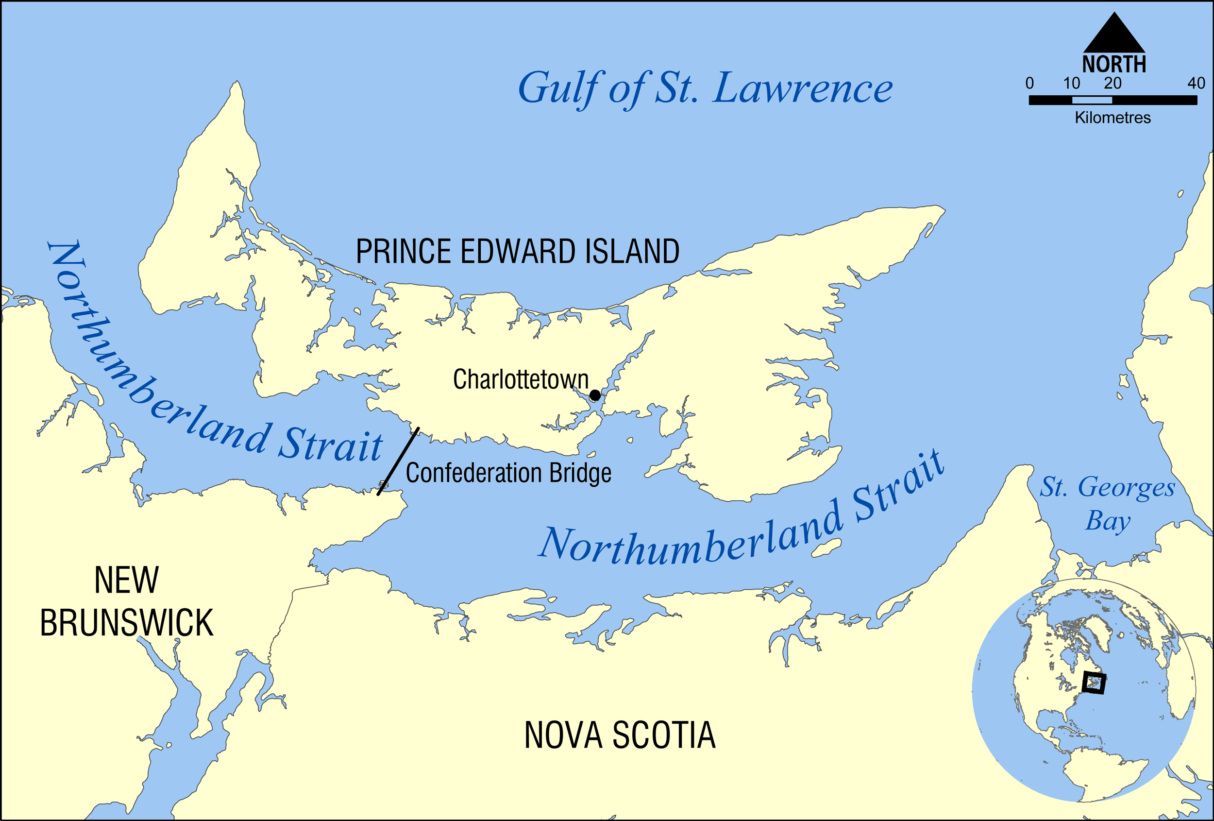
 Map of the Northumberland Strait.
The Northumberland Strait (French: détroit de Northumberland) is a strait in the southern part of the Gulf of Saint Lawrence in eastern Canada. The strait is formed by Prince Edward Island and the gulf's eastern, southern and western shores.
Contents
Boundaries
The western boundary of the strait is delineated by a line running between North Cape, Prince Edward Island and Point Escuminac, New Brunswick while the eastern boundary is delineated by a line running between East Point, Prince Edward Island and Inverness, Nova Scotia.
Water temperature
The strait's shallow depths lend to warm water temperatures in summer months, with some areas reaching 25 °C, or 77 °F. Consequently the strait is reportedly home to the warmest ocean water temperatures in Canada, and some of the warmest ocean water temperatures on the Atlantic coast north of Virginia.
During the winter months between December and April, sea ice covers the entire strait and Gulf of St. Lawrence.
Geomorphology
While the western shores of Cape Breton Island and northeastern shores of the Nova Scotia peninsula are dominated by granite, sedimentary rocks along the central and western parts of the strait, as well as the entire south shore of Prince Edward Island, consist of sandstone, lending to beautiful sandy beaches with minimal coastal development. The largest island in the strait is Pictou Island.
Settlements
Major communities on the strait include the cities of Charlottetown and Summerside, Prince Edward Island as well as the towns of Souris, Prince Edward Island, Pictou, Nova Scotia, and Shediac, New Brunswick.
Transportation
Shipping
The Northumberland Strait is a minor shipping route, with ports such as Pugwash shipping salt, Summerside, Charlottetown, Georgetown and Souris shipping agricultural products and receiving petroleum and aggregate, and Pictou shipping forestry products and general cargo. Shipping has declined in recent decades with the decline of rail service to ports and the increased capacity of highways to larger ports outside of the Gulf of St. Lawrence, which freezes in the winter.
Confederation Bridge
The narrowest part of the strait, the 13-kilometre (7–nautical mile) wide Abegweit Passage in the western part of the strait between Borden-Carleton, Prince Edward Island and Cape Jourimain, New Brunswick, is now spanned by the Confederation Bridge.
Ferries
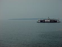
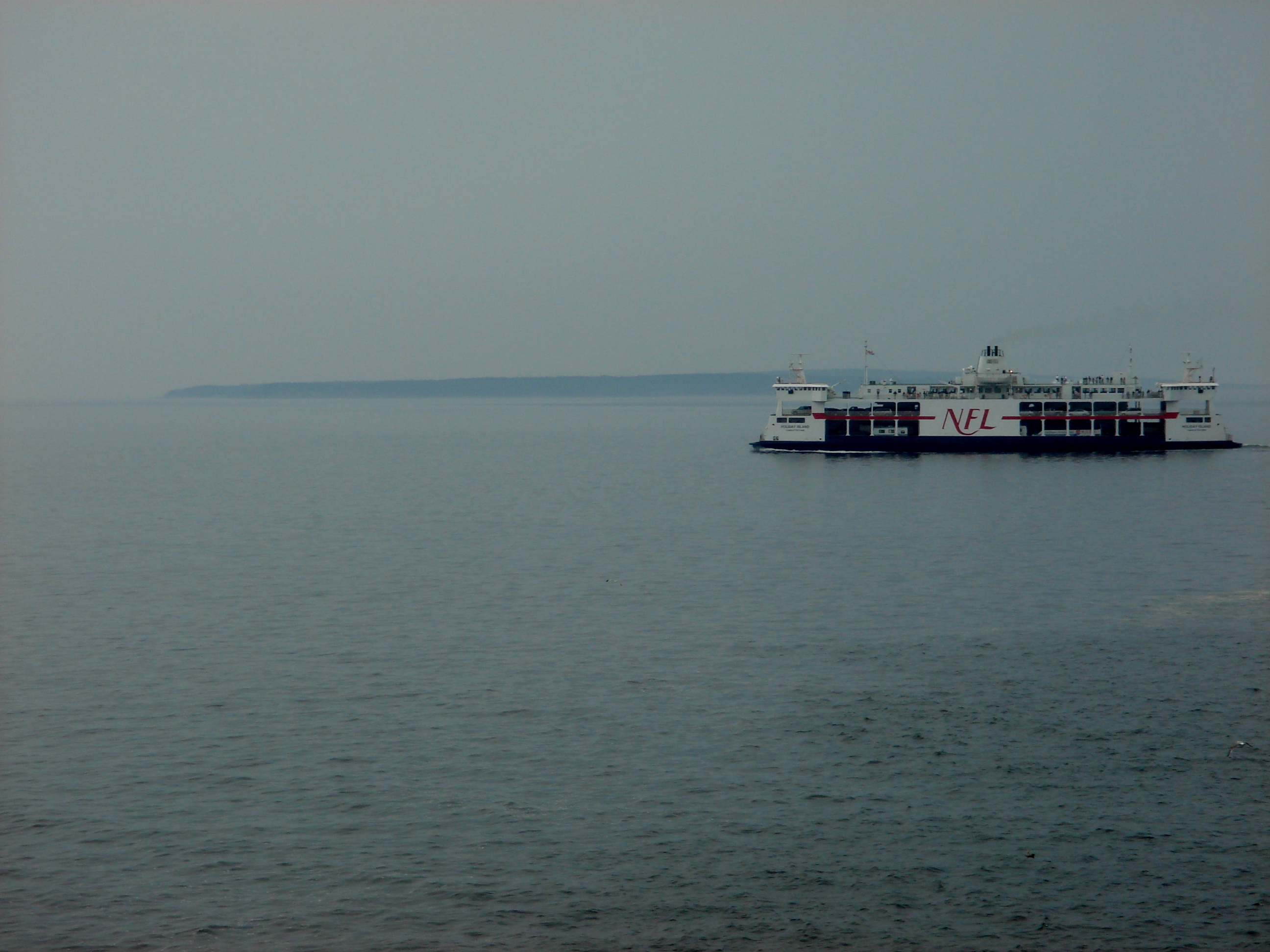
The strait hosts two seasonal ferry services: Northumberland Ferries Limited operates a passenger/vehicle service between Caribou, Nova Scotia and Wood Islands, Prince Edward Island, a separate passenger-only ferry service also operates from Caribou to Pictou Island. The other passenger/vehicle service is located between Souris, Prince Edward Island and Iles de la Madeleine, Quebec. Both services are located at the eastern end of the strait.
There was a ferry service between Borden-Carleton, Prince Edward Island and Cape Tormentime, New Brunswick until May 31, 1997. It was one of Canada's busiest ferry services and was operated by Marine Atlantic across Abegweit Passage. This service has been replaced by the Confederation Bridge.
Undersea cables
- Electrical
Maritime Electric supplies electricity to customers across Prince Edward Island. The electricity is mainly purchased from NB Power and supplied via an interprovincial electrical interconnection consisting of two submarine transmission cables under the Northumberland Strait at the western end of the Abegweit Passage between Murray Corner, New Brunswick and Fernwood, Prince Edward Island.
Pictou Island, in Nova Scotia receives no electricity from that province's utility, Nova Scotia Power. Residents must generate their own electricity from off-grid sources.
- Telecommunications
Bell Aliant has two fibre optic telecommunications cables spanning Northumberland Strait to serve Prince Edward Island. The first is a submarine cable running from Caribou, Nova Scotia to Wood Islands, Prince Edward Island. The other runs through the Confederation Bridge; this cable replaced a submarine cable that used to run from Borden-Carleton, Prince Edward Island to Cape Tormentine, New Brunswick.
Eastlink has a fibre optic telecommunications cable connecting Gaspereau, Prince Edward Island with Port Hood, Nova Scotia.
Swim Crossings
There have been several documented unassisted swim crossings of the strait, although there is no official body to verify these claims. There are only two documented single-day double crossings (~28km) to date:
- On July 26, 2007, Jennifer Alexander (who has Type 1 Diabetes) of Halifax, swam a double crossing in 19 hours, 17 minutes.[1]
- On July 26, 2008, Kristin Roe, also of Halifax, swam a double crossing, recorded at 15 hours, 40 minutes for the Stephen Lewis Foundation and Farmers Helping Farmers.[2]
References
- ^ "The Canadian Press: Halifax woman completes two-way swim of Northumberland Strait". http://www.journalpioneer.com/index.cfm?pid=1632&cpcat=atlantic&stry=17073014. Retrieved 2008-08-13.
- ^ "The Charlottetown Guardian: She's Doing It for Everyone But Herself". http://www.theguardian.pe.ca/index.cfm?sid=156725&sc=98. Retrieved 2008-08-13.
See also
- Northumberland Strait microclimate
External links
Categories:- Landforms of Prince Edward Island
- Landforms of New Brunswick
- Straits of Nova Scotia
- Straits of Canada
- Borders of New Brunswick
- Borders of Nova Scotia
- Borders of Prince Edward Island
Wikimedia Foundation. 2010.