- Nova Scotia Highway 101
-
Highway 101
Route information Maintained by Nova Scotia Department of Transportation and Infrastructure Renewal Length: 310 km[1] (193 mi) Major junctions West end:  Trunk 3 near Yarmouth43°50′29″N 66°5′56.7″W / 43.84139°N 66.099083°W
 Trunk 8 near Annapolis Royal
 Trunk 14 near Windsor
East end: 
 Hwy 102 / Trunk 1 in Bedford44°44′41.5″N 63°39′23.4″W / 44.744861°N 63.6565°W
Highway system Provincial highways in Nova Scotia
←  Trunk 30
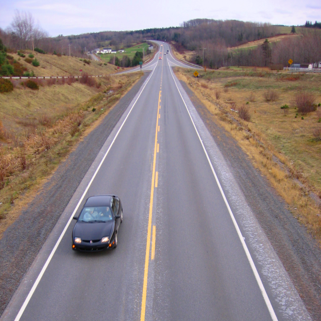
Hwy 102 → View of Highway 101 as it passes outside Kentville, Nova Scotia.
Highway 101 is an east-west highway in Nova Scotia that runs from Bedford to Yarmouth.[1][2]
The highway follows a 310 km (190 mi) route along the southern coast of the Bay of Fundy through the Annapolis Valley. Between its western terminus at Yarmouth to Weymouth, the highway is 2-lane controlled access. Between Weymouth and Digby, the highway reverts to a 2-lane local road. From Digby to Grand Pre, the highway is 2-lane controlled access. From the Gasperaux River crossing near Grand Pre to 3 km west of Exit 6 (Falmouth) the highway is a 4-lane expressway. Heading east the highway is 2-lane controlled access until Exit 5 (Trunk 14). From Three Mile Plains to its eastern terminus at Bedford, the highway is a 4-lane expressway. Some of the 2-lane controlled access sections of the highway are actually 3 or 4 lanes, with the addition of passing lanes. One section of the 4-lane expressway near Hantsport is actually a short 5-lane (3 lanes westbound) section for about 2 km due to previous road configuration for a passing lane due to a steep hill.[1]
The highway has developed in sections, with the part between Bedford and Windsor having been built in the 1970s, followed by parts through the Annapolis Valley and Digby and Yarmouth counties in the 1980s-1990s. The highway was built largely to replace the Dominion Atlantic Railway service in the communities along its route. As a result the highway serves as a "B-Train" route for the area.[1]
Exit list
Location km Exit number Destinations Notes Lower Sackville 0 
 Trunk 1 east to Trunk 2 / Trunk 7 – Bedford, Dartmouth
Continuation beyond Hwy 102 0 1 Hwy 102 – Halifax International Airport, Truro, HalifaxSigned as exits 1G (south) and 1H (north) 0 1K Trunk 1 west / Cobequid Road – Lower SackvilleWestbound exit and eastbound entrance 0 1F To Trunk 7 east (Bedford Bypass) – DartmouthEastbound exit and westbound entrance 3 2  Route 354 (Beaver Bank Road) – Lower Sackville, Middle Sackville
Mount Uniacke 16 3 Trunk 1 – Mount Uniacke, Upper SackvilleSt. Croix 35 4  Trunk 1 / Trunk 14 / Route 215 – St. Croix, Newport, Ellershouse, Noel Shore
Three Mile Plains 44 5 Trunk 14 to Trunk 1 / Route 215 – Windsor, Chester, Three Mile Plains, RawdonWindsor 47 5A Wentworth Road - Windsor 49 6 Trunk 1 – WindsorFalmouth 50 7 Trunk 1 – FalmouthHantsport 56 8 Trunk 1 – Hantsport, Mount DensonWest Brooklyn 61 8A Ben Jackson Road Avonport 65 9 Trunk 1 east – Avonport, West BrooklynEast end of Trunk 1 overlap Grand Pre 68 10 Trunk 1 west – Grand Pré, Hortonville, WolfvilleWest end of Trunk 1 overlap Greenwich, Wolfville 77 11  To Trunk 1 / Route 358 – Greenwich, Port Williams, Canning, Wolfville
New Minas 83 12 To Trunk 1 – New Minas, KentvilleKentville 87 13  Trunk 12 – Kentville, North Alton, South Alton, New Ross
Kentville, Coldbrook 91 14 Trunk 1 – Coldbrook, Cambridge, Waterville, KentvilleBerwick 105 15  Route 360 – Berwick, Harbourville, Cambridge
Aylesford 114 16 Victoria Harbor Road - Aylesford, Auburn Kingston 123 17 Bishop Mountain Road - Kingston, Greenwood Westbound exit and eastbound entrance 125 17 Marshall Road - Kingston, Greenwood Eastbound exit and westbound entrance Middleton 133 18A 
 To Trunk 1 / Trunk 10 / Route 362 – Middleton, Nictaux Falls, Margaretsville
Westbound exit and eastbound entrance 136 18 To Trunk 1 / Trunk 10 / Route 362 – Middleton, Brickton, Mount Hanley, Nictaux Falls, MargaretsvilleLawrencetown 144 19 To Trunk 1 – Lawrencetown, Clarence, Port LorneBridgetown 156 20 Trunk 1 (Evangeline Trail) – Bridgetown, Upper Granville, Paradise160 21  To Trunk 10 / Route 201 – Bridgetown, Centrelea, Tupperville
Lequille, Annapolis Royal 182 22 Trunk 8 north to Trunk 1 / Route 201 – Lequille, Granville Ferry, Annapolis RoyalCornwallis 196 23A Cornwallis, Clementsport, Clemenstvale Westbound exit and eastbound entrance Deep Brook 200 23 Trunk 1 east – Deep Brook, Cornwallis, ClementsportEast end of Trunk 1 overlap Smith's Cove 202 24 Trunk 1 west – Smith's Cove, Bear RiverWest end of Trunk 1 overlap Joggin's Bridge 207 25 Trunk 1 eastEast end of Trunk 1 overlap; at-grade Digby 210 26 
 Route 303 to Route 217 – Digby
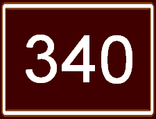
Weymouth 233 27 Trunk 1 westWest end of Trunk 1 overlap; at-grade St. Bernard 240 28  Trunk 1 to Route 340 – Weymouth, St. Bernard, Belliveaus Cove, Grosses Coques, Church Point
Comeauville, Little Brook 255 29 To Trunk 1 – Concession, Comeauville, Church Point, Little Brook, SaulniervilleMeteghan 270 31 To Trunk 1 – Meteghan, St. Alphonse de Clare, Mavillette, Meteghan River, SaulniervilleSalmon River 282 32 Salmon River Road At-grade Port Maitland 291 33 To Trunk 1 – Port Maitland, Darling's Lake, Beaver RiverHebron 301 34 Route 340 to Trunk 1 – South Ohio, Hebron, YarmouthYarmouth 308  Trunk 3 to Hwy 103 – Yarmouth
Highway ends References
- ^ a b c d "Nova Scotia Roads - Highway 101". Nova Scotia Roads Website. http://www.the506.com/roads/NS/101.html. Retrieved 2009-05-30.
- ^ "Nova Scotia's Highway 101 to be widened". CBC News. 2009-03-06. http://www.cbc.ca/canada/nova-scotia/story/2009/03/06/highway-101-funding.html. Retrieved 2009-05-30.
Roads and highways in Nova Scotia 100-series Trunk Routes Collector roads 201 · 202 · 203 · 204 · 205 · 206 · 207 · 208 · 209 · 210 · 211 · 212 · 213 · 214 · 215 · 216 · 217 · 219 · 221 · 223 · 224 · 236 · 239 · 242 · 245 · 246 · 247 · 252 · 253 · 255 · 256 · 276 · 277 · 289 · 301 · 302 · 303 · 304 · 305 · 306 · 307 · 308 · 309 · 311 · 312 · 316 · 318 · 320 · 321 · 322 · 324 · 325 · 326 · 327 · 328 · 329 · 330 · 331 · 332 · 333 · 334 · 335 · 336 · 337 · 340 · 341 · 344 · 347 · 348 · 349 · 354 · 357 · 358 · 359 · 360 · 362 · 366 · 368 · 374 · 376 · 395Scenic routes Categories:- Nova Scotia provincial highways
- Limited-access roads in Canada
- Roads in Annapolis County, Nova Scotia
- Roads in Digby County, Nova Scotia
- Roads in the Halifax Regional Municipality
- Roads in Hants County, Nova Scotia
- Roads in Kings County, Nova Scotia
- Roads in Yarmouth County, Nova Scotia

Wikimedia Foundation. 2010.