- Bedford, Nova Scotia
Infobox Settlement
official_name = Bedford
other_name =
native_name =
nickname =
settlement_type = Community
motto =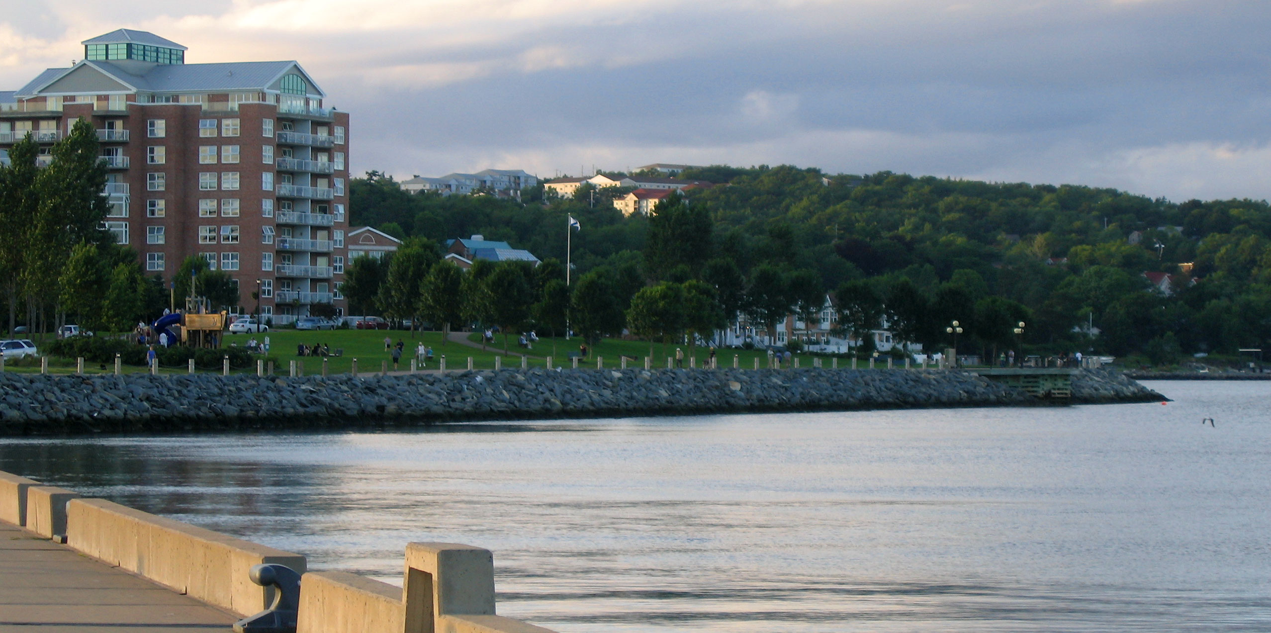
imagesize = 260px
image_caption = Waterfront development in Bedford, NS at the tip of the Bedford Basin
flag_size =
image_
seal_size =
image_shield =
shield_size =
city_logo =
citylogo_size =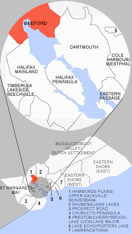
mapsize = 220px
map_caption = Location of Pagename
mapsize1 =
map_caption1 =
image_dot_
dot_mapsize = 250px
dot_map_caption =
dot_x = 97|dot_y =120
pushpin_
pushpin_label_position =
pushpin_map_caption =Location of Pagename
pushpin_mapsize =
subdivision_type = Country
subdivision_name = CAN
subdivision_type1 = Province
subdivision_name1 = NS
subdivision_type2 = Municipality
subdivision_name2 = HRM
subdivision_type3 = District
subdivision_name3 = 21
subdivision_type4 =
subdivision_name4 =
government_footnotes =
government_type =
leader_title =Governing Body
leader_name =Halifax Regional Council
leader_title1 = Community Council
leader_name1 = North West Community Council
leader_title2 =
leader_name2 =
leader_title3 =
leader_name3 =
leader_title4 =
leader_name4 =
established_title = Founded
established_date = 1750
established_title2 =
established_date2 =
established_title3 =
established_date3 =
area_magnitude =
unit_pref =
area_footnotes =
area_total_km2 =72.97
area_land_km2 =
area_water_km2 =
area_total_sq_mi =
area_land_sq_mi =
area_water_sq_mi =
area_water_percent =
area_urban_km2 =
area_urban_sq_mi =
area_metro_km2 =
area_metro_sq_mi =
population_as_of = 2006
population_footnotes =
population_note =
population_total = 16645
population_density_km2 =
population_density_sq_mi =
population_metro =
population_density_metro_km2 =
population_density_metro_sq_mi =
population_urban =
population_density_urban_km2 =
population_density_urban_sq_mi =
population_blank1_title =
population_blank1 =
population_density_blank1_km2 =
population_density_blank1_sq_mi =
timezone = AST
utc_offset = -4
timezone_DST = ADT
utc_offset_DST = -3
latd= 44.73212
longd= -63.65676
elevation_footnotes =
elevation_m = 0 - 107
elevation_ft =
postal_code_type =Postal code span
postal_code = B4A to B4B
area_code = 902
blank_name =Telephone Exchange
blank_info = 832, 835, 444
blank1_name = GNBC Code
blank1_info = CACLW
blank2_name = NTS Map
blank2_info = 011D12
website =
footnotes =Bedford (2006 pop.: 16,780) is a community in the
Halifax Regional Municipality ,Nova Scotia ,Canada . It was an independent town from 1980-1996. Bedford lies on the northwestern end ofBedford Basin , which is part of theHalifax Harbour . Bedford is a community of primarily middle class professional commutersuburb s for neighbouring Halifax and Dartmouth, with a reputation for large and expensive homes. It is located at the junctions of Trunks 1, 2, and 7.History
The history of Bedford began when Governor
Edward Cornwallis organised his men and began the construction of a road leading toMinas Basin on theBay of Fundy after establishing the garrison at Halifax. To protect it, he hired John Gorham and his Rangers to erect a fort on the shore ofBedford Basin . It was named Fort Sackville after Lionel Cranfield, Viscount Sackville and first Duke of Dorset. The area around the fort became known as Sackville until the mid-1850s when it became Bedford. In 1752, among the first to receive a large land grant was George Scott in the Fort Sackville area. Joseph Scott, paymaster at the Halifax Garrison in the 1760s received two grants in 1759 and 1765. He built Scott Manor House in 1770. Anthony Holland established the Acadian Paper Mill on the Basin around 1819 to provide paper to produce the Halifax newspaperAcadian Recorder . When the railway went through the station named Millview, the Moirs, Son and Co. moved a part of the Moirs Mill factory to Bedford. The Moirs Mill generating station built in the early 1930s to supply the necessary electricity required to run the factory.The village took on the name of Bedford in the honour of John Russell, the 4th Duke of Bedford and Secretary of State for the colonies in 1749. In 1896 the name became official by an Act of Legislation. Bedford was incorporated as atown onJuly 1 ,1980 . OnApril 1 ,1996 , Bedford was amalgamated with Halifax, Dartmouth, and Halifax County Municipality to form the Halifax Regional Municipality (HRM) for the municipal level of government however the place name still exist for 911,mail ,legal and other services.The current mayor of the HRM isPeter J. Kelly , who was the mayor of Bedford at the time of amalgamation.Bedford was rated by Macleans Magazine as being the "Best community to live in Canada," in an issue dated the 23rd of March 1997.
There is currently a movement within the community to gain more independence from HRM. Many residents feel that the area does not receive its fair share of public development. A common example in support of this view is the lack of recreational facilities in the area compared with other regions of the municipality.
Sports and Recreation
There is a popular walkway along much of the Bedford Basin waterfront, as well as the Bedford-Sackville Connector Greenway, a crushed gravel covered trail that meanders along the Sackville River. There is an outdoor 25m pool and smaller splash pool located at the Lions Park on Shore Drive. In the summer, there are numerous lakes sutable for swimming. The topography of the area limits the possible locations for soccer and football fields. However, there are fields at Basinview Drive School, Sunnyside Elementary, Bedford Junior High,
Charles P. Allen High School , and Range Field. The community is currently home to one ice rink, at the Lebrun Centre. However, construction recently began on new ice pads to be located on Duke Street.hopping and Eating
Bedford is well-served by two medium-sized malls,
Bedford Place Mall andSunnyside Mall . There are also many shops outside of the malls, such as Maples and Cricket on the Hearth. There are three main grocery stores:Real Atlantic Superstore ,Sobey's andPete's Frootique .In addition to the standard fastfood restaurants, Bedford is home to The Chickenburger, considered by many to be the iconic symbol of Bedford. There are also a number of upscale-casual restaurants, such as Il Mercato and The Cellar.
Transportation
Bedford is served
Halifax Regional Municipality 's transit authority,Metro Transit . Routes 66, 80, 82, 86 and 88 directly serve Bedford while many more routes serve the nearby Cobequid terminal inLower Sackville .There is a fast ferry service planned for the Mill Cove area that would connect to the Ferry Terminal in
Downtown Halifax .Bedford is well serviced by taxis, roads, highways, and sidwalks/walking paths.
References
External links
* [http://www.destination-ns.com/common/trails/areaid.asp?AreaID=4C Bedford on Destination Nova Scotia]
* [http://www.annapolisvalleytourism.com Annapolis Valley Tourism.com]

Wikimedia Foundation. 2010.