- Freeport, Nova Scotia
Infobox Settlement
official_name = Pagename
other_name =
native_name =
nickname =
settlement_type = Village
motto =
imagesize =
image_caption =
flag_size =
image_
seal_size =
image_shield =
shield_size =
city_logo =
citylogo_size =
mapsize =
map_caption =
mapsize1 =
map_caption1 =
image_dot_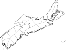
dot_mapsize =250px
dot_map_caption =Location of Pagename
dot_x = 3|dot_y = 127
pushpin_
pushpin_label_position =
pushpin_map_caption =
pushpin_mapsize =
subdivision_type = Country
subdivision_name = CAN
subdivision_type1 = Province
subdivision_name1 = NS
subdivision_type2 = County
subdivision_name2 = Digby
subdivision_type3 = Municipality
subdivision_name3 = The Municipality of the District of Digby
subdivision_type4 =
subdivision_name4 =
government_footnotes =
government_type =
leader_title =
leader_name =
leader_title1 =
leader_name1 =
leader_title2 =
leader_name2 =
leader_title3 =
leader_name3 =
leader_title4 =
leader_name4 =
established_title = Founded
established_date =1784
established_title2 =
established_date2 =
established_title3 =
established_date3 =
area_magnitude =
unit_pref =
area_footnotes =
area_total_km2 =
area_land_km2 =
area_water_km2 =
area_total_sq_mi =
area_land_sq_mi =
area_water_sq_mi =
area_water_percent =
area_urban_km2 =
area_urban_sq_mi =
area_metro_km2 =
area_metro_sq_mi =
population_as_of =
population_footnotes =
population_note =
population_total =
population_density_km2 =
population_density_sq_mi =
population_metro =
population_density_metro_km2 =
population_density_metro_sq_mi =
population_urban =
population_density_urban_km2 =
population_density_urban_sq_mi =
population_blank1_title =
population_blank1 =
population_density_blank1_km2 =
population_density_blank1_sq_mi =
timezone = AST
utc_offset = -4
timezone_DST = ADT
utc_offset_DST = -3
latd=44 |latm=16|lats= 27|latNS=N
longd=66 |longm=19 |longs=18 |longEW=W
elevation_footnotes =
elevation_m = 0- 5
elevation_ft =
postal_code_type = Canadian Postal code
postal_code =B0V 1B0
area_code = 902
blank_name =Telephone Exchange
blank_info = 839
blank1_name = NTS Map
blank1_info = 021B08
blank2_name = GNBC Code
blank2_info = CAMZW
website = http://www.freeportns.com/
footnotes =Part of a series about Places in Nova Scotia Freeport, Nova Scotia is a village in
Digby County, Nova Scotia and it is located on Long Island in theBay of Fundy .At the end of Digby Neck on Long Island, Freeport is a working fishing village nestled around tidal basin. This area is great for bird watching, beach combing, hiking trails, birds, whale watching, gift shops, accommodations, restaurants, and unique flora and fauna.
Average daily temperatures for summer
June: Daily high: 19°C (66°F) Nightly low: 7.7°C (46°F)
July: Daily high: 20.6°C (69°F) Nightly low: 10.7°C (51°F)
August: Daily high: 22°C (72°F) Nightly low: 11.4°C (53°F)
October: Daily high: 9°C (52°F)
History
Loyalists founded Freeport in 1784 establishing fishing and trading industries. Prior to this it had been inhabited by the Mi’kmaq Indians.
Place names such as Petit Passage, Grand Passage and the Saint Mary’s Bay can be attributed to the French explorer, Champlain, who first visited the area in 1604.
References
External links
* [http://freeportns.com Freeport Community Development Association]
* [http://www.eastcoastlobster.com East Coast Lobster ]
* [http://novascotiaoceanfronts.com Nova Scotia Oceanfronts]
Wikimedia Foundation. 2010.