- Charlesville, Nova Scotia
-
Charlesville — Community — Location of Charlesville, Nova Scotia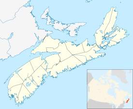

Coordinates: 43°34′57″N 65°46′44″W / 43.5825°N 65.778889°W[1] Country  Canada
Province  Nova Scotia
County Shelburne Municipal district Barrington Time zone AST (UTC-4) - Summer (DST) ADT (UTC-3) Area code(s) 902 Access Routes  Trunk 3
Charlesville is a community in the Canadian province of Nova Scotia, located in the Barrington municipal district of Shelburne County.[2]
Contents
Climate
Charlesville experiences an oceanic climate with cold, snowy winters and mild summers.
Climate data for Charlesville Month Jan Feb Mar Apr May Jun Jul Aug Sep Oct Nov Dec Year Record high °C (°F) 14.0
(57.2)12.0
(53.6)16.5
(61.7)23.5
(74.3)25.0
(77.0)29.0
(84.2)30.0
(86.0)29.0
(84.2)27.0
(80.6)26.0
(78.8)18.5
(65.3)15.5
(59.9)30.0
(86.0)Average high °C (°F) 1.7
(35.1)1.8
(35.2)4.3
(39.7)8.4
(47.1)12.7
(54.9)16.6
(61.9)18.4
(65.1)19.1
(66.4)17.4
(63.3)13.4
(56.1)9.0
(48.2)4.3
(39.7)10.59
(51.07)Average low °C (°F) −5.7
(21.7)−5.4
(22.3)−2.5
(27.5)1.6
(34.9)5.4
(41.7)8.9
(48.0)11.5
(52.7)12.0
(53.6)10.1
(50.2)6.5
(43.7)2.2
(36.0)−3.1
(26.4)3.46
(38.22)Record low °C (°F) −21
(−5.8)−19
(−2.2)−17.5
(0.5)−8.5
(16.7)−2.5
(27.5)0.0
(32.0)4.5
(40.1)3.0
(37.4)−3
(26.6)−5.5
(22.1)−12
(10.4)−20
(−4.0)−21
(−5.8)Precipitation mm (inches) 123.7
(4.87)91.9
(3.618)121.3
(4.776)103.7
(4.083)89.2
(3.512)98.0
(3.858)109.3
(4.303)81.0
(3.189)103.8
(4.087)102.9
(4.051)123.5
(4.862)115.4
(4.543)1,263.7
(49.752)Snowfall cm (inches) 32.9
(12.95)20.0
(7.87)11.8
(4.65)1.9
(0.75)0.0
(0)0.0
(0)0.0
(0)0.0
(0)0.0
(0)0.0
(0)4.3
(1.69)22.0
(8.66)92.9
(36.57)Avg. precipitation days (≥ 0.2 mm) 16.2 12.2 14.6 16.4 17.6 15.8 15.8 15.6 14.5 16.0 16.7 17.5 188.9 Source: Environment Canada[3] See also
References
External links

Lower East Pubnico Atlantic Ocean 
 Charlesville

Forbes Point Upper Woods Harbour Categories:- Communities in Shelburne County, Nova Scotia
- General Service Areas in Nova Scotia
- Populated coastal places in Canada
- Shelburne County, Nova Scotia geography stubs

Wikimedia Foundation. 2010.