- Marshallton, Chester County, Pennsylvania
-
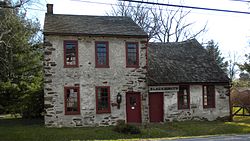
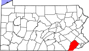
Marshallton — Unincorporated community — Blacksmith in Marshallton Location within the state of Pennsylvania Coordinates: 39°56′59″N 75°40′49″W / 39.94972°N 75.68028°WCoordinates: 39°56′59″N 75°40′49″W / 39.94972°N 75.68028°W Country United States State Pennsylvania County Chester Township West Bradford Time zone Eastern (EST) (UTC-5) - Summer (DST) EDT (UTC-4) ZIP codes 19382 Area code(s) 610 Marshallton Historic DistrictLocation: Strasburg Rd., Marshallton, Pennsylvania Area: 102 acres (41 ha) Architect: Multiple Architectural style: Mid 19th Century Revival, Colonial, Federal Governing body: Private NRHP Reference#: 86000056[1] Added to NRHP: January 08, 1986 Marshallton is an unincorporated community and federal historic district in West Bradford Township, Chester County, Pennsylvania, United States. It is one of three historic districts in West Bradford Township that are on the National Register of Historic Places. The village is largely known for its historic buildings, some notable restaurants, and the nearby Highland Orchards, a pick-your-own orchard offering a variety of produce year round and very popular for its apples and pumpkins as well as products made from the same. Highland Orchards is a frequent field trip destination for local schools, especially in the fall.
References
- ^ "National Register Information System". National Register of Historic Places. National Park Service. 2009-03-13. http://nrhp.focus.nps.gov/natreg/docs/All_Data.html.
External links
Municipalities and communities of Chester County, Pennsylvania County seat: West Chester City Boroughs Atglen | Avondale | Downingtown | Elverson | Honey Brook | Kennett Square | Malvern | Modena | Oxford | Parkesburg | Phoenixville | South Coatesville | Spring City | West Chester | West Grove
Townships Birmingham | Caln | Charlestown | East Bradford | East Brandywine | East Caln | East Coventry | East Fallowfield | East Goshen | East Marlborough | East Nantmeal | East Nottingham | East Pikeland | East Vincent | East Whiteland | Easttown | Elk | Franklin | Highland | Honey Brook | Kennett | London Britain | London Grove | Londonderry | Lower Oxford | New Garden | New London | Newlin | North Coventry | Penn | Pennsbury | Pocopson | Sadsbury | Schuylkill | South Coventry | Thornbury | Tredyffrin | Upper Oxford | Upper Uwchlan | Uwchlan | Valley | Wallace | Warwick | West Bradford | West Brandywine | West Caln | West Fallowfield | West Goshen | West Marlborough | West Nantmeal | West Nottingham | West Pikeland | West Sadsbury | West Vincent | West Whiteland | Westtown | Willistown
CDPs Unincorporated
communitiesBirchrunville | Bucktown | Chester Springs | Cheyney | Cossart | Coventryville | Daylesford | Eagle | Embreeville | Ercildoun | Hopewell | Kemblesville | Kimberton | Knauertown | Landenberg | Lower Hopewell | Ludwigs Corner | Marshallton | Mortonville | Nottingham | Pughtown | Southeastern | Strafford | Strickersville | Sugartown | Unionville | Valley Forge | Wayne | Willowdale | Yellow Springs
U.S. National Register of Historic Places Topics Lists by states Alabama • Alaska • Arizona • Arkansas • California • Colorado • Connecticut • Delaware • Florida • Georgia • Hawaii • Idaho • Illinois • Indiana • Iowa • Kansas • Kentucky • Louisiana • Maine • Maryland • Massachusetts • Michigan • Minnesota • Mississippi • Missouri • Montana • Nebraska • Nevada • New Hampshire • New Jersey • New Mexico • New York • North Carolina • North Dakota • Ohio • Oklahoma • Oregon • Pennsylvania • Rhode Island • South Carolina • South Dakota • Tennessee • Texas • Utah • Vermont • Virginia • Washington • West Virginia • Wisconsin • WyomingLists by territories Lists by associated states Other  Category:National Register of Historic Places •
  Portal:National Register of Historic PlacesCategories:
- Historic districts in Pennsylvania
- Federal architecture in Pennsylvania
- Georgian architecture
- Houses on the National Register of Historic Places in Pennsylvania
- Unincorporated communities in Chester County, Pennsylvania
- Pennsylvania geography stubs
Wikimedia Foundation. 2010.


