- New Garden Township, Chester County, Pennsylvania
-
For the township in Indiana, see New Garden Township, Wayne County, Indiana.
New Garden Township Township Country United States State Pennsylvania County Chester Elevation 472 ft (143.9 m) Coordinates 39°50′08″N 75°46′01″W / 39.83556°N 75.76694°W Area 16.2 sq mi (42 km2) - land 16.1 sq mi (42 km2) - water 0.1 sq mi (0 km2), 0.62% Population 11,984 (2010) Density 744.3 / sq mi (287.4 / km2) Timezone EST (UTC-5) - summer (DST) EDT (UTC-4) Area code 610 
 Location of New Garden Township in Pennsylvania
 Location of Pennsylvania in the United States
Website: http://www.newgarden.org New Garden Township is a township in Chester County, Pennsylvania, United States. The population was 11,984 at the 2010 census. New Garden is the center of the mushroom agribusiness in southeastern Pennsylvania with a higher concentration of composting, mushroom growing, packaging, and shipping businesses than in any other municipality in the area. It was named for the New Garden Friends' Meeting House, an eighteenth-century brick house of worship of the Religious Society of Friends, within its territorial limits.
One of the original mushroom farms in the area is now home to a tiny but nationally recognized vineyard and winery, Va La Vineyards.
Contents
Geography
According to the United States Census Bureau, the township has a total area of 16.2 square miles (42 km2), of which 16.1 square miles (42 km2) is land and 0.1 square miles (0.26 km2), or 0.31%, is water.
Demographics
As of the census[1] of 2000, there were 9,083 people, 2,700 households, and 2,200 families residing in the township. The population density was 562.9 people per square mile (217.3/km²). There were 2,831 housing units at an average density of 175.5/sq mi (67.7/km²). The racial makeup of the township was 84.91% White, 3.67% African American, 0.41% Native American, 1.30% Asian, 0.04% Pacific Islander, 8.07% from other races, and 1.61% from two or more races. Hispanic or Latino of any race were 22.73% of the population.
There were 2,700 households out of which 46.9% had children under the age of 18 living with them, 70.6% were married couples living together, 6.4% had a female householder with no husband present, and 18.5% were non-families. 14.0% of all households were made up of individuals and 4.5% had someone living alone who was 65 years of age or older. The average household size was 3.16 and the average family size was 3.45.
Historical populations Census Pop. %± 1930 2,391 — 1940 2,716 13.6% 1950 3,027 11.5% 1960 3,718 22.8% 1970 4,153 11.7% 1980 4,790 15.3% 1990 5,430 13.4% 2000 9,083 67.3% 2010 11,984 31.9% www.dvrpc.org/data/databull/rdb/db82/appedixa.xls.</ref> In the township the population was spread out with 30.7% under the age of 18, 8.2% from 18 to 24, 34.1% from 25 to 44, 19.7% from 45 to 64, and 7.2% who were 65 years of age or older. The median age was 34 years. For every 100 females there were 119.2 males. For every 100 females age 18 and over, there were 121.8 males.
The median income for a household in the township was $75,307, and the median income for a family was $89,812. Males had a median income of $54,524 versus $32,792 for females. The per capita income for the township was $30,364. About 0.8% of families and 5.7% of the population were below the poverty line, including none of those under age 18 and 11.4% of those age 65 or over.
References
- ^ "American FactFinder". United States Census Bureau. http://factfinder.census.gov. Retrieved 2008-01-31.
External links
Municipalities and communities of Chester County, Pennsylvania City 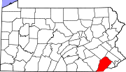
Boroughs Atglen | Avondale | Downingtown | Elverson | Honey Brook | Kennett Square | Malvern | Modena | Oxford | Parkesburg | Phoenixville | South Coatesville | Spring City | West Chester | West Grove
Townships Birmingham | Caln | Charlestown | East Bradford | East Brandywine | East Caln | East Coventry | East Fallowfield | East Goshen | East Marlborough | East Nantmeal | East Nottingham | East Pikeland | East Vincent | East Whiteland | Easttown | Elk | Franklin | Highland | Honey Brook | Kennett | London Britain | London Grove | Londonderry | Lower Oxford | New Garden | New London | Newlin | North Coventry | Penn | Pennsbury | Pocopson | Sadsbury | Schuylkill | South Coventry | Thornbury | Tredyffrin | Upper Oxford | Upper Uwchlan | Uwchlan | Valley | Wallace | Warwick | West Bradford | West Brandywine | West Caln | West Fallowfield | West Goshen | West Marlborough | West Nantmeal | West Nottingham | West Pikeland | West Sadsbury | West Vincent | West Whiteland | Westtown | Willistown
CDPs Unincorporated
communitiesBirchrunville | Bucktown | Chester Springs | Cheyney | Cossart | Coventryville | Daylesford | Eagle | Embreeville | Ercildoun | Hopewell | Kemblesville | Kimberton | Knauertown | Landenberg | Lower Hopewell | Ludwigs Corner | Marshallton | Mortonville | Nottingham | Pughtown | Southeastern | Strafford | Strickersville | Sugartown | Unionville | Valley Forge | Wayne | Willowdale | Yellow Springs
Categories:- Townships in Chester County, Pennsylvania


Wikimedia Foundation. 2010.