- De Soto, Kansas
-
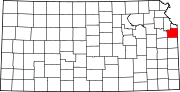
De Soto, Kansas — City — Location of De Soto, Kansas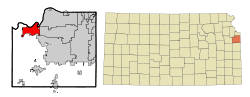
Coordinates: 38°57′54″N 94°57′44″W / 38.965°N 94.96222°WCoordinates: 38°57′54″N 94°57′44″W / 38.965°N 94.96222°W Country United States State Kansas Counties Johnson, Leavenworth Area - Total 11.3 sq mi (29.3 km2) - Land 11.3 sq mi (29.3 km2) - Water 0.0 sq mi (0.0 km2) Elevation 860 ft (262 m) Population (2000) - Total 4,561 - Density 403.0/sq mi (155.6/km2) Time zone Central (CST) (UTC-6) - Summer (DST) CDT (UTC-5) ZIP codes 66018-66019 Area code(s) 913 FIPS code 20-17850[1] GNIS feature ID 0479178[2] De Soto (pronounced /dəˈsoʊtoʊ/) is a city in Johnson and Leavenworth counties in the U.S. state of Kansas, along the Kansas River. The population was 4,561 at the 2000 census. The area code is 913, and the two zip codes are 66018 and 66019.
Contents
Geography
De Soto is located at 38°57′54″N 94°57′44″W / 38.965°N 94.96222°W (38.965081, -94.962285)[3].
According to the United States Census Bureau, the city has a total area of 11.3 square miles (29 km2), all of it land.
Demographics
Historical populations Census Pop. %± 1990 2,291 — 2000 4,561 99.1% U.S. Decennial Census As of the census[1] of 2000, there were 4,561 people, 1,642 households, and 1,246 families residing in the city. The population density was 403.0 people per square mile (155.6/km²). There were 1,730 housing units at an average density of 152.9 per square mile (59.0/km²). The racial makeup of the city was 94.80% White, 0.20% African American, 0.94% Native American, 0.37% Asian, 0.07% Pacific Islander, 1.69% from other races, and 1.93% from two or more races. Hispanic or Latino of any race were 6.86% of the population. 22.2% were of German, 14.3% American, 13.0% English and 10.7% Irish ancestry according to Census 2000.
There were 1,642 households out of which 41.7% had children under the age of 18 living with them, 62.1% were married couples living together, 8.6% had a female householder with no husband present, and 24.1% were non-families. 21.3% of all households were made up of individuals and 7.4% had someone living alone who was 65 years of age or older. The average household size was 2.78 and the average family size was 3.23.
In the city the population was spread out with 30.5% under the age of 18, 8.1% from 18 to 24, 32.5% from 25 to 44, 20.9% from 45 to 64, and 8.1% who were 65 years of age or older. The median age was 32 years. For every 100 females there were 103.2 males. For every 100 females age 18 and over, there were 100.4 males.
The median income for a household in the city was $47,426, and the median income for a family was $53,219. Males had a median income of $36,203 versus $31,682 for females. The per capita income for the city was $23,141. About 3.2% of families and 5.2% of the population were below the poverty line, including 6.1% of those under age 18 and 13.1% of those age 65 or over.
Arts and culture
Between 1999 and 2000, a barn that had originally been built in the 1880s was moved piece by piece from a farmstead and placed on the Zimmerman farm at the northwest corner of the Kill Creek Road and K-10 interchange.[4] The barn was historically called the White-Waitmann barn but after its erection in 2000, by contractors and community volunteers, it also became known as the Zimmerman barn. The barn was not only a piece of American history, but it became well known throughout the community because the owner, Darrel Zimmerman, allowed the barn to be used for a multitude of events such as weddings, graduations, and other meetings. However, a fierce storm demolished the barn in May 2010.[5]
Major employers
Three local corporations, Mr. Goodcents Franchise Systems, Inc., Great American Bank and Custom Foods, Inc., are headquartered in De Soto. Huhtamaki Americas, Inc. and Engineered Air, two international enterprises, chose De Soto for their North American headquarters. In addition, Intervet, one of the world’s leading manufacturers of animal health supplies, selected De Soto for one of its four U.S. manufacturing facilities.
Education
The city of De Soto is served by the De Soto school district.
Other local education institutions near De Soto include:
- University of Kansas
- Ottawa University adult campus
- University of Kansas-Edwards Campus
- Johnson County Community College
- Baker University Overland Park Campus
- Emporia State University - Overland Park Campus (Metro Learning Center)
Library
The Johnson County Library System maintains the De Soto Library.
References
- ^ a b "American FactFinder". United States Census Bureau. http://factfinder.census.gov. Retrieved 2008-01-31.
- ^ "US Board on Geographic Names". United States Geological Survey. 2007-10-25. http://geonames.usgs.gov. Retrieved 2008-01-31.
- ^ "US Gazetteer files: 2010, 2000, and 1990". United States Census Bureau. 2011-02-12. http://www.census.gov/geo/www/gazetteer/gazette.html. Retrieved 2011-04-23.
- ^ http://www.desotoks.org/KillCreekFarm.html
- ^ http://www.kansascity.com/2010/05/13/1943534/storm-destroys-historic-zimmerman.html
External links
Municipalities and communities of Johnson County, Kansas County seat: Olathe Cities Bonner Springs‡ | De Soto‡ | Edgerton | Fairway | Gardner | Lake Quivira‡ | Leawood | Lenexa | Merriam | Mission | Mission Hills | Mission Woods | Olathe | Overland Park | Prairie Village | Roeland Park | Shawnee | Spring Hill‡ | Westwood | Westwood Hills
Townships Aubry | Gardner | Lexington | McCamish | Olathe | Oxford | Shawnee | Spring Hill
Unincorporated
communityFootnotes ‡This populated place also has portions in an adjacent county or counties
Municipalities and communities of Leavenworth County, Kansas County seat: Leavenworth Cities Basehor | Bonner Springs‡ | De Soto‡ | Easton | Lansing | Leavenworth | Linwood | Tonganoxie

Unincorporated
communityWadsworth
Footnotes ‡This populated place also has portions in an adjacent county or counties
Kansas City Metropolitan Area's cities and counties Central city 
Largest cities (over 100,000 in 2000) Medium-sized cities (10,000 to 100,000 in 2000) Blue Springs • Belton • Excelsior Springs • Gladstone • Grandview • Lansing • Leawood • Leavenworth • Lee's Summit • Lenexa • Liberty • Merriam • Ottawa • Prairie Village • Raymore • Raytown • ShawneeCounties Categories:- Cities in Kansas
- Populated places in Johnson County, Kansas
- Populated places in Leavenworth County, Kansas


Wikimedia Foundation. 2010.