- Westwood Hills, Kansas
Infobox Settlement
official_name = Westwood Hills, Kansas
settlement_type =City
nickname =
motto =
imagesize =
image_caption =
image_
imagesize =
image_caption =
image_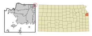
mapsize = 250px
map_caption = Location of Westwood Hills, Kansas
mapsize1 =
map_caption1 =subdivision_type = Country
subdivision_name =United States
subdivision_type1 = State
subdivision_name1 =Kansas
subdivision_type2 = County
subdivision_name2 = Johnson
government_footnotes =
government_type =
leader_title =
leader_name =
leader_title1 =
leader_name1 =
established_title =
established_date =unit_pref = Imperial
area_footnotes =area_magnitude =
area_total_km2 = 0.2
area_land_km2 = 0.2
area_water_km2 = 0.0
area_total_sq_mi = 0.1
area_land_sq_mi = 0.1
area_water_sq_mi = 0.0population_as_of = 2000
population_footnotes =
population_total = 378
population_density_km2 = 2128.2
population_density_sq_mi = 5512.0timezone = Central (CST)
utc_offset = -6
timezone_DST = CDT
utc_offset_DST = -5
elevation_footnotes =
elevation_m = 275
elevation_ft = 902
latd = 39 |latm = 2 |lats = 21 |latNS = N
longd = 94 |longm = 36 |longs = 39 |longEW = Wpostal_code_type =
ZIP code
postal_code = 66205
area_code = 913
blank_name = FIPS code
blank_info = 20-77525GR|2
blank1_name = GNIS feature ID
blank1_info = 0479026GR|3
website =
footnotes =Westwood Hills is a city in Johnson County,
Kansas ,United States . The population was 378 at the 2000 census.Geography
Westwood Hills is located at coor dms|39|2|21|N|94|36|39|W|city (39.039055, -94.610808)GR|1.
According to the
United States Census Bureau , the city has a total area of 0.1square mile s (0.2km² ), all of it land.History
Westwood Hills as "The Most Beautiful City in Kansas" is 175 homes and approximately 400 citizens living in northeast Johnson County. Bounded by 48th Terrace to the north, 50th Terrace to the South, State Line to the East and Rainbow to the West, the city provides a sense of community to its citizens.
Westwood Hills began as a rock quarry for the development of the Country Club Plaza. In 1922 the subdivision was laid for what would become Westwood Hills. Services were created as the need arose. As Westwood Hills was an unincorporated corner of the county, police and fire came from the Johnson County. The Nichols Company provided water service to its Kansas developments from Kansas City, Missouri sources, and laid its own sewer lines as well.
In 1922 the first lot was sold in Westwood Hills. It was reported that, "Miss Ida Carter climbed through a barbed wire fence on the west side of State Line at Fiftieth Street, shooed the cows out of her way, accompanied by a salesman for the J.C.Nichols Company, and a blueprint of what was to be known as Westwood Hills."
1925 saw construction of the shops at the corner of 50th Street and State Line Road. "Designed (by Nichols Company architect Edward Tanner) in the mode common to English farm buildings, with a touch of Normandy in its main round tower" this commercial area was to house six shops. A beauty shop, Piggly Wiggly and drugstore, were opened in the shops.
in 1949, Westwood Hills was incorporated as a city of the Third Class in Johnson County. This was celebrated in 1999 as the 50th Anniversary of the City.
Westwood Hills continues its sense of community with an Annual Spring
Easter Egg Hunt , 4th of July Celebration, Annual Dinner and Christmas Tree Lighting. In addition many of the streets host block parties and other opportunities for gathering neighbors.Westwood Hills is served by the Shawnee Mission School District, with students attending Westwood View Elementary, Indian Hills and Shawnee Mission East.
Demographics
As of the
census GR|2 of 2000, there were 378 people, 170 households, and 116 families residing in the city. Thepopulation density was 5,512.0 people per square mile (2,085.0/km²). There were 173 housing units at an average density of 2,522.7/sq mi (954.2/km²). The racial makeup of the city was 93.92% White, 1.59% African American, 0.26% Native American, 3.17% Asian, and 1.06% from two or more races. Hispanic or Latino of any race were 1.06% of the population.There were 170 households out of which 28.2% had children under the age of 18 living with them, 59.4% were married couples living together, 7.6% had a female householder with no husband present, and 31.2% were non-families. 25.9% of all households were made up of individuals and 4.1% had someone living alone who was 65 years of age or older. The average household size was 2.22 and the average family size was 2.70.
In the city the population was spread out with 21.7% under the age of 18, 3.2% from 18 to 24, 33.1% from 25 to 44, 31.7% from 45 to 64, and 10.3% who were 65 years of age or older. The median age was 41 years. For every 100 females there were 98.9 males. For every 100 females age 18 and over, there were 93.5 males.
The median income for a household in the city was $81,812, and the median income for a family was $108,732. Males had a median income of $76,250 versus $52,188 for females. The
per capita income for the city was $48,256. About 1.8% of families and 2.4% of the population were below thepoverty line , including none of those under the age of eighteen or sixty-five or over.Libraries
The Johnson County Library services Westwood Hills.
References
External links
* [http://westwoodhills.org/ City of Westwood Hills]
* [http://www.jocolibrary.org Johnson County Library]
Wikimedia Foundation. 2010.