- Countryside, Kansas
-
Countryside, Kansas — Neighborhood — Location of Countryside, Kansas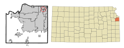
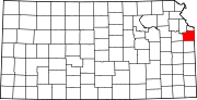
Coordinates: 39°0′58″N 94°39′19″W / 39.01611°N 94.65528°WCoordinates: 39°0′58″N 94°39′19″W / 39.01611°N 94.65528°W Country United States State Kansas County Johnson Area – Total 0.1 sq mi (0.3 km2) – Land 0.1 sq mi (0.3 km2) – Water 0.0 sq mi (0.0 km2) Population (2000) – Total 295 – Density 2,449.9/sq mi (945.9/km2) Time zone Central (CST) (UTC-6) – Summer (DST) CDT (UTC-5) ZIP code 66202 Area code(s) 913 FIPS code 20-15975[1] Countryside was a city-block-long residential street in Johnson County, Kansas, USA, which was incorporated by its residents as a city in 1951 under Kansas Law, as a status statement. In a special election on December 3, 2002, residents voted to re-consolidate with the surrounding city of Mission, Kansas, in which the houses and street had originally been built beginning in 1937. Countryside, as a separate governmental entity, ceased to exist on January 15, 2003, although the neighborhood retains the name informally.
As a city, Countryside consisted of 16 ranch-style houses of middle-class value situated on the north side of West 62nd Terrace, running eastward from Lamar Boulevard on the west to the Outlook Drive exit to Shawnee-Mission Parkway on its east. The south side was kept undeveloped, consisting of a strip of well-kept grass and trees opening, on its far side, onto a view of Shawnee-Mission Parkway, which had become a divided four-lane major artery, also running in an east-west direction, through Johnson County during the lated 1970s.
Countryside was entirely dependent, by conract, on Mission, Kansas for fire and police services, and had no commercial or governmental or other non-residential buildings within its boundaries. It drew its property regulations from the Countryside Homes Association, which regulated the larger Mission residential neighborhood from which Countryside had separated.
Contents
Geography
Countryside is located at 39°0′58″N 94°39′19″W / 39.01611°N 94.65528°W (39.015985, -94.655297)[2].
According to the United States Census Bureau, the city had a total area of 0.3 km² (0.1 mi²), all land.
Demographics
The census[1] of 2000 provides some bizarre and obviously incorrect demographics for Countryside. The census claimed that there were 295 people, 133 households, and 91 families residing in the city. The population density was 949.2/km² (2,449.9/mi²). There were 133 housing units at an average density of 421.5/km² (1,087.9/mi²). The racial makeup of the city was 99.32% White, 0.34% Native American, and 0.34% from two or more races. Hispanic or Latino of any race were 1.02% of the population. 32.5% were of German, 19.2% English, 13.6% Irish and 5.3% American ancestry according to Census 2000.
There were 133 households out of which 27.1% had children under the age of 18 living with them, 60.5% were married couples living together, 7.0% had a female householder with no husband present, and 30.2% were non-families. 26.4% of all households were made up of individuals and 7.0% had someone living alone who was 65 years of age or older. The average household size was 2.29 and the average family size was 2.77.
In the city the population was spread out with 21.4% under the age of 18, 2.7% from 18 to 24, 34.6% from 25 to 44, 26.8% from 45 to 64, and 14.6% who were 65 years of age or older. The median age was 41 years. For every 100 females there were 86.7 males. For every 100 females age 18 and over, there were 90.2 males.
The median income for a household in the city was $73,958, and the median income for a family was $88,029. Males had a median income of $49,063 versus $52,813 for females. The per capita income for the city was $37,129. About 2.7% of families and 1.0% of the population were below the poverty line, including 1.1% of those under the age of eighteen and none of those sixty five or over.
References
- ^ a b "American FactFinder". United States Census Bureau. http://factfinder.census.gov. Retrieved 2008-01-31.
- ^ "US Gazetteer files: 2010, 2000, and 1990". United States Census Bureau. 2011-02-12. http://www.census.gov/geo/www/gazetteer/gazette.html. Retrieved 2011-04-23.
External links
Municipalities and communities of Johnson County, Kansas Cities Bonner Springs‡ | De Soto‡ | Edgerton | Fairway | Gardner | Lake Quivira‡ | Leawood | Lenexa | Merriam | Mission | Mission Hills | Mission Woods | Olathe | Overland Park | Prairie Village | Roeland Park | Shawnee | Spring Hill‡ | Westwood | Westwood Hills
Townships Aubry | Gardner | Lexington | McCamish | Olathe | Oxford | Shawnee | Spring Hill
Unincorporated
communityFootnotes ‡This populated place also has portions in an adjacent county or counties
Categories:- Former municipalities in Kansas
- Geography of Johnson County, Kansas
- Unincorporated communities in Kansas


Wikimedia Foundation. 2010.