- Deaconsbank
-
Coordinates: 55°47′50″N 4°19′50″W / 55.797299°N 4.330448°W
Deaconsbank 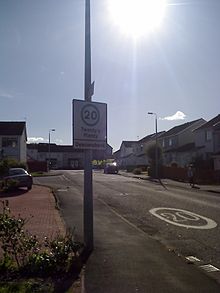

The road entrance to the Inverewe phase of Deaconsbank from the A727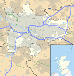
 Deaconsbank
Deaconsbank shown within GlasgowOS grid reference NS540584 Council area Glasgow City Council Lieutenancy area Glasgow Country Scotland Sovereign state United Kingdom Post town GLASGOW Postcode district G46 Dialling code 0141 Police Strathclyde Fire Strathclyde Ambulance Scottish EU Parliament Scotland UK Parliament Glasgow South West Scottish Parliament Glasgow Pollok Glasgow List of places: UK • Scotland • Glasgow Deaconsbank is a district in the Scottish city of Glasgow. It is situated south of the River Clyde. The main feature of the area is an estate of around 639 Private houses built in the late 1970s by Barratt homes. Deaconsbank falls into the Greater Pollok ward of Glasgow City Council and directly borders on the East Renfrewshire council region which accepts pupils from Deaconsbank into their schools.
Contents
Residential
Deaconsbank is split into three phases of houses that were built one after the other, with no direct road access between them, only pedestrian footpaths. The first phase to be built was Inverewe off the Nitshill Road A727. Phase two was Loganswell again off the Nitshill Road it was built adjoining from the Jenny Lind area that was constructed decades previously. The last phase built was Invergarry this time off the Stewarton Road B769. The streets in each phase all share the phase's name as the first part of the street's name for example Loganswell Road, Loganswell Place.
Deaconsbank has for many years had an active residents association campaigning for many issues for residents as well as organizing events such as a Christmas Cavalcade, football tournament for children and a garden competition. The residents association also manages the many communal green spaces of the estate that are maintained through financial contributions by the residents.
Inverewe is the smallest of the three phases. It contains Inverewe Avenue, Inverewe Gardens, Inverewe Place and Inverewe Drive.
Loganswell is the 2nd largest of the three phases. It contains Loganswell Road, Loganswell Gardens, Loganswell Place and Loganswell Drive.
Invergarry is the largest of the three phases. It contains Invergarry Quadrant, Invergarry Drive, Invergarry View, Invergarry Court, Invergarry Place, Invergarry Grove, Invergarry Avenue and Invergarry Gardens.-

Loganswell Road entrance to Jenny Lind from the A727 with the Loganswell phase of Deaconsbank in the background.
Historical
The name Deaconsbank is taken from the former nearby Deacons Bank Farm beside the Auldhouse burn which was located in what is now the modern day Rouken Glen park. Before housing was constructed in the area that was to bear the name of the farm, the land there was also primarily used for agriculture and both areas were part of the Maxwell family's Pollok Estate. Paintings of the original Deacons Bank Farm and an area of land which is located between present day Deaconsbank and Jenny Lind titled 'The Clogholes' both hang in Pollok House the ancestral home of the Maxwell family. Both works are watercolours painted in 1830 by an unknown artist working for the Maxwell family and are part of a larger series depicting parts of their vast estate.
During World War II the land of Deaconsbank and Patterton were used as a prisoner-of-war camp. In recent years before the construction of more housing, archaeological evaluation and recording work in connection with the prisoner of war camp took place. It appears to have been the first piece of archaeological work on a PoW camp in Scotland, and camp remains are now in the care of Glasgow City Council who have made provision for the enhancement and maintenance of the objects.
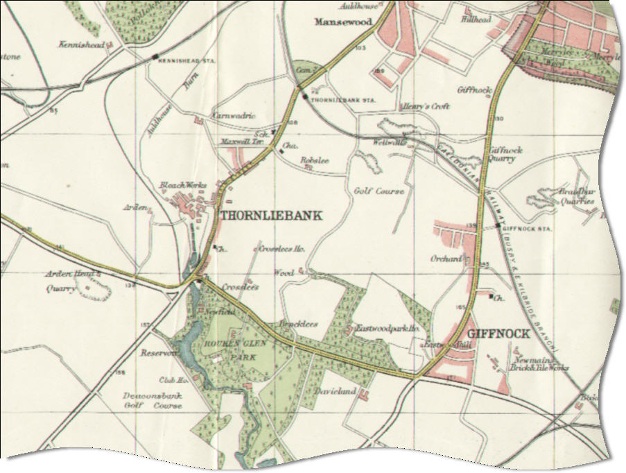
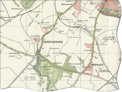 Map showing the Deaconsbank area (bottom left) adjacent to the golf course of the same name in 1923
Sports
Deaconsbank also is the name of the Golf course adjacent to Invergarry adjoining Rouken glen park.
Before relocating to Newton Mearns, Deaconsbank was also home to Whitecraigs Rugby Club with their ground adjoining Invergarry. The land has since been used for a Nursing home and more housing.
New adjoining housing developments
In recent years more housing has been built to the south of Invergarry heading toward Newton Mearns these developments are Thistlebank and Mearns Grove. In a nod to the existing housing estate it adjoined, the streets in Thistlebank are named after Deaconsbank.
Transport
Road: A727, M77 motorway Junction 3, B769 road.
Railway: Patterton railway station.
First Bus Services to Deaconsbank:
- 45A City Centre - Shawlands - Thornliebank - Jenny Lind - Deaconsbank Southpark Village - Pollok - Silverburn.
- 56/57(A) Auchinairn, Woodhill - City Centre - Ibrox - Silverburn - Pollok - Darnley - Deaconsbank (at Inverewe, 56/57a: also at Loganswell) - Thornliebank - Shawlands - City Centre - Charing Cross (57 Clockwise, 56 Anticlockwise)
References
External links
- Glasgow City Council Website
- East Renfrewshire Schools
- Greater Pollok page on Deaconsbank residents association
- East Renfrewshire Parks
- The Glasgow Story page on the The Clogholes painting (featuring image)
- The Glasgow Story page on an aerial photograph taken in January 1959 by the RAF showing the Deaconsbank/Jenny Lind and surrounding areas.
- The Glasgow Story page on the The Deacons Bank Farm painting (featuring image)
- Online Archaeology page on Deaconsbank
- Annual Report of the West of Scotland Archaeology Service 2005/06
- Golf Today page on Deaconsbank course
- Whitecraigs Rugby Club History
- Miller homes page on new housing developments adjoining Deaconsbank
Categories:- Districts of Glasgow
-


Wikimedia Foundation. 2010.