- Patterton railway station
Infobox UK station
name = Patterton
other_name =
code = PTT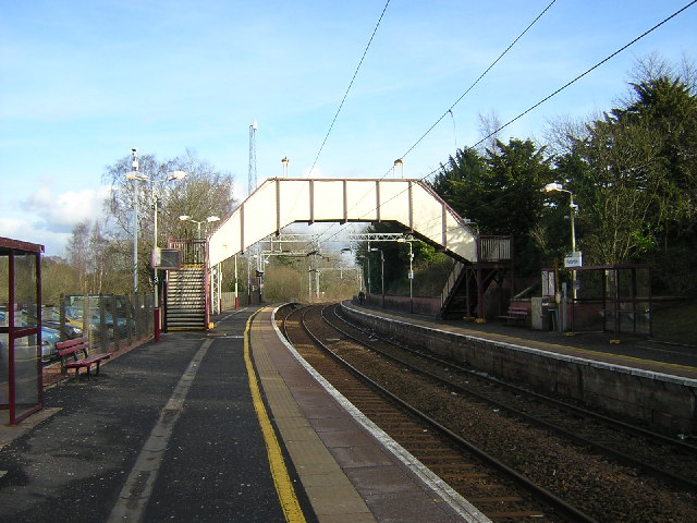
caption =
manager =First ScotRail
locale =Newton Mearns
borough =East Renfrewshire
latitude = 55.790848
longitude = -4.334593
platforms = 2
pte = SPT
usage0203 = 0.286
usage0405 = 0.293
usage0506 = 0.308
usage0607 = 0.342
original =Lanarkshire and Ayrshire Railway
pregroup =Caledonian Railway
postgroup = LMS
years =1 May 1903
events = OpenedButt (1995), page 182]
years1 =1 January 1917
events1 = Closed
years2 =1 February 1919
events2 = Re-opened as Patterton for Darnley Rifle Range
years3 = Unknown date
events3 = Renamed PattertonPatterton railway station is a railway station serving
Newton Mearns andDeaconsbank ,Scotland . The station is managed byFirst ScotRail and lies on theCathcart Circle Lines .History
The station was originally opened as part of the
Lanarkshire and Ayrshire Railway on1 May 1903 . It closed on1 January 1917 due to wartime economy, and reopened on1 February 1919 as Patterton for Darnley Rifle Range (sometimes referred to as simply Patterton for Darnley). It was renamed back to Patterton byBritish Rail .ervices
The station is an intermediate station on the Glasgow Central - Neilston line. The line was electrified in 1962. Since then the basic service has been a 30 minute service on Mondays to Saturdays, with additional peak hour services on Mondays to Fridays. In the early part of the 21st century, a 30 minute service was also provided on Sundays.
Class 303 "Blue Train" electric multiple units provided almost all trains services for many years thereafter, being joined by the similar Class 311. Services are now mainly operated by the Class 314, with occasional services operated by Class 318 and Class 334.
rail line
next = Whitecraigs
previous = Neilston
route =First ScotRail Cathcart Circle Lines
col = FF80C0rail line
next = Whitecraigs
"Line and station open"
previous = Lyoncross
"Line open;
station never constructed"
route =Caledonian Railway Lanarkshire and Ayrshire Railway
col = Caledonian colour
###@@@KEYEND@@@###References
Notes
ources
*
*
*
Wikimedia Foundation. 2010.