- Mansewood
-
Coordinates: 55°48′58″N 4°18′05″W / 55.816192°N 4.301314°W
Mansewood 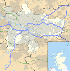
 Mansewood
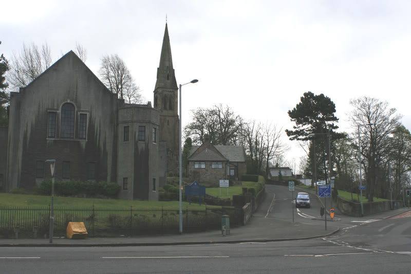
Mansewood shown within GlasgowOS grid reference NS559605 Council area Glasgow City Council Lieutenancy area Glasgow Country Scotland Sovereign state United Kingdom Post town GLASGOW Postcode district G43 Dialling code 0141 Police Strathclyde Fire Strathclyde Ambulance Scottish EU Parliament Scotland UK Parliament Glasgow South Scottish Parliament Glasgow Cathcart Glasgow List of places: UK • Scotland • Glasgow 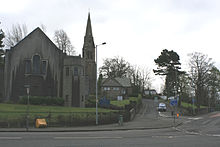 A view of the junction of Auldhouse Road, Thornliebank Road and Mansewood Road. Mansewood road is the hill with the descending car.
Mansewood is a residential district in the Scottish city of Glasgow. It is situated south of the River Clyde and is surrounded by the districts of Pollokshaws, Hillpark, Thornliebank, and Giffnock.
Contents
Geography
Mansewood is located on the summit and slopes of a boulder clay Drumlin lying approximately NE to SW and rises approximately 63m (207 feet) above sea level.
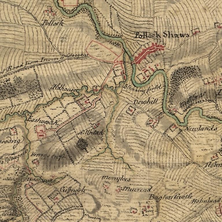
 Mansewood as depicted in William Roy's Military Survey of Scotland 1747-1755. The Drumlin on which Mansewood is located is shown as the oval shaded area in the lower left. It is bounded by Henry's Croft farm in the South West, the original Eastwood Kirk (now Eastwood Old Cemetery) to the West, Auldhouse to the North and Hillhead House to the North East.
History
Mansewood was originally Church or 'Glebe' land belonging to nearby Eastwood Parish Church. The name is dervived from 'Manse' (the ministers home) and 'Wood' referring to the trees which grew in the area.
In 1871, the Reverend George Campbell, Minister of Eastwood Parish, submitted an application to feu the land to developers. This was the catalyst for the building of houses.
First houses
The first houses in Mansewood were constructed from 1880 onwards from blonde sandstone in plots located in the triangle formed by Statute Labour Road (Now Mansewood Road), Bemersyde Avenue and Turnpike Road, leading from Glasgow by Pollokshaws to Stewarton (Now Thornliebank Road). The original residents were employed in a wide variety of trades such as wine merchant, bleach works manager, ship owner, fancy box maker and Minister. The area has seen gradual development up until the main housing scheme was built in the 1950s during the huge building project to replace Glasgow's slums.
Local history
The fields on which Hillpark Secondary School now stands were known locally as the 'Kirkie'. Before the school was built, the lands were the site of Hillhead house. Hillhead house appears on Roy's map of Scotland, 1747 and stood approximately where the grocers shop is located on Hillpark Drive. Hillhead West lodge house stood approximately where the school janitor's house now stands.
The 'Kirkie' along with the ruins of Hillhead house were inadvertently photographed in may 1950 by an RAF aerial reconnaissance team and can be viewed at http://www.theglasgowstory.com/imageview.php?inum=TGSE00507. The 'Kirkie' is the area of open ground towards the bottom left of the photograph.
There was a farm located at what is now the corner of Mansewood Road and Burnfield Road known as Henryscroft Farm. Older residents remember the farmer driving his cows to and from the fields in the morning and evening and seeing the farmer plough his fields by horse.
Local businesses
The main depot of the Postal Service for the postcodes G43-G46 is based on Burnfield Rd in Mansewood .
There is a Mini car dealership next door, a Morrisons supermarket (newly opened) and several local shops and other businesses along Burnfield Rd.
Past residents
Famous past residents in the area include Kai Johansen, of Rangers FC.
External links
History of Mansewood
Categories:- Districts of Glasgow
- Glasgow geography stubs

Wikimedia Foundation. 2010.