- Cranhill
-
Coordinates: 55°51′52″N 4°10′12″W / 55.864416°N 4.169917°W
Cranhill 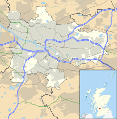
 Cranhill
Cranhill shown within GlasgowOS grid reference NS643656 Council area Glasgow City Council Lieutenancy area Glasgow Country Scotland Sovereign state United Kingdom Post town GLASGOW Postcode district G33 Dialling code 0141 Police Strathclyde Fire Strathclyde Ambulance Scottish EU Parliament Scotland UK Parliament Glasgow East Scottish Parliament Glasgow Baillieston Glasgow List of places: UK • Scotland • Glasgow 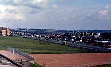 Edinburgh Road, Cranhill in 1966
Cranhill is a housing estate in the east end of Glasgow.
Contents
History
Like many similar publicly-funded 'schemes', it was built in the early 1950s on the outskirts of the city to alleviate the post-war housing shortage. However, unlike the 'big four' schemes, Easterhouse, Drumchapel, Castlemilk and Pollok, Cranhill was relatively compact, with High Carntyne to the west (separated by Ruchazie Road), Springboig and Carntyne to the south (separated by the A8 Edinburgh Road), Queenslie to the east (separated by Stepps Road) and Ruchazie to the north (separated by the Monkland Canal, now the M8 motorway). Most of the streets were named after Scottish lighthouses and include Startpoint Street, Lamlash Crescent, Toward Road, Skerryvore Road, Gantock Crescent, Strone Road, Crowlin Crescent, Monach Road. Longstone Road is an exception, Longstone being located in the Farne Islands off the coast of England. The main street, running east-west through the scheme, was Bellrock Street.
Housing
The housing stock consisted mostly of four-storey tenement blocks divided into common 'closes', each with eight flats with the end close in each street called a "T" close with 4 flats. Other types included three tower blocks, locally known as 'the multis' or the 'high flats', a number of terraced maisonettes and a variety of pseudo sandstone (concrete blocks) four-in-a-block cottage flats.
Most of the flats were typical family accommodation of the time, containing a kitchen, bathroom/toilet, two or three bedrooms and a living room. Many of them had balconies or verandas overlooking the street and all were a vast improvement on living conditions in the old Glasgow slum tenements. For many of the families who moved in, this was their first access to green fields and nearby farms, and the playing areas were paradise compared to the rat-infested back-courts which the children had formerly suffered. Nevertheless, a favourite play area was the 'Sugarolly Mountains', substantial hills made from chemical tailings dumped by the side of the canal on the site now occupied by the high flats (and featured in the lyrics of Jim Diamond). No-one knew what they were made of, but the rainwater puddles were green! Even the canal itself was an attraction, given that the next-nearest 'recreational' water was either at Alexandra Park or Hogganfield Loch
Amenities
As the scheme became established and the community grew, amenities were put in place. Bus routes were extended through the scheme to make it easier for people to travel for work or pleasure, to the City Centre or the nearby shopping areas of Shettleston and Dennistoun. Other basic needs were served with the establishment of three local shopping parades.
As well as the shops, local people were served by mobile street traders with vans and lorries selling foodstuffs, coal and paraffin oil, sweets and soft drinks, ice cream and even fish and chips. In the evenings one could hear the cry of Dalzeil's Bakeries van man shouting "roells!" (bread rolls). Candy apples and 'whelks' (actually periwinkles) could be obtained while rag-merchants would shout 'any old rags' or 'Delft (crockery) for rags' from horsedrawn or hand carts. Today, the only surviving mobile service is the 'ice cream van'.
The first primary schools to be erected were small metal constructions but, at its peak, Cranhill had four primary schools: Lamlash, St Elizabeth Seton RC (originally St Modans RC Annex), the larger brick-built Milncroft (including the Toward Rd annex) and St Modans RC. Milncroft was demolished in 2006 and St Modans RC in March 2007. All four original primary schools are now closed and demolished. The two original nursery schools, Bellrock Nursery and Lamlash Nursery, are now also closed. Two new primary schools, Cranhill Primary and St Maria Goretti's RC Primary, were built in 2005/2006, the former on the site of the demolished Milncroft. Lamlash nursery school is now located within St Maria Goretti's Primary school and Bellrock nursery school is located within Cranhill Primary School.
As the children grew older, local secondary schools were needed, the first being Lightburn Secondary across the Edinburgh Rd in Torphin Crescent, Greenfield. With the construction of Cranhill Secondary in Startpoint St, the Torphin Crescent building became St Gregory's RC Secondary to meet the needs of the Roman Catholic population. Some time later, a new St Gregory's was built on waste land at Crowlin Cres in Cranhill and the Torphin Crescent was renamed again, as St Andrews RC Secondary. At its peak, Cranhill Secondary had a roll of some 1300, but both secondaries in Cranhill were razed in the early 1990s and replaced by private housing estates.
Two churches were built: Cranhill (Church of Scotland) Parish Church and St Maria Goretti's RC Chapel. There were two Boy Scout troops, the 68th Glasgow and the 158th Glasgow, a Boys' Brigade troop, the 150th, and a Girls' Brigade company, the 63rd. The Tenants' Association hall provided an early focus for social events and a Community Centre was opened around 1980.
Cranhill Park was built in the centre of the scheme and became the heart (and lungs) of the community. It featured an 18-hole pitch-and-putt course (famous for the its sloping terrain), tennis courts and a bowling green. An annual carnival was held, with a visiting fairground and food outlets. A favourite amongst local children was free miniature loaves of bread distributed by a local bakery. The carnival, however, was stopped in the mid 1980s due to ignored safety regulations which led to some serious accidents, including a near fatal head injury of a 3 year old child.
The Cranhill Credit Union was set up by John Kerr, Ellen Kerr, Helen Kane MBE and other committed members of the community in the late 1970s. This was modelled on Scotland's first credit union, the Western Credit Union (now Drumchapel Credit Union) established by Bert Mullen in 1970.
The Cranhill Arts Project, possibly better known to more non-residents than to locals, goes from strength to strength, but the most famous local work of art is the Cranhill Water Tower, at the corner of Stepps Rd and Bellrock St. One of several huge elevated storage tanks built to provide high-volume, high-pressure storage, Cranhill Water Tower is unique in having a square concrete tank, in contrast to its cylindrical neighbours in Garthamlock and elsewhere. At night, the structure was illuminated a vibrant green with white spotlights shining from the base of the tank down to the ground.
Celebrities
Cranhill has produced its share of celebrities including Kevin Ross, actor Billy Boyd of The Lord of the Rings, footballers Jim and Joe Smith of Newcastle, Aberdeen and Scotland, Kenny Aird of St. Johnstone and comedy actor Gerard Kelly. Possibly the most famous former residents are Angus Young and brother Malcolm who found stardom after they moved to Australia and formed AC/DC.George Young, the older brother of Angus and Malcolm, first found fame with the 60s group, Easybeats. Pat Nevin, soccer pundit and former Scotland player, attended St. Gregory's Secondary School. Politician Adam Ingram lived in Skerryvore Road at the bottom of the lane and Glasgow Boy artist Adrian Wisnewski was also a Cranhill resident. Junior Campbell from the sixties band The Marmalade and who also wrote the music for Thomas the Tank Engine lived in nearby Springboig, but ran his schoolboy "paper round" from the Glasgow Evening Times/Citizen van drop at the infamous Cranhill Water Tower.
Cranhill today
Most of the original housing stock has been demolished to make way for 'back-and-front-door' houses and a private housing scheme and supermarket now occupy the site of the former Cranhill Secondary School. However, the original flats are retained in some of the streets around the Park, as are the shops at Lamlash Cres. A new school is currently under construction on the old St Gregory's RC Secondary site. The Community Centre has been replaced by a children's centre called 'The Beacon'.
The 'backfields', with their helter-skelter and a hangout for kids 'dogging' lessons, is now a construction site for semi-detached homes. Unfortunately, the Park today is in a dilapidated state, highlighted by the partial collapse of the pitch-and-putt green over a decade ago.
References
External links
Categories:- Districts of Glasgow
- Housing estates in Scotland
- Housing estates in Glasgow


Wikimedia Foundation. 2010.