Silverburn Centre — Infobox shopping mall shopping mall name = Silverburn location = Pollok, Glasgow, Scotland, UK coordinates = coord|55.822249| 4.339428|display=inline,title opening date = 25th Oct 2007 (Some stores later)/ Restaurant Complex March 2008. Tesco… … Wikipedia
Eastwood, or Pollock — EASTWOOD, or POLLOCK, a parish, in the Upper ward of the county of Renfrew, 2½ miles (S. W.) from Glasgow; containing, with the incorporated town of Pollockshaws, the village of Thornliebank, and part of the late quoad sacra district of Levern … A Topographical dictionary of Scotland
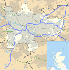
Glasgow — Glaswegian redirects here. For the Scots dialect spoken in Glasgow, see Glasgow patter. This article is about the original Glasgow in Scotland. For other uses, see Glasgow (disambiguation). Coordinates: 55°51′29″N 4°15′32″W / … Wikipedia
Nitshill — (Scots: Nitshull, Scottish Gaelic: Cnoc nan Cnòthan)[1] is a district on the south side of Glasgow. It is north of South Nitshill, south of Crookston, and southwest of Silverburn and Pollok. Nitshill was originally a coal mining village. The… … Wikipedia
Maryhill — For other uses, see Maryhill (disambiguation). Coordinates: 55°53′39″N 4°17′40″W / 55.894141°N 4.294395°W / 55.894141; 4.294395 … Wikipedia
Kelvinbridge — Coordinates: 55°52′29″N 4°16′47″W / 55.874763°N 4.279765°W / 55.874763; 4.279765 … Wikipedia
Mount Vernon, Glasgow — Coordinates: 55°50′35″N 4°08′31″W / 55.843°N 4.142°W / 55.843; 4.142 … Wikipedia
Cowcaddens — Coordinates: 55°52′05″N 4°15′35″W / 55.868194°N 4.259635°W / 55.868194; 4.259635 … Wikipedia
North Kelvinside — Coordinates: 55°52′46″N 4°16′40″W / 55.879541°N 4.277882°W / 55.879541; 4.277882 … Wikipedia
List of places in Glasgow — Places that are part of Glasgow vary depending on context as Glasgow is the name of a number sub divisions of Scotland. Arguably the most common usage of the term is to describe the local authority area styled Glasgow City. Like most large cities … Wikipedia
 Cowglen