- Cowcaddens
-
Coordinates: 55°52′05″N 4°15′35″W / 55.868194°N 4.259635°W
Cowcaddens Scottish Gaelic: Coille Challtainn Scots: Coocaddens
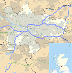
 Cowcaddens shown within Glasgow
OS grid reference NS587662 Council area Glasgow City Council Lieutenancy area Glasgow Country Scotland Sovereign state United Kingdom Post town GLASGOW Postcode district G4 Dialling code 0141 Police Strathclyde Fire Strathclyde Ambulance Scottish EU Parliament Scotland UK Parliament Glasgow Central Scottish Parliament Glasgow Kelvin Glasgow List of places: UK • Scotland • Glasgow Cowcaddens (Scots: Coocaddens, Scottish Gaelic: Coille Challtainn)[1] is an area of the city of Glasgow, Scotland. It is virtually in the city centre and is bordered by the areas of Garnethill to the south and Townhead to the east.
The southern fringes of Cowcaddens have historically housed one of Glasgow's premier entertainment districts, with the Theatre Royal at the upper end of Hope Street, the massive Cineworld multi-storey cinema complex and the Glasgow Royal Concert Hall taking place at the top of West Nile Street. From 1957 to 2003, the headquarters of STV were located there - having since relocated to Pacific Quay. Two former theatres, the Royalty Theatre and the Glasgow Apollo (now occupied by the Cineworld complex) used to stand in the area.
Housing in the area is primarily ex-council housing (there are no council houses in Glasgow since their transfer to the Glasgow Housing Association).
Glasgow Caledonian University is nearby. Cowcaddens is served by Cowcaddens subway station on the Glasgow Subway system.
The socialist politician Edward Hunter, who was instrumental in helping build the left in New Zealand, was a Labour councillor for Cowcaddens from 1937 till 1959.
References
Categories:- Districts of Glasgow
- Glasgow geography stubs
Wikimedia Foundation. 2010.

