- Corkerhill
-
Coordinates: 55°50′04″N 4°20′04″W / 55.834443°N 4.334333°W
Corkerhill Scottish Gaelic: Cnoc Chorcair Scots: Coarkerhull 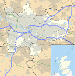
 Corkerhill
Corkerhill shown within GlasgowOS grid reference NS539626 Council area Glasgow City Council Lieutenancy area Glasgow Country Scotland Sovereign state United Kingdom Post town GLASGOW Postcode district G52 Dialling code 0141 Police Strathclyde Fire Strathclyde Ambulance Scottish EU Parliament Scotland UK Parliament Glasgow South West Scottish Parliament Glasgow Pollok Glasgow List of places: UK • Scotland • Glasgow Corkerhill (Scots: Coarkerhull, Scottish Gaelic: Cnoc Chorcair)[1] was originally a farm and a few houses to the southwest of Glasgow, on the Paisley Canal Line from Glasgow, and still houses engine sheds and sidings, although Corkerhill signal box was demolished in the late 1970s (originally located to the rear of the houses now facing Mosspark shops.
Corkerhill railway station was built in 1 July 1885. It is on the Paisley Canal Line.
In the 1920s building in Glasgow expanded as far as Mosspark making Corkerhill part of the Glasgow conurbation.
In the 1960s Glasgow Corporation (now Glasgow City Council) built Hardridge Road, part of Corkerhill, but locally referred to as Hardridge, consisting of terraced and tenement dwellings.
Later in the 1960s shops were built to address the shortage in the area, with the nearest then being in Cardonald, and Pollok. After that(post 1975) 'The Cart' public house was opened, as the only one in the immediate area. However the area spiralled into decline (in the mid to late eighties) until many of the tenements were vandalised and empty, and most of the shops were unrented (there was only a Chippy, originally 'Bruno's then De Marco's, Marshall's, which was taken over by Asians who took on the larger shop, and the Community Council Shop).
In 2004 the tenement demolition began and were replaced with privately owned suburban style housing. This rebirth worked well, with the area still retaining its village identity by being bordered by the railway and Pollok Park as well as Nethercraigs Sports Complex, while still only ten minutes on the train from Glasgow Central - attracting commuters.
References
Categories:- Districts of Glasgow
- Glasgow geography stubs

Wikimedia Foundation. 2010.