- District line
-
This article is about a London Underground line, for a district line see border
District 
Colour on map Green Year opened 1868 Line type Sub-Surface Rolling stock C69 & C77
D786 carriages per trainset
Stations served 60 Length 64 km (40 mi) Depots Upminster
Ealing Common (D Stock only)
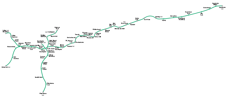
Hammersmith (C Stock only)Journeys made 172.879 million (2009) [1] Rail lines of Transport for LondonLondon Underground lines Bakerloo Central Circle District Hammersmith & City Jubilee Metropolitan Northern Piccadilly Victoria Waterloo & City Other lines Docklands Light Railway Tramlink Overground The District line is a line of the London Underground, coloured green on the Tube map. It is a "sub-surface" line, running through the central area in shallow cut-and-cover tunnels. It is the busiest of the sub-surface lines. Out of the 60 stations served, 25 are underground. Two of the four (Richmond and Wimbledon) western branches of the route are also the only lines across the entire network to cross the Thames by bridge and not by tunnel. Although the District line is only the fourth longest line on the network, it serves more stations than any other line.
Contents
History
The District line was built by the Metropolitan District Railway (MDR) and opened in stages from 1868. The MDR was later bought by Charles Yerkes, forming part of the "Underground" group until it was nationalised in the 1930s. It had branches to Uxbridge and Hounslow West, but both are now operated by the Piccadilly line. Eastbound services ran as far as the seaside town of Southend-on-Sea in Essex from 1 June 1910 and to Shoeburyness from 1911, until 30 September 1939. Between 1 March 1883 and 30 September 1885 the line also served stations from Ealing Broadway to Windsor, running on the Great Western Main Line.
Trains
Most of the District line's services use sub-surface D stock trains, although the Wimbledon to Edgware Road service is operated with C stock trains due to shorter platform lengths between High Street Kensington and Edgware Road. The D stock trains were refurbished between 2005 and 2008, receiving the standard Underground livery of red, white and blue to replace the previous unpainted aluminium finish, which was prone to damage by graffiti vandals. The stock also received a complete interior refurbishment and was fitted with CCTV and passenger information displays.[2] The trains are maintained at Ealing Common Depotmap 61 and Upminster Depot.map 62
From 2013 both the C stock and D stock fleets will gradually be replaced by new S stock trains from Bombardier Transportation.[3] The fleet is expected to be completely renewed by 2016.[2] The new trains, which are shorter (7-car) versions of the new trains already appearing on the Metropolitan line, will be air-conditioned. Because they will be longer than the trains currently in use, some station platforms will need to be lengthened.[4]
Map
Stations
In order from west to east
Richmond branch
Richmond branch Station Image Opened Additional information Richmond 


27 July 1846 District line 1 June 1877map 1 Kew Gardens 


1 January 1869 District line 1 June 1877map 2 Gunnersbury 

1 January 1869 Opened as Brentford Road renamed 1871, District line 1 June 1877map 3 Ealing Broadway branch
Ealing Broadway branch Station Image Opened Additional information Ealing Broadway  (
( Trains to Heathrow)
1 July 1879 Change for Central linemap 4 Ealing Common 1 July 1879 From 1886 until 1 March 1910 known as Ealing Common and West Actonmap 5 Acton Town 
1 July 1879 Opened as Mill Hill Park, renamed 1 March 1910map 6 Chiswick Park 
1 July 1879 Opened as Acton Green, renamed Chiswick Park and Acton Green in 1889, renamed 1910map 7 The Richmond and Ealing Broadway branches join just west of Turnham Green Station Image Opened Additional information Turnham Green 1 January 1869 District line 1 June 1877map 8 Stamford Brook 
1 February 1912 District line 1 June 1877 enroute to Richmondmap 9 Ravenscourt Park 
1 April 1873 Opened as Shaftesbury Road, District line 1 June 1877, renamed 1 March 1888map 10 Hammersmith 

15 December 1906 Change for Piccadilly linemap 11 Barons Court 
15 December 1906 Change for Piccadilly linemap 12 West Kensington 
9 September 1874 Opened as Fulham – North End, renamed 1877map 13 Wimbledon branch
Wimbledon branch Station Image Opened Additional information Wimbledon 


21 May 1838 District line 3 June 1889map 14 Wimbledon Park 
3 June 1889 map 15 Southfields 
3 June 1889 map 16 East Putney 
3 June 1889 map 17 Putney Bridge 1 March 1880 Opened as Putney Bridge & Fulham, renamed 1 January 1902 as Putney Bridge & Hurlingham, current name from 1932map 18 Parsons Green 1 March 1880 map 19 Fulham Broadway 

1 March 1880 Opened as Walham Green, renamed 2 March 1952map 20 West Brompton 


12 April 1869 map 21 The Wimbledon branch joins the main line west of Earl's Court Kensington (Olympia) branch
Kensington (Olympia) branch Station Image Opened Additional information Kensington (Olympia) 


2 June 1862 Opened as Addison Road, District line 1872, renamed 1946map 22 The Kensington (Olympia) branch joins the main line west of Earl's Court, and trains from it normally run to High Street Kensington Edgware Road branch
The Edgware Road branch diverges from the main line east of Earl's Court Station Image Opened Additional information High Street Kensington 
1 October 1868 Circle linemap 23 Notting Hill Gate 
1 October 1868 Circle linemap 24 Bayswater 
1 October 1868 Circle linemap 25 Paddington  (
( Trains to Heathrow)
1 October 1868 Bakerloo, Hammersmith & City, Great Western Main Linemap 26 Edgware Road 
1 October 1863 map 27 Main line
Main line Station Image Opened Additional information Earl's Court 

15 December 1906 map 28 Gloucester Road 
1 October 1868 map 29 South Kensington 
24 December 1868 map 30 Sloane Square 24 December 1868 map 31 Victoria  (
( Trains to Gatwick)
24 December 1868 Victoriamap 32 St. James's Park 24 December 1868 map 33 Westminster (  Westminster Pier)
24 December 1868 Jubileemap 34 Embankment (  Charing Cross) (
 Embankment Pier)
30 May 1870 Bakerloo, Northernmap 35 Temple 
30 May 1870 map 36 Blackfriars (closed until 2011)  (
( Trains to Gatwick and Luton) (
 Blackfriars Millennium Pier)
30 May 1870 First Capital Connect / Southeastern (Thameslink)map 37 Mansion House 
3 July 1871 map 38 Cannon Street 

6 October 1884 Southeasternmap 39 Monument 6 October 1884 Central, Northern, Waterloo & City, DLR (all via escalator connection to Bank station)map 40 Tower Hill (  Fenchurch Street) (
 Tower Gateway) (
 Tower Pier)
25 September 1882 map 41 Aldgate East 6 October 1884 map 42 Whitechapel 
6 October 1884 map 43 Stepney Green 1902 map 44 Mile End 1902 map 45 Bow Road  Bow Church
1902 map 46 Bromley-by-Bow 1858 map 47 West Ham 

1 February 1901 map 48 Plaistow 1858 map 49 Upton Park 
1877 map 50 East Ham 

1858 map 51 Barking 


1854 map 52 Upney 
1932 map 53 Becontree 1932 map 54 Dagenham Heathway 
1932 Opened as Heathway, renamed 1949map 55 Dagenham East 1885 Opened as Dagenham, District line 1902 to 1905, District restarted 1932 and station renamed 1949[5]map 56 Elm Park 
1935 map 57 Hornchurch 
1885 District line 1902 to 1905, District restarted 1932map 58 Upminster Bridge 
17 December 1934 map 59 Upminster 


1885 District line 1902 to 1905, District restarted 1932map 60 Closed stations
- Hounslow Town tube station, opened 1 May 1883, replaced by Hounslow East on 2 May 1909
- Mark Lane, Main line, opened 1884, replaced by Tower Hill 4 February 1967
- South Acton, Ealing branch, opened 1880, closed 28 February 1959
- St. Mary's, Main line, opened 3 March 1884, closed 30 April 1938
- Tower of London, Main line, opened 1882, closed 1884
Current service pattern
The following off-peak service pattern currently runs on the District line (frequencies in peak hours are generally higher):
- 6 trains per hour Ealing Broadway – Tower Hill
- 6 trains per hour Richmond – Upminster
- 6 trains per hour Wimbledon – Upminster
- 6 trains per hour Wimbledon – Edgware Road
- 3 trains per hour Kensington (Olympia) – High Street Kensington
This gives a total of 18 trains per hour between Earl's Court and Tower Hill.
Safety
In early 2009, three safety failures occurred on the line. All of them were recorded to have involved trains which passed signals showing red. In August 2009 it was reported that the line had been given a period of less than a month to improve safety features or face possible legal action, involving temporary line closures.[6][7]
Interavailabilty
c2c also serves Upminster, Barking, West Ham and Fenchurch Street (for Tower Hill). Tickets are interavailable between the two operators with Oyster cards (including pay as you go) accepted on this part of c2c's route. South West Trains services occasionally operate on the Wimbledon Branch between East Putney and Wimbledon, often due to engineering works or problems on the mainline, although trains do not stop at any of the intermediate stations.
In popular culture
- The fictional Walford East tube station in the BBC television series EastEnders is on the District line, taking the place of Bromley-by-Bow. From 4 February 2010 EastEnders will use shots of District line trains to superimpose on their episodes to show the trains running into the fictional station of Walford East which is part of the set.
- Sheffield band Milburn wrote a song called 'The District Line' which refers to London.
- Canadian guitarist Pat Travers wrote a song called 'Life in London' which mentions the District Line.
Gallery
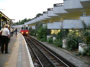
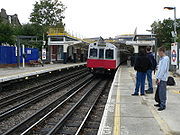
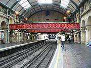
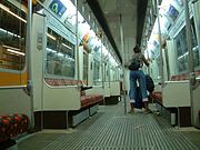
Images Gunnersbury station on the Richmond branch. As at Kew Gardens, tracks are shared with London Overground services on the North London Line.Ealing Common is one of only two stations where District and Piccadilly line trains call at the same platforms (the other being Acton Town).The District line platforms at Wimbledon.Earl's Court station is the hub of the District line.The eastbound platform at Temple: a typical District line cut & cover station.The District and Circle Line platforms at Paddington station on the Edgware Road branch.A train of C69/C77 Stock leaving West Brompton en route to Wimbledon.D78 Stock on an Upminster Service at Embankment.Inside an unrefurbished D78 Stock carriage.For comparison, the interior of a refurbished District Line train.Maps
- ^map 1 Richmond – 51°27′47″N 000°18′00″W / 51.46306°N 0.3°W
- ^map 2 Kew Gardens – 51°28′38″N 000°17′07″W / 51.47722°N 0.28528°W
- ^map 3 Gunnersbury – 51°29′30″N 000°16′30″W / 51.49167°N 0.275°W
- ^map 4 Ealing Broadway – 51°30′53″N 000°18′06″W / 51.51472°N 0.30167°W
- ^map 5 Ealing Common – 51°30′37″N 000°17′17″W / 51.51028°N 0.28806°W
- ^map 6 Acton Town – 51°30′10″N 000°16′48″W / 51.50278°N 0.28°W
- ^map 7 Chiswick Park – 51°29′41″N 000°16′04″W / 51.49472°N 0.26778°W
- ^map 8 Turnham Green – 51°29′43″N 000°15′18″W / 51.49528°N 0.255°W
- ^map 9 Stamford Brook – 51°29′42″N 000°14′45″W / 51.495°N 0.24583°W
- ^map 10 Ravenscourt Park – 51°29′39″N 000°14′09″W / 51.49417°N 0.23583°W
- ^map 11 Hammersmith – 51°29′39″N 000°13′30″W / 51.49417°N 0.225°W
- ^map 12 Barons Court – 51°29′26″N 000°12′49″W / 51.49056°N 0.21361°W
- ^map 13 West Kensington – 51°29′27″N 000°12′23″W / 51.49083°N 0.20639°W
- ^map 14 Wimbledon – 51°25′24″N 000°12′15″W / 51.42333°N 0.20417°W
- ^map 15 Wimbledon Park – 51°26′02″N 000°12′00″W / 51.43389°N 0.2°W
- ^map 16 Southfields – 51°26′42″N 000°12′25″W / 51.445°N 0.20694°W
- ^map 17 East Putney – 51°27′31″N 000°12′41″W / 51.45861°N 0.21139°W
- ^map 18 Putney Bridge – 51°28′06″N 000°12′32″W / 51.46833°N 0.20889°W
- ^map 19 Parsons Green – 51°28′31″N 000°12′04″W / 51.47528°N 0.20111°W
- ^map 20 Fulham Broadway – 51°28′50″N 000°11′41″W / 51.48056°N 0.19472°W
- ^map 21 West Brompton – 51°29′12″N 000°11′45″W / 51.48667°N 0.19583°W
- ^map 22 Kensington (Olympia) – 51°29′55″N 000°12′39″W / 51.49861°N 0.21083°W
- ^map 23 High Street Kensington – 51°30′03″N 000°11′33″W / 51.50083°N 0.1925°W
- ^map 24 Notting Hill Gate – 51°30′32″N 000°11′49″W / 51.50889°N 0.19694°W
- ^map 25 Bayswater – 51°30′43″N 000°11′17″W / 51.51194°N 0.18806°W
- ^map 26 London Paddington – 51°31′02″N 000°10′39″W / 51.51722°N 0.1775°W
- ^map 27 Edgware Road – 51°31′12″N 000°10′04″W / 51.52°N 0.16778°W
- ^map 28 Earl's Court – 51°29′29″N 000°11′41″W / 51.49139°N 0.19472°W
- ^map 29 Gloucester Road – 51°29′41″N 000°10′59″W / 51.49472°N 0.18306°W
- ^map 30 South Kensington – 51°29′39″N 000°10′26″W / 51.49417°N 0.17389°W
- ^map 31 Sloane Square – 51°29′33″N 000°09′24″W / 51.4925°N 0.15667°W
- ^map 32 London Victoria – 51°29′48″N 000°08′41″W / 51.49667°N 0.14472°W
- ^map 33 St. James's Park – 51°29′58″N 000°08′04″W / 51.49944°N 0.13444°W
- ^map 34 Westminster – 51°30′04″N 000°07′30″W / 51.50111°N 0.125°W
- ^map 35 Embankment – 51°30′25″N 000°07′19″W / 51.50694°N 0.12194°W
- ^map 36 Temple – 51°30′40″N 000°06′52″W / 51.51111°N 0.11444°W
- ^map 37 Blackfriars – 51°30′42″N 000°06′11″W / 51.51167°N 0.10306°W
- ^map 38 Mansion House – 51°30′44″N 000°05′39″W / 51.51222°N 0.09417°W
- ^map 39 Cannon Street – 51°30′37″N 000°05′27″W / 51.51028°N 0.09083°W
- ^map 40 Bank-Monument – 51°30′47″N 000°05′17″W / 51.51306°N 0.08806°W
- ^map 41 Tower Hill – 51°30′36″N 000°04′34″W / 51.51°N 0.07611°W
- ^map 42 Aldgate East – 51°30′55″N 000°04′20″W / 51.51528°N 0.07222°W
- ^map 43 Whitechapel – 51°31′08″N 000°03′40″W / 51.51889°N 0.06111°W
- ^map 44 Stepney Green – 51°31′19″N 000°02′47″W / 51.52194°N 0.04639°W
- ^map 45 Mile End – 51°31′30″N 000°01′59″W / 51.525°N 0.03306°W
- ^map 46 Bow Road – 51°31′38″N 000°01′29″W / 51.52722°N 0.02472°W
- ^map 47 Bromley-by-Bow – 51°31′26″N 000°00′41″W / 51.52389°N 0.01139°W
- ^map 48 West Ham – 51°31′41″N 000°00′14″E / 51.52806°N 0.00389°E
- ^map 49 Plaistow – 51°31′53″N 000°01′02″E / 51.53139°N 0.01722°E
- ^map 50 Upton Park – 51°32′06″N 000°02′04″E / 51.535°N 0.03444°E
- ^map 51 East Ham – 51°32′20″N 000°03′06″E / 51.53889°N 0.05167°E
- ^map 52 Barking – 51°32′21″N 000°04′54″E / 51.53917°N 0.08167°E
- ^map 53 Upney – 51°32′19″N 000°06′05″E / 51.53861°N 0.10139°E
- ^map 54 Becontree – 51°32′25″N 000°07′37″E / 51.54028°N 0.12694°E
- ^map 55 Dagenham Heathway – 51°32′30″N 000°08′49″E / 51.54167°N 0.14694°E
- ^map 56 Dagenham East – 51°32′40″N 000°09′56″E / 51.54444°N 0.16556°E
- ^map 57 Elm Park – 51°32′59″N 000°11′52″E / 51.54972°N 0.19778°E
- ^map 58 Hornchurch – 51°33′11″N 000°13′08″E / 51.55306°N 0.21889°E
- ^map 59 Upminster Bridge – 51°33′29″N 000°14′03″E / 51.55806°N 0.23417°E
- ^map 60 Upminster – 51°33′32″N 000°15′04″E / 51.55889°N 0.25111°E
- ^map 61 Ealing Common Depot – 51°30′24″N 000°17′07″W / 51.50667°N 0.28528°W
- ^map 62 Upminster Depot – 51°33′38″N 000°15′52″E / 51.56056°N 0.26444°E
References
- ^ "District Line Facts". Transport for London. 2009. http://www.tfl.gov.uk/corporate/modesoftransport/londonunderground/keyfacts/13166.aspx. Retrieved 2011-09-25.
- ^ a b "Tube upgrade plan: District line". Transport for London.
- ^ Waboso, David (December 2010). "Transforming the tube". Modern Railways (London): pp. 42–45.
- ^ "'S' stock making its mark". Modern Railways (London): p. 46. December 2010.
- ^ Rose, Douglas (December 2007) [1980]. The London Underground: A Diagrammatic History (8th ed.). Harrow Weald: Capital Transport. ISBN 978 1 85414 315 0.
- ^ Tobin, Dominic (27 August 2009). "Tube to face rap over District safety lapses". thelondonpaper: p. 4. http://www.thelondonpaper.com/thelondonpaper/news/london/tube-to-face-rap-over-district-line-safety-failures. Retrieved 27 August 2009.
- ^ Littlejohn, Georgina (27 August 2009). "Tube risks legal action over safety". London Lite: p. 5.
External links
- "District line facts". Transport for London. http://www.tfl.gov.uk/corporate/modesoftransport/londonunderground/keyfacts/13166.aspx. Retrieved 11 July 2008.
- "District Dave's London Underground Site". http://www.trainweb.org/districtdave/index.html. Retrieved 11 July 2008.
- "District Line". Clive's UndergrounD Line Guides. 15 April 2008. http://www.davros.org/rail/culg/district.html. Retrieved 11 July 2008.
West: Crossings of the River Thames East: Kew Bridge Richmond branch,
between Gunnersbury
and Kew GardensChiswick Bridge Putney Bridge Wimbledon branch,
between Putney Bridge
and East PutneyWandsworth Bridge District line Stations Acton Town · Aldgate East · Barking
 · Barons Court · Bayswater · Becontree ·
 Blackfriars · Bow Road · Bromley-by-Bow · Cannon Street
  · Chiswick Park · Dagenham East · Dagenham Heathway · Ealing Broadway
  · Ealing Common · Earl's Court · East Ham · East Putney · Edgware Road · Elm Park · Embankment · Fulham Broadway · Gloucester Road · Gunnersbury
 · Hammersmith · High Street Kensington · Hornchurch · Kensington (Olympia)
 · Kew Gardens
 · Mansion House · Mile End · Monument (
 Bank) · Notting Hill Gate · Paddington
  · Parsons Green · Plaistow · Putney Bridge · Ravenscourt Park · Richmond
 · Sloane Square · South Kensington · Southfields · St. James's Park · Stamford Brook · Stepney Green · Temple · Tower Hill (
 Tower Gateway) (
 Fenchurch Street) · Turnham Green · Upminster
  · Upminster Bridge · Upney · Upton Park · Victoria
  · West Brompton
 · West Ham
  · West Kensington · Westminster · Whitechapel · Wimbledon
 · Wimbledon Park

click to enlarge
Rolling stock History Former stationsCastle Hill and Ealing Dene · Hanwell · Hayes · Hounslow Town · Langley · Mark Lane · Slough · South Acton · Southall · St Mary's (Whitechapel Road) · Tower of London · West Drayton · WindsorFormer companiesFormer stockFuture Future StockSee also Other Sub-surface linesLondon Underground · Transport for London
Categories:- London Underground lines
- Railway stations opened in 1868
- Transport in Barking and Dagenham
- Transport in Ealing
- Transport in Hammersmith and Fulham
- Transport in Havering
- Transport in Hounslow
- Transport in Kensington and Chelsea
- Transport in Merton
- Transport in Newham
- Transport in Richmond upon Thames
- Transport in the City of London
- Transport in Tower Hamlets
- Transport in Westminster
- Standard gauge railways in England
Wikimedia Foundation. 2010.

