- Oeno Island
-
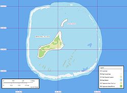 Map of Oeno Island
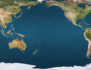
 OenoLocation of Oeno Island in the Pacific Ocean
Oeno 
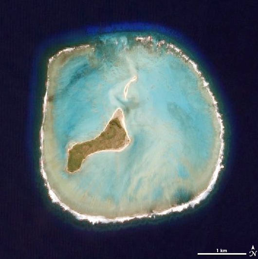
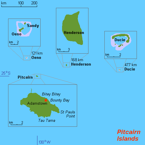
Satellite photo of Oeno IslandGeography Location Southern Pacific Ocean Coordinates 23°55′36″S 130°44′14″W / 23.92667°S 130.73722°WCoordinates: 23°55′36″S 130°44′14″W / 23.92667°S 130.73722°W Total islands 2–3 Area 20 km2 (8 sq mi) Country Demographics Population Unhabitated 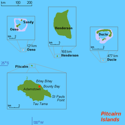 Map of Pitcairn Islands.
Oeno Island (
 /oʊˈiːnoʊ/ oh-ee-noh)[1] or Holiday Island is a coral atoll in the South Pacific Ocean, part of the Pitcairn Islands overseas territory.
Contents
Geography
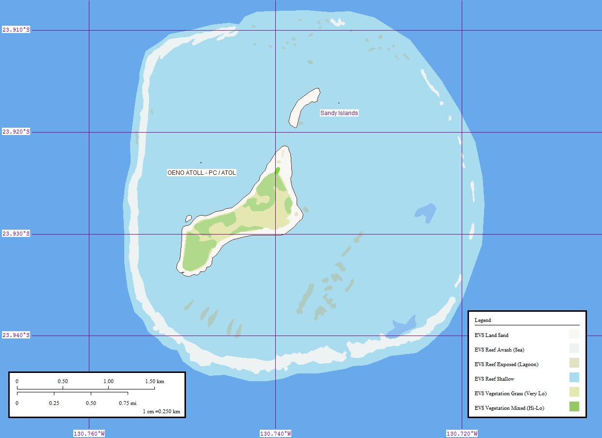
Located 143 kilometres (89 mi) northwest of Pitcairn Island, at 23°55′26″S 130°44′03″W / 23.92389°S 130.73417°W. Oeno Island measures about 5 kilometres (3.1 mi) in diameter, including the central lagoon, with a total area exceeding 20 square kilometres (7.7 sq mi). There are two larger and three smaller islets on the rim of the atoll. Their aggregate land area is only 0.69 square kilometres (170 acres). Oeno Island serves as a private holiday site for the few residents of Pitcairn Island, who will travel there and stay for two weeks in January.[2]
The main island (Oeno), about 0.5 square kilometres (120 acres) in area, has forest and scrub with pandanus and palm trees. It is located on the southwest rim of the atoll. There is a water tap installed on the island.[3] The maximum elevation is less than 5 metres (16 ft). Three smaller islets are to the south and west of the main island.
History
- June 1819
- Captain James Henderson of the British East India Company ship Hercules sights Oeno Island.
- 26 January 1824
- Captain George Worth aboard the American whaler Oeno names the atoll after his ship.
- 5 March 1858
- The Wild Wave, a 1500 ton clipper sailing from San Francisco, is wrecked on Oeno's reef.[4]
- 1893
- The Bowdon is wrecked on Oeno.
- 10 July 1902
- Oeno is annexed by United Kingdom.
- 1938
- Incorporated into the Pitcairn Islands colony.
References
- ^ The name is not Polynesian but Greek. The island was named after the whaling ship Œno.. However, the islanders pronounce it with three syllables, as if it were Polynesian.
- ^ South Pacific & Micronesia. Lonely Planet. 2006. p. 427. ISBN 1-74104-304-2. "Unless you've got your own yacht, your only chance of getting to Oeno is in January, when Pitcairners fit out two of their longboats with essential supplies and swap everyday life on Pitcairn for a fortnight's summer holiday on Oeno."
- ^ Fresh water is pumped out of a well dug in the sand – library.puc.edu
- ^ http://www.winthrop.dk/wildwave.html
External links
- Oeno Photo Tour – Pitcairners spending holidays on the island
- Island Evolution: Oeno Island from NASA Earth Observatory
- Map of Oeno Island
 Pitcairn Islands topics
Islands and settlement 
Culture Main topics Outlying territories of European countries Territories under European sovereignty but closer to or on continents other than Europe (see inclusion criteria for further information) Denmark France Italy Netherlands Norway Portugal Spain United
KingdomAnguilla · Bermuda · British Virgin Islands · Cayman Islands · Falkland Islands · Montserrat · Saint Helena, Ascension and Tristan da Cunha · Turks and Caicos Islands · British Antarctic Territory · British Indian Ocean Territory · Pitcairn Islands · South Georgia and the South Sandwich IslandsCategories:- Atolls of the Pacific Ocean
- Uninhabited islands of the Pitcairn Islands
- Pitcairn Islands stubs
- Oceania geography stubs


Wikimedia Foundation. 2010.