- Bassas da India
-
Coordinates: 21°28′57″S 39°40′19″E / 21.4825°S 39.67194°E
Bassas da India Basse de Judie
Motto: Liberté, égalité, fraternité Anthem: La Marseillaise 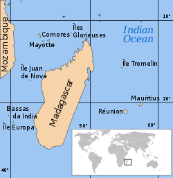 Location of the Scattered islands in the Indian Ocean:
• 1 : Bassas da India • 2 : Europa Island • 3 : Glorioso Islands • 4 : Juan de Nova Island
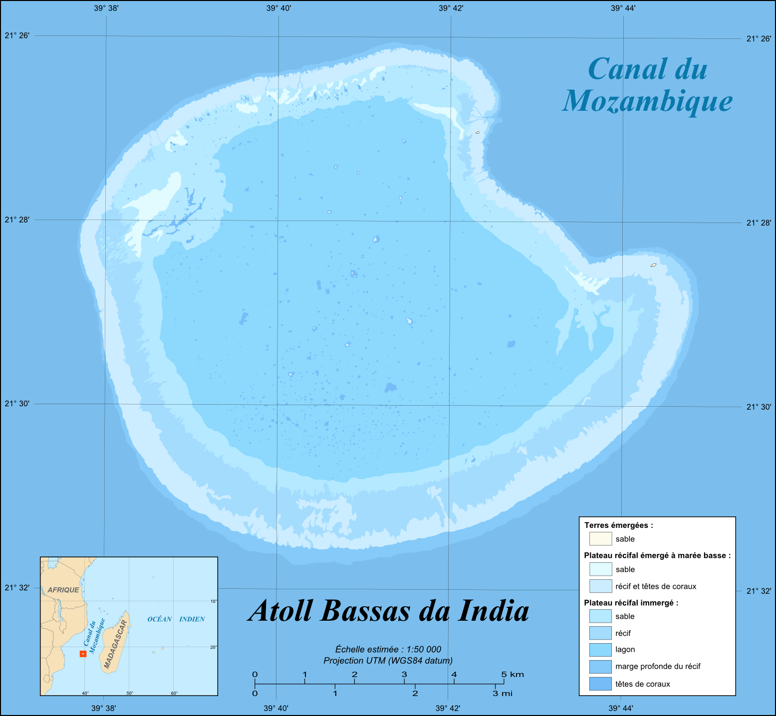
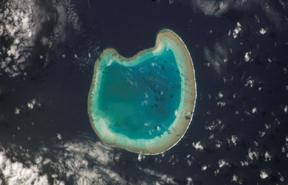
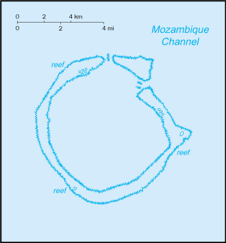
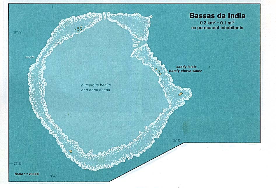
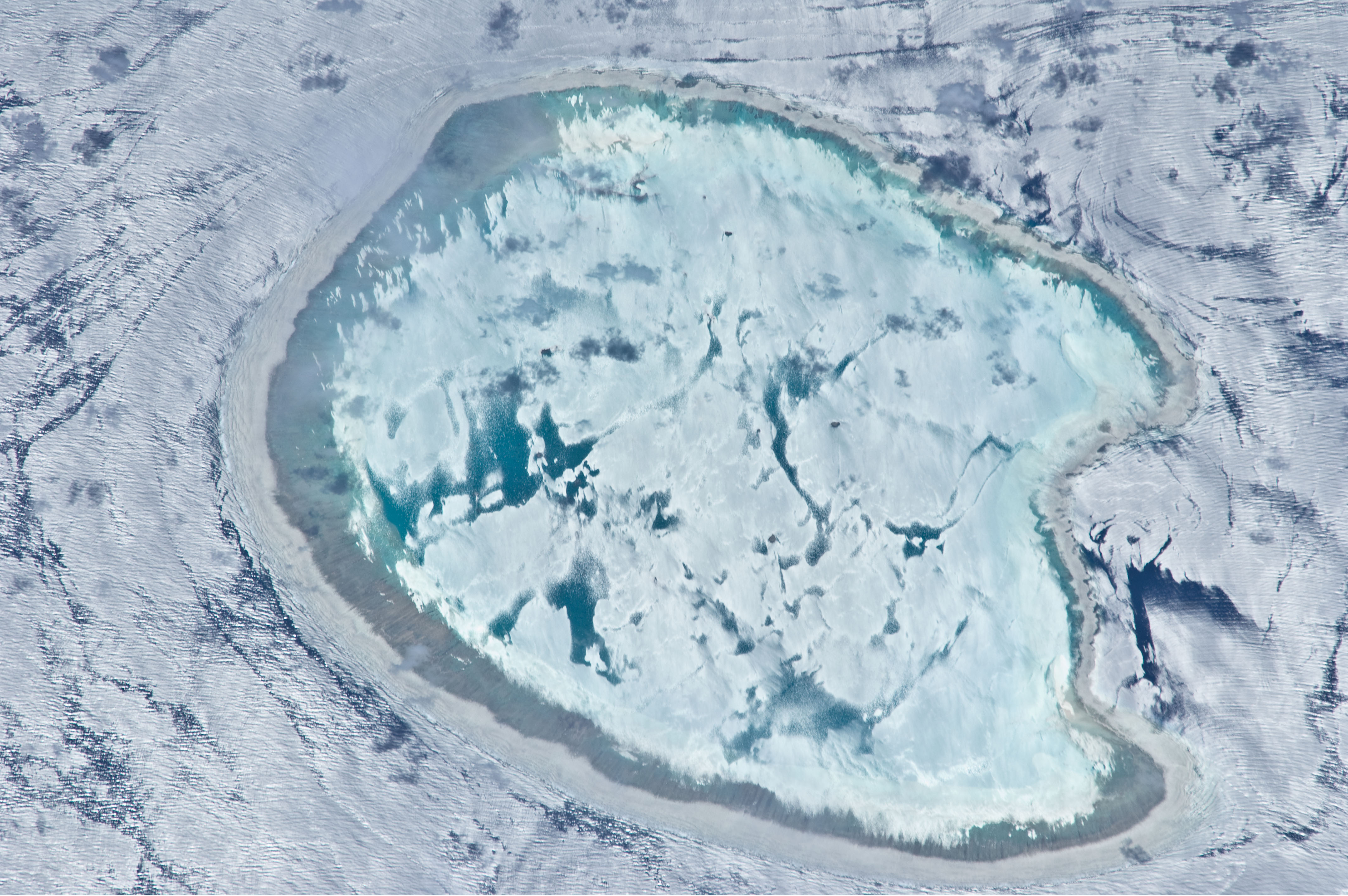
• 5 : Tromelin IslandBassas da India (also called Basse de Judie) is part of the French Southern and Antarctic Lands. It is an uninhabited, roughly circular atoll about 10 km (6 mi) in diameter, which corresponds to a total size (including lagoon) of 80 km2 (31 sq mi). It is located in the southern Mozambique Channel, about half-way between Madagascar (which is 385 km (239 mi) to the east) and Mozambique, and 110 km (68 mi) northwest of Europa Island. It rises steeply from the seabed 3000 m below. The reef rim averages around 100 m across and completely encloses a shallow lagoon that has a maximum depth of 15 m. Its Exclusive Economic Zone (EEZ) of 123,700 km2 (47,761 sq mi) is contiguous with that of Europa Island.
The atoll consists of ten barren rocky islets, with no vegetation, totalling 0.2 km² (.077 sq mi) in area. Those on the north and east sides are 2.1 to 3 m high, and those on the west and south sides 1.2 m The reef is completely covered by the sea from 3 hours before to 3 hours after high tide. The coastline of the reef measures 35.2 km (22 mi). The region is subject to cyclones. The atoll has long been a maritime hazard and is the site of numerous shipwrecks.
About 40 and 70 km southwest of Bassas da India are Jaguar Seamount and Hall Tablemount.
Contents
-

Detailed map.
-
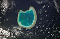
ISS photograph.
-

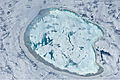
Landsat 7 image.
-

CIA WFB map.
-

CIA map.
-
ISS image of Bassas da India with varying degrees of sunglint.
History
Bassas da India was first recorded by Portuguese explorers in the early sixteenth century. It was first named Baixo da Judia, "Shoal of Judia". "Judia" was the name of a Portuguese ship that ran aground on this reef. This ship was named "Judia" (Jewess in Portuguese), because its owner was a Jewish trader from Portugal.[1] The name became Bassas da India due to transcription errors by cartographers.
It was also discovered by the Europa in 1774, hence the name "the Europa Rocks".[2]
"The Malay was lost July 27, 1842, on Europa Rocks in Mozambique Channel" [3]
In 1897 it became a French possession, later being placed under the administration of a commissioner residing in Réunion in 1968. Madagascar continues to claim sovereignty over the islands.
Tourism
Diving at Bassas Da India requires a permit from the French Government. Diving without such a permit may result in the boat being expelled or even confiscated.[citation needed]
References
- ^ Bernardo Gomes de Brito. Historia Tragico-Maritima. Em que se escrevem chronologicamente os Naufragios que tiverão as Naos de Portugal, depois que se poz em exercicio a Navegação da India. Lisboa 1735
- ^ "..Europa [R]ocks, was discovered by the ship Europa in 1774." Africa pilot, Part 3 Hydrographic Office of Great Britain.
- ^ Historical Sketch of Salem, 1626-1879
External links
Wikimedia Atlas of Bassas da India
- Oceandots
- Sailing Directions: East Africa and the South Indian Ocean
- French Southern and Antarctic Lands entry at The World Factbook
Banc du Geyser · Bassas da India · Europa Island · Glorioso Islands · Juan de Nova Island · Tromelin Island

 Overseas departments and territories of France
Inhabited areas  Special status
Uninhabited areas Pacific Ocean French Southern and
Antarctic LandsBanc du Geyser4 · Bassas da India4 · Europa Island4 · Glorioso Islands3, 4, 5 · Juan de Nova Island4 · Tromelin Island4, 51 Also known as overseas regions. 2 Claimed by Comoros. 3 Claimed by Madagascar. 4 Claimed by Seychelles. 5 Claimed by Mauritius.Outlying territories of European countries Territories under European sovereignty but closer to or on continents other than Europe (see inclusion criteria for further information)Denmark France Scattered islands in the Indian Ocean (Banc du Geyser • Bassas da India • Europa Island • Glorioso Islands • Juan de Nova Island • Tromelin Island) · Île Amsterdam · Île Saint-Paul · Crozet Islands · Kerguelen Islands · Adélie LandItaly Netherlands Norway Portugal Spain United
KingdomAnguilla · Bermuda · British Virgin Islands · Cayman Islands · Falkland Islands · Montserrat · Saint Helena, Ascension and Tristan da Cunha · Turks and Caicos Islands · British Antarctic Territory · British Indian Ocean Territory · Pitcairn Islands · South Georgia and the South Sandwich IslandsCategories:- Atolls of the Indian Ocean
- Disputed islands
- Uninhabited islands of France
- French Southern and Antarctic Lands
- Territorial disputes of France
- Territorial disputes of Madagascar
- Bassas da India
-


Wikimedia Foundation. 2010.