- Crickhowell
-
Coordinates: 51°51′35″N 3°08′14″W / 51.8597°N 3.1372°W
Crickhowell Welsh: Crug Hywel 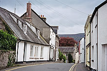
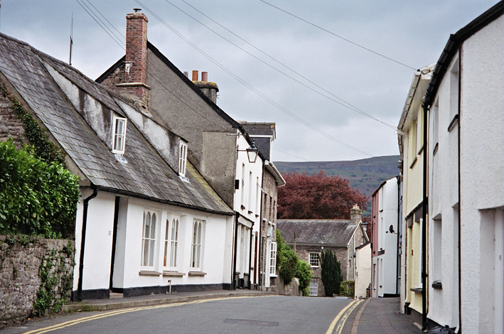
Crickhowell streets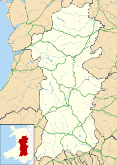
 Crickhowell
Crickhowell shown within PowysPopulation 2,800 OS grid reference SO217186 Principal area Powys Ceremonial county Powys Country Wales Sovereign state United Kingdom Post town CRICKHOWELL Postcode district NP8 Dialling code 01873 Police Dyfed-Powys Fire Mid and West Wales Ambulance Welsh EU Parliament Wales UK Parliament Brecon & Radnorshire List of places: UK • Wales • Powys Crickhowell (Crug Hywel, Crughywel, or Crucywel in Welsh) is a small town in Powys, Mid Wales.
Contents
Location
The name Crickhowell is taken from that of the nearby Iron Age hill fort of Crug Hywel above the town, the Welsh language name being anglicised by map-makers and local English-speaking people. The town lies on the River Usk, on the southern edge of the Black Mountains and in the eastern part of the Brecon Beacons National Park. Significant parts of the surrounding countryside, over 20,000 acres (80 km²) form part of the Glanusk Park estate. The town has a population of around 2,800 people.
Schools
Crickhowell High School is a secondary school with approximately 670 pupils. In 2000, it was ranked 77th in Wales in terms of its GCSE results (based on 5 GCSEs, grades A-C). Since then, the school's exam results have improved dramatically and according to the latest inspection report by Estyn the pass rate has risen to 72%, which means the school is now ranked in equal 19th place, or in the top 10% in Wales. It is also the 4th best performing secondary school in Powys, behind Ysgol Uwchradd Llanidloes, Builth Wells High School and Llanfyllin High School.
Crickhowell Castle
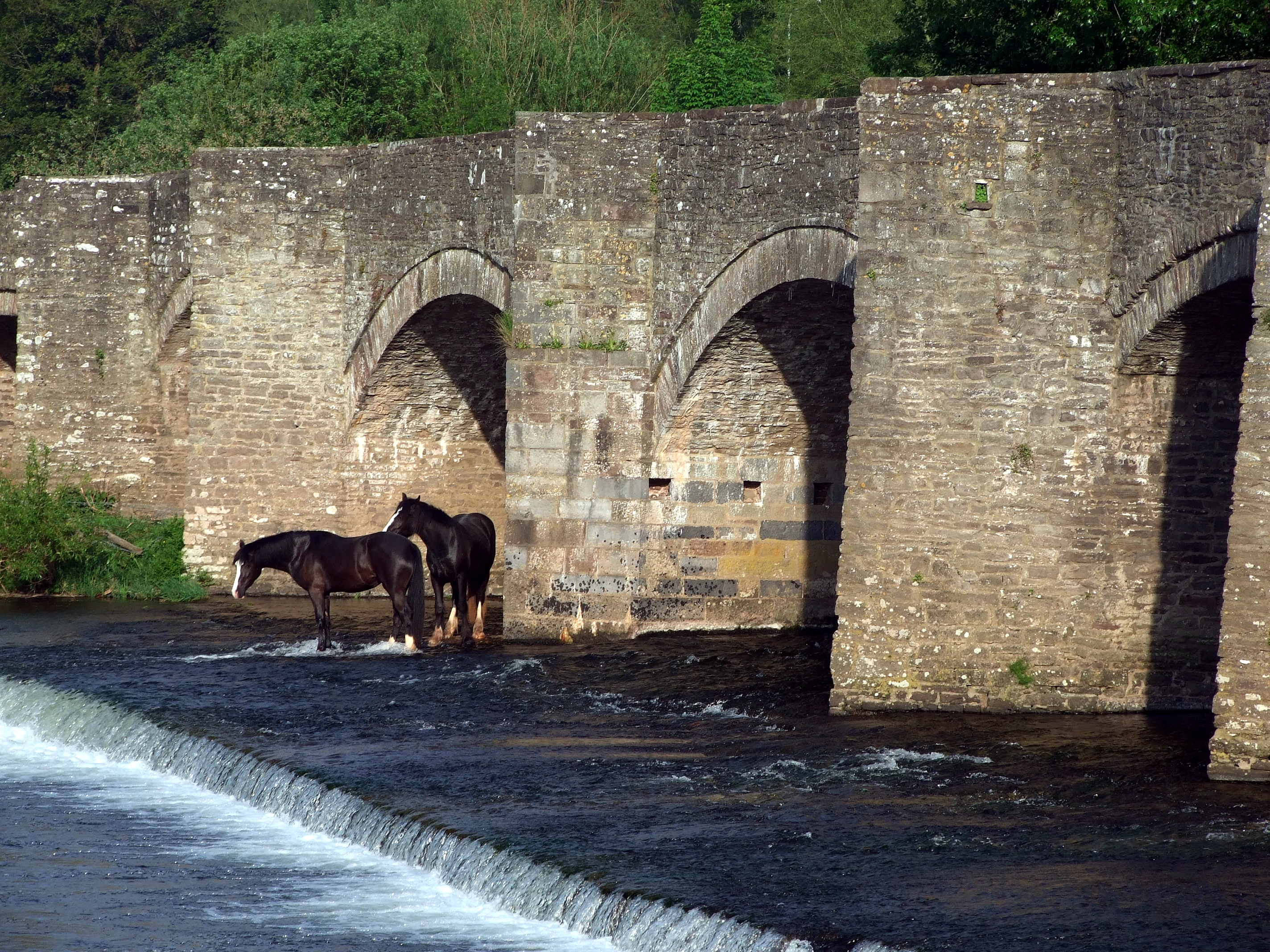
Notable features in Crickhowell include the seventeenth-century stone bridge [1] over the River Usk [2] with its odd arches (twelve on one side, thirteen on the other) and its seat built into the walls, the 14th-century parish church of St Edmund, and the ruins of Crickhowell Castle on the green "tump" beside the A40 Brecon to Abergavenny road.
Crickhowell castle was initially a motte and bailey castle built from 1121, probably by Robert Turberville of the family of Norman Lords, at this time a tenant of Bernard de Neufmarche, Hugh Turberville holding the castle from 1273 not as tenant-in-chief but as mesne lord. Hugh Turberville was Seneschal of Gascony whose services were called upon by King Edward I to train Welsh men-at-arms and transform the royal levy into a disciplined medieval army capable of conquering Wales. Hugh led both cavalry and 6,000 infantry recruited in the Welsh Marches for King Edward's forces. He was later a Deputy Constable and later Constable of Castell y Bere in Merionethshire. He fought against Rhys ap Maredudd during his rising from 1287 to 1291. He died in 1293 the last of the family in the direct line.
The castle was refortified in stone from 1242 when Sybil Turberville a Turberville heiress married Sir Grimbold Pauncefote or Paunceforte. The castle was walled with substantial stone towers and a large bailey, a home castle befitting an important Royal ally in Wales.
The castle was in the hands of the powerful Mortimer family dynasty of Marcher Lords and in the 14th century and declined as a smaller holding within a large portfilio of lands, titles and larger castles.
The castle was refortified on the Royal command of new King King Henry IV in 1400 and carried out by Sir John Pauncefote, great grandson of Sir Grimbold, in advance of the uprising led by Owain Glyndŵr to 1412. The castle was largely destroyed in the early 15th century by Owain Glyndŵr's forces [3] who also attacked and burned Abergavenny town and other settlements in the area. The ruined stone double tower still stands on the Castle Green.
The town
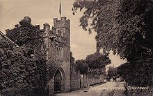 Porthmawr Gate from 1898
Crickhowell is administered by Powys County Council. Planning issues are controlled by the Brecon Beacons National Park Authority. There are two schools - primary and secondary - which act as a central point for a large catchment area. There is some light industry on the outskirts of Crickhowell at the Elvicta Industrial Estate. The town centre [2] includes a variety of traditional businesses, many of which are family owned. Other facilities in Crickhowell include a library, two play areas, public toilets and the CRiC building, which houses a tourist information centre, an internet cafe, an art gallery and a local history archive. There are a number of pubs, restaurants and hotels.
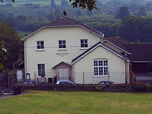 One of several churches in Crickhowell
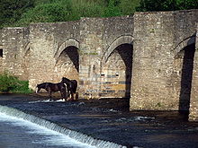 Detail of the bridge
There are a number of churches in Crickhowell. St Edmund's Church holds a service every Sunday. There is also a baptist church, an evangelical church [3] and a Catholic church.
Crickhowell’s most famous son was the mapping expert Sir George Everest (1798–1866) who was born at Gwernvale Manor near Crickhowell (this is now a hotel, known simply as 'The Manor'[4]). He was a Surveyor-General of India, after whom Mount Everest was named, there is also a street in Crickhowell named after him (Everest Drive).
Admiral John Gell died here in 1806 after over thirty years at sea in the British fleets.[5]
The Glanusk Park estate is not far away, the childhood home of the former royal nanny Tiggy Legge-Bourke, who still lives near the town.
Tourism
Today, Crickhowell is a popular tourist destination. In 2005 a Tourist Information centre was built in the centre of town and during summer the town is notably busier. Most people visit Crickhowell to see the Black Mountains and the Brecon Beacons, and maybe enjoy some mountain-biking, camping, hillwalking, rock climbing, fly-fishing, hang-gliding, caravanning or simply tour the area by car staying at Bed-and-breakfasts.
Notable people
- See Category:People from Crickhowell
Surrounding villages
- Cwmdu [4]
- Glangrwyney [5] & [6]
- Llanbedr [7] & [8]
- Llangattock [9] & [10]
- Llangenny [11]
- Llangynidr [12] & [13]
- Tretower [14] which is home to a 12th Century castle and a medieval Manor House, which is still in very good condition.
Also nearby is Cwrt-y-Gollen, a British Army training base.
References
External links
- Crickhowell visitor website
- BBC feature on Crickhowell castle
- Photos of Crickhowell and surrounding area on geograph.org.uk
Categories:- Towns in Powys
- Black Mountains, Wales
- River Usk


Wikimedia Foundation. 2010.