List of Sites of Special Scientific Interest in Radnor — This is a list of the Sites of Special Scientific Interest (SSSIs) in the Radnor Area of Search. For SSSIs elsewhere in Wales, see List of SSSIs by Area of Search.* Aberithon and Bedw Turbaries * Bach Howey Gorge * Bach y graig Stream Section *… … Wikipedia
Machynlleth — Coordinates: 52°35′27″N 3°50′56″W / 52.59087°N 3.84887°W / 52.59087; 3.84887 … Wikipedia
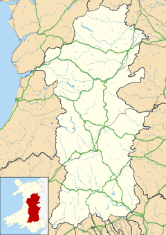
New Radnor — For the former parliamentary constituency, see New Radnor (UK Parliament constituency). Coordinates: 52°14′N 3°10′W / 52.24°N 3.16°W / 52.24; 3.16 … Wikipedia
Montgomery, Powys — Coordinates: 52°33′46″N 3°08′57″W / 52.5628°N 3.1493°W / 52.5628; 3.1493 … Wikipedia
Crickhowell — Coordinates: 51°51′35″N 3°08′14″W / 51.8597°N 3.1372°W / 51.8597; 3.1372 … Wikipedia
Criggion — is a village in Powys, Wales. Criggion radio station was located nearby. A branch of the now defunct Shropshire and Montgomeryshire Railway stopped at Criggion. External links grid reference SJ293149 Bausley with Criggion Community Council Home… … Wikipedia
Meifod — Coordinates: 52°43′N 3°15′W / 52.71°N 3.25°W / 52.71; 3.25 … Wikipedia
Cwmtwrch — is a village in the Swansea Valley, Wales, some 15 miles north of Swansea. Contents 1 History and origins 2 Amenities 3 Sport 4 Photos of … Wikipedia
List of places in Herefordshire — This is a list of cities, towns and villages in the county of Herefordshire, England. See List of places in England for settlements in other counties.compactTOC NOTOC A*Abbey Dore (gbmappingsmall|SO386305) *Abcott (gbmappingsmall|SO393788) *Acton … Wikipedia
Church Stoke — Churchstoke or Church Stoke (Welsh: Yr Ystog) is a large village in Powys, but adjacent to the English Welsh border, on the junction of the A489 and A490 roads. It is overlooked by Roundton Hill. The nearest town is Montgomery. An outline map of… … Wikipedia
 Dolyhir
