- Meifod
-
Coordinates: 52°43′N 3°15′W / 52.71°N 3.25°W
Meifod
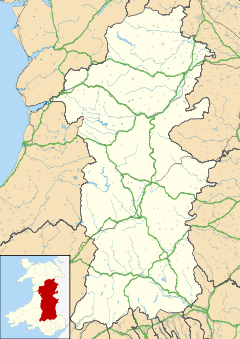
 Meifod shown within Powys
OS grid reference SJ154133 Principal area Powys Ceremonial county Powys Country Wales Sovereign state United Kingdom Post town MEIFOD Postcode district SY22 Dialling code 01938 Police Dyfed-Powys Fire Mid and West Wales Ambulance Welsh EU Parliament Wales UK Parliament Montgomeryshire List of places: UK • Wales • Powys Meifod (
 Welsh pronunciation (help·info)) is a small village 7 miles north-west of Welshpool in Powys, mid Wales, on the A495 road and located in the valley of the River Vyrnwy. The River Banwy has a confluence with the Vyrnwy approximately two miles to the west of the village.
It is noted as the royal burial ground of many of the kings and princes of the Welsh Powys at various sites around the village. At the village centre is the parish church of St Tysilio and St. Mary which occupies a very large site. In addition, in common with many Welsh villages, there are a number of Nonconformist chapels with the village and its catchment area. The village has one pub, the King's Head and a convenience store (with a post office),. In 2006, local rugby union team C.O.B.R.A built a new rugby clubhouse and two pitches. The club house has two bars and a balcony. The village football team plays in the amateur division.
The village also has a primary school, Ysgol Meifod (formerly Meifod County Primary (or CP) School) and a modern village hall located next door which provides facilities for a wide variety of clubs and societies.
Dyffryn Hall, a Georgian period manor house, is situated to the west of the village and was home to Clement Davies, the Montgomeryshire MP and leader of the post-war Liberal Party between 1945 and 1956.
Contents
Demographics
57% of the population of Meifod were born in England, however this might not be evidence alone for large scale immigration from England. It may only show the preference of local parents to use larger hospitals more conveniently situated in nearby Shropshire for giving birth.
Welsh language
The United Kingdom Census 2001 revealed that some 38% of the population over 3 years old have some knowledge of the Welsh language with almost 20% able to speak, read and write in Welsh.[1] The Meifod valley hosted the National Eisteddfod in 2003.
References
- ^ 2001 Census Neighbourhood Statistics: Meifod
External links
- Ysgol Meifod
- Photograph of headteacher and boys Meifod School 1890s
- Photograph of teachers and girls Meifod School 1890s
- BBC: Meifod
- 2001 Census Neighbourhood Statistics for Meifod
- Useful Information on Meifod
- www.geograph.co.uk : photos of Meifod and surrounding area
- Francis Frith photos of Meifod
- Genuki info on Meifod
Categories:- Villages in Powys
- Powys geography stubs
Wikimedia Foundation. 2010.


