- El Nido, Palawan
-
"El Nido" redirects here. For the small towns in the United States, see El Nido, California (disambiguation).
Municipality of El Nido
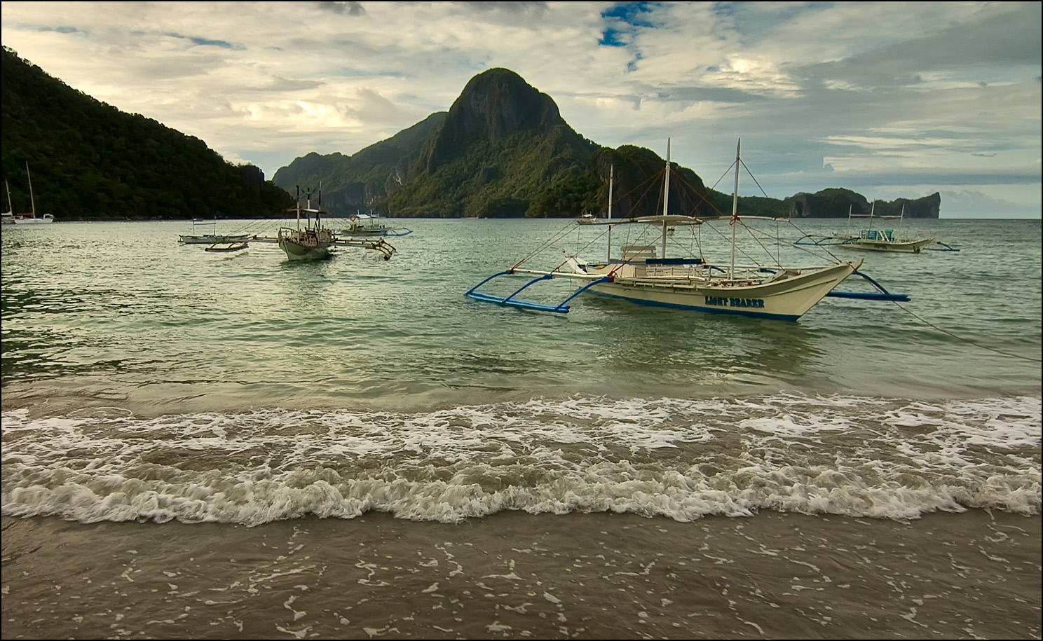
Bayan ng El Nido— 1st class municipality — The limestone islands of El Nido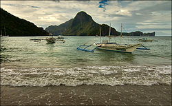
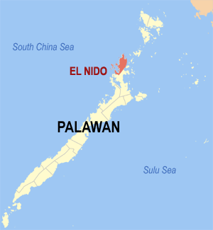
SealNickname(s): Heaven on Earth[1] Map of Palawan showing the location of El Nido
Coordinates: 11°20′N 119°41′E / 11.333°N 119.683°ECoordinates: 11°20′N 119°41′E / 11.333°N 119.683°E Country Philippines Region MIMAROPA (Region IV-B) Province Palawan Districts 1st District of Palawan (Northern Palawan) Barangays 18 Government - Mayor Edna Gacot-Lim - Vice Mayor Roberto "Tisoy" Rodriguez Area - Total 465.10 km2 (179.6 sq mi) Elevation 609 m (1,998 ft) Population (2007) - Total 30,249 - Density 60/km2 (155.4/sq mi) Time zone PST (UTC+8) ZIP code 5313 Area code(s) 48 Website www.elnidotourism.com El Nido (officially the Municipality of El Nido) is a first class municipality[2] and managed resource protected area[3] in the province of Palawan in the Philippines. It is about 420 kilometres (260 mi) southwest of Manila,[4] and about 238 kilometres (148 mi) northeast of Puerto Princesa, Palawan’s capital.[3]
Geography
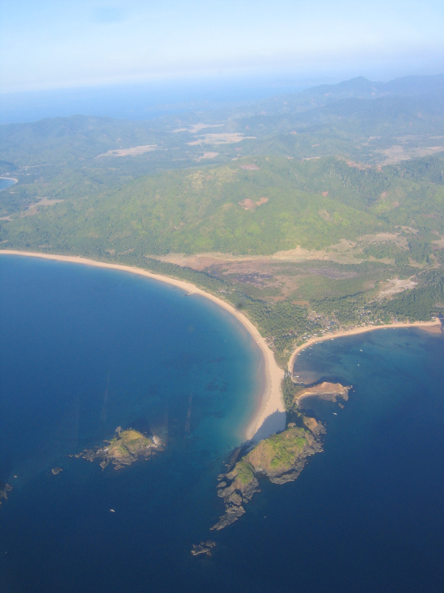
The municipality, covering a land area of 465.1 square kilometres (179.6 sq mi)[3][5] in the northernmost tip of mainland Palawan, is bordered by the Linapacan Strait in the north, the Sulu Sea in the east, and the South China Sea in the west. It is composed of 45 islands and islets,[4] each has its own unique geological formations. The highest peak is at Cadlao Island, towering up to 640 metres (2,100 ft)[6] above sea level.
Together with Sulu Archipelago, Sabah, and South China Sea, El Nido, being part of Palawan, is located in the tectonically active and seismically active Sunda Plate,[7] a plate that is entirely separate from the Philippine Mobile Belt to which the rest of the Philippines belongs. The Permian to Paleogene rocks and limestone cliffs of El Nido are similar to those that can be found in Ha Long Bay in Vietnam, Guilin in China, as well as Krabi in Thailand, all of which are part of the Sunda Plate.[7][8]
History
El Nido has been inhabited by humans as early 2680 BC, or even up to 22,000 years ago.[9] This was confirmed by the fossils and burial sites, dating back to the Late Neolithic Age, that can be found in many caves and excavation sites surrounding the municipality, particularly the Ille Cave in New Ibajay. Chinese traders had been regularly visiting the area of El Nido for its edible birds' nests during the Sung Dynasty (960-1279 BC). In fact, El Nido is specifically mentioned in Chinese records as far back 1225 BC. Caho Ju-Kua, a member of the Chinese Royal Family, Trade Commissioner and Superintendent of Customs of the Port of Chuan How wrote about the island, Pa-Lao-Yu or Land of Beautiful Harbors in his book Chu Fan Chai.[4]
The town traces its roots from a small Tagbanua village called Talindak. Some time in the 16th century, waves of migrants from Cuyo Islands came here to settle. In the 1800s, the Spaniards arrived, and they moved to the part where the present-day Población and Mabini are located.[4] The first Spanish families were the Canovas, Vázquez, Ríos and Rey. In 1890, the Spaniards renamed it as Bacuit. At the time, the center of the town was Cabigsing, then known as Inventario. Chinese families moved into the area about the same period, first settling in Langeblangeban. The first Chinese settlers were named Lim, Chin, Liao, Edsan, Ambao, Que-Ke, Lim Piao, Yu His, Pe Phan and Pe Khen.[4]
 Aerial shot of Población, El Nido's town proper.
During the Spanish colonization of the Philippines, the town was under the jurisdiction of the Municipality of Taytay, which was the capital of the former Province of Calamianes from 1818, and the Province of Castilla, the area of what is now known as northern Palawan, from 1858. It remained part of Taytay until 1916 when it formally became an independent municipality.[4] The new municipality was then known as Bacuit.
On June 17, 1954, Republic Act No. 1140[10] was approved changing the name of the town from Bacuit to its present name, El Nido, after the edible nests of swiftlets, collocalia fuciphaga, found in the crevices of its limestone cliffs. These nests, "nido" in Spanish, the main ingredient for the gourmet nido soup, are being sold at approximately US$ 3,000 per kilogram.[3]
In 1957, the following barrios were created:
- Villa Paz comprising the sitios of New Igabas, Candolay, Malapaho, Mabeñgeten, Dewel, Nalbekan, and Lapia;
- Bebeladan comprising the sitios of Mainlong, Bolabod, Balete, Culiong, Codongnon, Vigan, Pagawanen, Langeblangeban, Talulap, Bocboc, Miadiao, Avirawan, Pita, Deboluan, Balay-Bacaco, Kiminawit, Pamontonan, Simpian, Binabanan, Tegas, and Pinacpanacan;
- Bagong-Bayan comprising the sitios of Manogtog, Cadleman, Pinagtual, Omao, Nami, Tebey, Bato, Tuñgay, Cataaban, and Lomocob;
- Pasadeña comprising the sitios of Lamoro, Cagbatang, Bulalacao, Pinañganteñgan, Quinawañgan, Nagbaclao, Colantod, Loblob, and Badiang;
- Sibaltan comprising the sitios of Turatod, Buluang, Santa Monica, Senodioc, Laolao, Caboñgan, Tapic, Panian, Guitan, Loro, and Nagcalasag;
- Barotuan comprising the sitios of Taberna, Locaroc, Nagpan, Yocoton, Calitang, Wawa, Makinit, Canoling, Mabañgaon, and Mapeldeten;
- San Fernando comprising the sitios of Panian, Madorianen, Dipnay, Maubog, Guenleng, Palabuayan, Parañgaycayan, San Pablo, and Olac-olacan; and,
- Villa Libertad comprising the sitios of Calelenday, Taolili, Boloc, Inigtan, Mepague, Matolatolaon, Dao, Batbat, Madacotdacot, Nasigdan, Semenled, Bancalen, and Cagbanaba.[11] In the same year, the barrio of Oton was renamed to Mabini.[12]
Because El Nido was quite remote from most of the inhabited islands in the Philippines, its pristine beauty was hidden to the world until 1979 when a sea accident happened in Bacuit Bay. As the story goes, "a tuna line disabled a dive boat's propeller in the middle of the night forcing it to drop anchor in an inlet. The following morning, the divers woke up to an amazing scenery of skyscraping dark cliffs, thick green forest, white sandbeach, sparkling water and, rising above it, a series of magnificently sculpted jade islands."[4]
In 1983, a dive station was established in Miniloc Island by a group of divers who were on board the diveboat M/V Via Mare. In the same year, major tourism commenced in El Nido, when the Ten Knots Development Corporation, a Filipino-Japanese joint venture company, opened a divers' resort on Miniloc Island, and an airstrip (Lio Airport) at Villa Libertad on the mainland. In 1992, the company set up a second resort on Pangulasian Island, and in 1998, the third and largest Ten Knots resort on Lagen Island. The opening of the third resort coincided with the destruction of the Pangulasian Resort by fire. During this period several other tourism establishments were developed, paving the way for tourism to become a thriving economic sector.[4]
El Nido is a showcase of the Philippines' geological and biological diversity. In recognition of the importance of its unique ecosystem, the Philippine government made the entire area of El Nido first to a turtle sanctuary in 1984, then to a marine reserve park in 1991,[13] and finally in 1998, to that of a managed resource protected area.[14]
Government
El Nido is governed by a Mayor and a Vice Mayor, who are elected to three-year terms. The Mayor is the executive head and leads the municipality's departments in executing the municipal ordinances and improving public services. The Vice Mayor heads the legislative council consisting of 8 councilors, or more commonly known as Sangguniang Bayan members. The Municipal Council is in charge of creating the municipality's policies in the form of Ordinances and Resolutions.
 Aerial view of Bucana, one of the eighteen barangays of El Nido.
El Nido is politically subdivided into eighteen barangays. Four of which are situated in the Población (town proper), and are also known by their respective zones.
- Bagong Bayan
- Buena Suerte (Zone II)
- Barotuan
- Bebeladan
- Corong-corong (Zone IV)
- Mabini (formerly Oton)
- Manlag
- Masagana (Zone III)
- New Ibajay
- Pasadeña
- Maligaya (Zone I)
- San Fernando
- Sibaltan
- Teneguiban
- Villa Libertad
- Villa Paz
- Bucana
- Aberawan
Población (Town proper)
The Población, consisting of barangays Buena Suerte, Corong-corong, Maligaya and Masagana, sits in a sheltered bay with a pier at one end along a crescent beach, and is flanked by the area's famous limestone cliffs on the eastern section and hills on the western side. It is a small town center with tree-lined streets, and the lifestyle is laidback.
The Municipal Building, which houses the offices of the head of the municipality, the local legislature and several local government agencies, is located at the middle of the town square between Calle Real and Abdulla Street. It is interconnected with other buildings that house other government facilities such as the Rural Health Unit, Municipal Circuit Trial Court, El Nido Post Office, just to name a few.
Seal
The municipality seal shows a silhouette of the territory of El Nido inside an armour-shaped picture. The famous marble and limestone cliffs represents the nestling ground of the swiftlets. Behind it is the oil rig, representing the areas within its administrative boundaries that are found to be rich in oil and natural gas such as the Malampaya Sound, which is 50 kilometers[15] within its borders, and the Cadlao Oilfield in Bacuit Bay area.[16] At the bottom of the picture is the ricefield, with the carabao head superimposed at the center, and on the other side, the sea, with the fish and the squid in situated the middle, representing farming and fishing, the two main industries of its people.
Protected Area status
Establishment
In 1984, the then Ministry of Natural Resources issued the Administrative Order No. 518, establishing a 360-square kilometer maritime area in El Nido as a turtle sanctuary. In 1991, the rest of the Bacuit Bay, including its island and islets, was proclaimed by the Philippine government as a marine reserve. A year later, by virtue of Administrative Order No. 14 Series of 1992 of the Department of Environment and Natural Resources, this area was expanded even more. In 1998, its status was elevated to that of a protected area, and it included even the terrestrial ecosystem of El Nido and portions of Taytay.[13]
Extent and scope
The so-called El Nido-Taytay Managed Resource Protected Area is the largest marine sanctuary in the entire Philippines.[17] The Protected Area status accords the areas of El Nido and portions of its neighboring town of Taytay[13] a place among the eight priority sites[6][18] in the country in need of conservation. The Protected Area covers a total of 903.21 square kilometers,[19] of which 40% are terrestrial and 60% marine.[20]
The provincial government has mobilized its citizenry to actively participate in various environmental conservation and protection programs, such as the "Bantay Gubat" for forest protection, and the "Bantay Dagat" for the marine life preservation.[15] Patrolling within the Protected Area especially in the marine zones is regularly conducted with the help of the World Wildlife Fund - Philippines that allocates funds to support the said activity. Other logistic support is by the concerned municipal governments. The Palawan Council for Sustainable Management (PCSD) provides legal assistance during the litigation of cases filed by the Protected Area Office (PAO).[19]
As a protected area, the Philippine government needs approximately US$ 180,000 annually to protect and manage its natural resources.[6][20] Tourists are encouraged to pay US$ 0.50 per day as conservation fee for the duration of their visit at the Municipal Tourism Office or the Office of the Protected Area Management Board (PAMB), which are housed in the Municipal Building in Calle Real.[20] This was embodied in the PAMB Resolution No. 08 series 2000 from the National Integrated Protected Area Program (NIPAP) of the Department of Environment and Natural Resources (DENR).[15]
El Nido, being one of the most diverse ecosystem in the country, is protected for its unique flora and fauna, and pristine geologic formations. These include:
- limestone cliffs, the home of the swiftlets
- 50 white sand beaches
- 5 types of forest (the lowland evergreen rainforests found in the mainland and islands such as Miniloc, Lagen and Pangulasian; semi-deciduous forests; forests over limestone; beach forests; and, the mangrove forests found mostly around major rivers and creeks in the mainland)
- 3 major marine habitats
- 16 endemic and 10 threatened species of birds (including the Palawan Hornbill, the Palawan Shama, the Palawan tit, Palawan Scops Owl, and the Palawan Peacock Pheasant)
- 6 species of marine mammals endemic to Palawan (including dolphins and its native dugong)
- the Palawan Tree Shrew, the Palawan Stink Badger, the Palawan Spiny Rat, the Palawan Anteater, and the Northern Palawan Tree Squirrel
- 4 species of endagered marine turtles (hawksbill, olive ridley, leatherback and green sea turtles)
- 100 species of corals,[21] 45 of which belongs to the genera of hard corals
- 813 species of fish
Climate and sea conditions
The climate in El Nido is distinguished by two seasons: generally dry, from December to May, and wet, from June to November. April and May are typically the driest months, while the heaviest rainfall occurs around August. The Northeast wind blows from December to March, occasionally interchanging with the North wind during December to February. The Southwest wind is felt from June to October while the East wind, the mildest of all winds, blows during the months of April and May.[22]
Surface Temperature
The average surface temperature ranges from a low of 22°C to a high of 33°C. The coolest temperatures are usually experienced during the month of January, while the hottest temperatures are felt in April and May.[22]
Water Current
The current in El Nido differ from very slight to moderate depending on tidal conditions. Divers and snorkellers can swim back to the boat without difficulty since currents are usually very manageable.[22]
Water Temperature
The average water temperature ranges from 24°C to 26°C during the months of December to March and 26°C to 29°C during the months of April to November.[22]
Water Visibility
Water visibility ranges from 3 meters to 10 meters from December to February, 10 meters to 30 meters from March to May, and 10 meters to 15 meters from June to November. The best time for diving at El Nido is during the months of March to May, as surface conditions are good.[22]
Demographics
Population Census 1918: 1,789 1990: 18,832 1995: 21,948 2000: 27,029 2007: 30,249 The first town census of 1918 showed El Nido having a population of 1,789. In the period between 1980 and 1990, the population grew up to 18,832.[4][23] Based in the 2000 census, the annual growth rate is 3.58% .[24] This is higher than the average annual population growth rate for the whole country for the periods 1990 to 2000 and 2000 to 2007, which was only 2.34% and 2.04%.[25]
According to the 2007 census, El Nido has a population of 30,249 people in 6,311 households in its eighteen barangays. Eighty-five percent of the population are living in the rural barangays, while only fifteen percent of them are in the Población area.[26]
Ethnic Groups
The original settlers of El Nido were the Tagbanuas and Cuyunons. Throughout the centuries, there has been a constant migration of Tagalogs, Visayans, Bicolanos, Ilocanos, Chinese and Spaniards. There are also a small number of Germans and Koreans. Intermarriage between ethnic and linguistic groups are not uncommon in El Nido.
Languages
The main language is Filipino, which is largely based on Tagalog. In addition, many people are very proficient in English, Visayan languages (Visayan, Cebuano, Kinaray-a, Ilonggo, and Waray), and Bicolano. A small but significant percentage of the population speaks or comprehends Cuyonon, the native dialect of the Cuyo Islands and most parts of Palawan.
Religion
El Nido is predominantly Roman Catholic like the rest of the Philippines. There are two parishes inside the municipality: the Parish of Saint Francis of Assissi, which covers the western part of El Nido, and the Parish of Santa Putenciana, which serves the eastern and northern part of El Nido and underlying areas of Linapacan and Taytay. The said parishes are under the Apostolic Vicariate of Taytay.
A small segment of the population belongs to other Christian denominations such as Baptist, Iglesia Ni Cristo, Seventh-day Adventist and other Protestant churches. Recently, there is a growing number of migrants, who are engaged in Islamic faith, from southern Palawan and parts of Mindanao.
Education
El Nido has more than ten public elementary and secondary schools located in most of its barangays. El Nido Central School and El Nido National High School, which are both located at the Población, have the largest facilities and number of students, among these schools. Recently, the Palawan State University opened its El Nido campus in New Ibajay, offering extramural programs and studies.
Economy
The main industries of El Nido are fishing, agriculture and tourism, being a popular diving location. Edible nest-gathering[27] is also an economic activity, although it is seasonal. Coconut, palay, cashew, banana, and mango are its major products.[5]
Transportation
Air
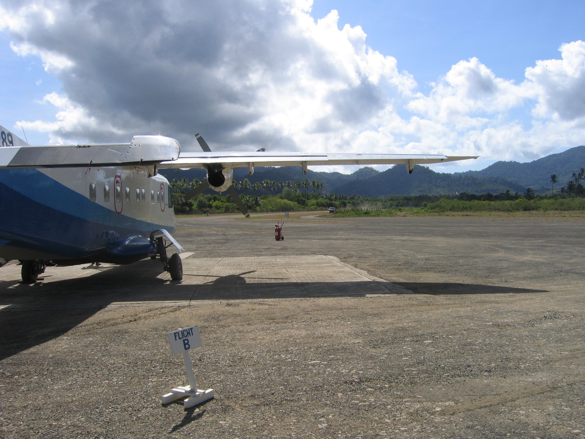
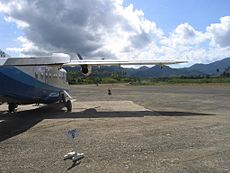 Island Transvoyager's Donier Do 228 aircraft at Lio Airport.
The fastest and most direct way to El Nido is from Manila. The flight takes one hour and fifteen minutes, and lands directly at Lio airport, which is located about 4 kilometers from the Población. There are only two airlines that fly to El Nido, namely South East Asian Airlines (SEAIR) and Island Transvoyager Inc. (ITI)[28] ITI is a charter airline that operates as a sister company to the two main resorts on El Nido. SEAIR is a commercial airline with flights from Manila to El Nido, with a stopover in Busuanga.[29]
Roads
The main roads of El Nido are organized around a set of radial and circumferential roads that radiate and circle in and around the town proper and its rural barangays. Its interconnected roads are connected to the major highway that leads Puerto Princesa City, Palawan's capital. Daily Buses and jeepneys depart at San Jose Terminal in Puerto Princesa for El Nido. Tricycles are used for short-distance trips around the town proper.
The 60 km national road between Taytay and El Nido was rehabilitated, and this has helped boost tourism and business activity in the area.[30]
Seaports and piers
The main port in El Nido, which is under the jurisdiction of the Philippine Ports Authority (PPA), is located in Buena Suerte (Zone II), although a number of small and accessible wharfs, such as the San Fernando pier, are being used in other rural barangays. A number of ferry and other sea vessels owned by Atienza Shipping Lines and San Nicholas Shipping Lines have regular trips from Manila to El Nido.
Communication
There are no telephone lines that operate in El Nido. Resorts and other tourist facilities use satellite telephone systems, while majority of the population rely on cellular networks Smart Communications and Globe Telecom. There is a telegraph facility at the El Nido Post Office, and wireless fidelity and Internet access in a number of establishments.[31]
Public services
The Población area is part of the service areas of electric utility, Palawan Electric Cooperative (PALECO), a division of the National Power Corporation operating with .423 megawatts of electricity.[32] Other barangays use solar panels and electric generators. The island resorts generate their own electricity. Water services are accessible in protected water tables and facilities. Ten percent (10%) of the population can avail of the Level II Water System, or communal faucet,[32] by the municipal government, while majority of them are still dependent on deep wells and natural springs. Internet services is available in few establishments with wireless broadband access.[33]
Medical Facilities
The government-run Rural Health Unit, manned by a doctor and support medical staff, provides health services for the whole municipality. It is capable of providing health services such as minor surgeries, and diagnosis and treatment of common diseases. Patients requiring more complex medical services are either flown to Manila or Puerto Princesa from El Nido or taken to the Taytay District Hospital, which is about 55 kilometers away. Antipyretic, cold and cough medicines, and other over-the-counter medicines as well as a limited supply of prescription drugs are available in El Nido.
Security
In charge of the overall security of El Nido is the multi-sectoral security network composed of the Philippine Navy, Philippine Air Force, and Philippine Army under the Armed Forces of the Philippines’ Western Command in Puerto Princesa, the Philippine National Police Maritime, the Philippine Coastguard, the Provincial Government, the local government units, members of the local community, and the Palawan Tourism Council.[34]
Being the closest municipality to the protected Malampaya gasfield, El Nido serves as the headquarters of the Philippine security force tasked to supplement the local security force already in place in El Nido. This special security force commands personnel, navy vessels, speedboats, and aircraft. The El Nido Resorts, being one of the top tourist destinations in Asia, also maintains an effective unit of security personnel duly licensed by the Philippine National Police Maritime They are in charge of monitoring the activities within the resort areas, as well as conducting day and night patrols and surveillance activities with in the resorts and nearby islands.[15]
Places of interest
From the towering marble cliffs and enchanting lagoons to its 100[35] white sandy beaches and lush jungle, El Nido is one of the top tourist destinations in Palawan, which is often referred to as the Philippines' Last Frontier.[23] In the November–December 2007 issue of the National Geographic Traveler's magazine, Palawan was chosen as one of the best travel destinations in the world, and particularly, it recommended El Nido and the Calamianes Islands.[36]
Bacuit Bay
The bay is dotted with islands and islets, most of which are inhabited. Its clear blue waters are teeming with marine life. It is home to dugongs, turtles, manta rays, species of fishes, coral reefs, and the occasional whale sharks. There are over 30 dive sites ranging in depth from six to more than thirty meters.[37]
Cadlao Island
It is the largest island in El Nido, occupying a land area of 10.06 square kilometers. Among all islands, it is the closest to town proper and has the highest peak that towers up to 640 meters above sea level. It is known for its white sand beaches, gradually sloping sea floor, hidden lagoons, and nature trails through its lush forest cover. One of these nature trails leads to the charming saltwater Makaamo Lagoon. Surrounded by mangroves, the lagoon is best enjoyed in silence at sunrise or sunset when the birds feed.
There are a number of beaches on Cadlao, including that at Bocal Point, Natnat, and Paradise Beach on the southern side of the island. Sabang Beach in the northeast offers good snorkeling opportunities, though some visitors may recognize it as one of the settings for the Scandinavian TV show Robinson Expedisjonen, the predecessor to Survivor.
Dilumacad Island
This island has a beautiful white sand beach stretching to some 300 meters that is ideal for picnic lunches during island-hopping trips. There is an underwater tunnel at its northern side and a fringing reef on its southern end. The island is also called Helicopter Island because its limestone cliffs resemble that of a helicopter when it is viewed from a considerable distance.
El Nido Resorts
El Nido Resorts refers to the resort complex operated by Ten Knots Development Corporation (TKDC), which is owned by the Asian Conservation Company (ACC).[14]
TKDC, the biggest private sector employer in El Nido, cooperates with the Philippine government in environmental conservation and management. At present, TKDC operates in two islands of El Nido namely, the Miniloc Island and the Lagen Island.[14]
The said establishment has won numerous citations both locally and internationally. The January 2008 issue of international magazine Travel + Leisure, published by the American Express Co. (which partnered with Conservation International), listed "El Nido Resorts" as "conservation-minded places on a mission to protect the local environment." Travel + Leisure’s 20 Favorite Green scored El Nido Resorts' protection of Palawan’s giant clam gardens and the re-introduction of endangered Philippine cockatoos: "8. El Nido Resorts, Philippines: Guest cottages on stilts are set above the crystalline ocean. The resorts are active in both reef and island conservation."[38][39][40] In 2009, El Nido Resorts won Wild Asia's Responsible Tourism Award for the "Mid to Small" accommodation category for its excellent sewage treatment facility that prevents waste water from contaminating the surrounding water systems, tree-planting activities to protect the municipality's watersheds, and skills training for local communities through its own foundation.[41]
Activities offered at El Nido Resorts include lagoon tours, cave tours, mangrove river tours, bottom fishing, bird watching, hat making, picnic lunches, sunset cruising, kayaking, windsurfing, hobiecat sailing, snorkeling, diving and, with prior arrangement, dive courses.[42]
Miniloc Island
Miniloc Island, where the first resort in El Nido was established, started as a diving station for Japanese and European tourists.[14] The tranquil turquoise-green waters of its orchid-lined limestone walls Big and Small Lagoons showcases a kaleidoscope of marine life. Scientists believe that these lagoons were actually caves which abound in these islands. The roofs of these caves must have collapsed millions of years ago, and these lagoons have emerged in their stead.[43]
The Miniloc Island Resort, renimiscent of a coastal village, is set in a cove with a backdrop of sheer limestone cliffs. The resort has a total of 50 rooms of varying types accommodations and its facilities include a restaurant located at the clubhouse, a boutique, video room, game area, Pavilion Bar, and a conference room that can accommodate up to 40 persons theater-style and 30 persons classroom-style. It has a complete diving and snorkeling facilities, as well as, kayaks, aqua bikes, windsurf, and hobie cat. The end of the resort's pier is a great place for snorkeling where guests can swim alongside 3-foot-long (0.91 m) groupers and hundreds of sergeant majors, damsel fish, fusiliers, and other multi-colored tropical fishes.[44]
Lagen Island
The island hosts a high diversity of birds including almost all of the species endemic to Palawan. The Lagen trail is one of the best sites for birdwatching, more rewarding during the early morning or towards late afternoon. Its Leta-Leta Cave was an important burial site of the Late Neolithic Age, where a collection of stone and shell artifacts, and sophisticated pottery, such as the "Yawning Jar,"[45] and nephrite adzes and axes were recovered. Other materials include stone ornaments and shell beads. It was excavated by Dr. Robert Fox in 1965.[4][46] It is also one of the pitstops of the 5th Season of The Amazing Race.
In one of its cove, which is fringed by a lush forest and limestone walls, lies the Lagen Island Resort, the most luxurious exclusive resort in the area. The resort complex has a total of 51 rooms of varying types of accommodation, a 12 x 25 meter swimming pool, designed with an even depth of 4 feet so as not to touch the roots of trees that lie underneath. Its clubhouse is the air-conditioned main dining area where buffet and a la carte meals are served. On the lower level of the clubhouse are the boutique, game area, library, clinic, and conference room that can accommodate up to 70 persons theater-style and 60 persons classroom-style.[46]
Pangalusian Island
It has one of the widest stretches of powdery white beaches in El Nido, which is very ideal for sun bathing, sunset viewing, and other beach activities. The waters fronting the beach are clusters of coral reefs that make this area a good snorkeling and diving site. A trail located in the middle of the island is a good place for birdwatching, especially during early mornings and late afternoons. The trail ends at the peak of the island and provides and an excellent 360-degree view of the Bacuit Bay and nearby islands.
Vigan Island
Located near Pangulasian Island, it is also referred to as, "Snake Island," because of the fine natural sandspit (s-shaped sandbar) that "snakes" off it shores. The sandspit is clearly visible only when the tide is low. On both sides of the sandspit are shallow swimming areas.
Cudugnon Point
It is an important anthropological site, where jewelry and pottery dating back to the Sung Dynasty (960-1279 BC) were yielded. The anthropologists believe that the cave dwellers were from Borneo, and travelled across the ancient land bridge that connected Palawan from Borneo. The crevices of its cave roof are inhabited by barn swallows and insectivorous bats.
Matinloc Island
Matinloc Island, the longest slim island in El Nido, has a secret beach, which is a pocket of white sand beach at the corner of a sinkhole,[35] that is inaccessible by boat and surrounded by steep rock walls. To reach it, divers must swim underwater through a narrow crevice in a rock wall. At noon, the sun streams in through the opening, allowing a play of light and shadow against its limestone walls. The beach floor drops abruptly.[35] According to local legend, this beach inspired Alex Garland's novel The Beach, which was written while the author was in El Nido.[23]
Aside from the Secret Beach, the island is also famous for the Kulasa Beach, a 100-meter beach strip of fine white sand located at one of its coves. The sea floor surrounding the beach slopes gradually and the water deepens only after about 10 meters.[35]
There are four dive sites around the island with the one at the south tip of Matinloc being the deepest at 39 meters.[35]
Pinasil Island
The island has a cathedral-like cavern accessible by dinghy and kayak. Its cool interior is lit at certain times of the day by sunlight coming through an opening at its peak. This one of important sites for the busyadors or the birds' nest gatherers.
Aberawan River
Aside from its several islands and beaches, tourists can also enjoy a mangrove tour along the Aberawan River where they can watch egrets roost among the mangrove trees at the mouth of the river.[43]
Ille Cave
12,000 years ago, El Nido was inhabited already by humans. Archaeologists found human and animals bones, potteries and even traces of 8,000 year old cremation at Ille Cave. Ille is located at New Ibajay, a 45-minute drive from the town center, and is frequented by tourists.[47]
Población (Town proper)
Nestled around the towering marble and limestone cliffs and green hills, the town proper is a thriving tourist center where most cottages, bars, and souvernir shops can be found.[31][48]
Balay Tubay
A 70-year old house turned into a bar along Calle Real where paintings and handicrafts of local artists are put on display. Every night, live music is performed there.[49][50]
Trivia
- In the game Chrono Cross there is an island with the name El Nido.
- Actress and FHM Philippines' Sexiest Woman for 2006 and 2007, Katrina Halili, was raised in El Nido and represented the municipality in the Miss Palawan beauty contest, wherein she was short-listed as one of the finalists. She is a descendant of the first Chinese families who migrated to El Nido at the end of the 19th century.
- The 3rd and 10th seasons of Expedition Robinson, a Swedish version of Survivor, was shot in Cadlao Island in El Nido in 1999 and 2009.
- Leg 12 of The Amazing Race 5 was shot in the Bacuit Bay of El Nido in 2004.
- The "Desert-Island Special Challenge" or the episodes 59 and 60 of the 3rd season of the most-outstanding comedy program in South Korea, Muhan Dojeon, was entirely shot in El Nido in 2007.
- All 10 episodes of the 7th edition of Les Aventuriers de Koh-Lanta, the French franchise of the popular reality American TV show Survivor was entirely shot in El Nido in 2007 and was aired to 7 million viewers in Europe.[51][52]
References
- ^ El Nido: What to Do in the Closest Thing to Paradise.
- ^ NSCB:El Nido Income Classification Accessed August 26, 2008.
- ^ a b c d Destination: El Nido. Accessed 24, 2008.
- ^ a b c d e f g h i j El Nido Tourism. Accessed August 24, 2008.
- ^ a b Official Website of the Province of Palawan. Accessed August 28, 2008.
- ^ a b c Palawan Council for Sustainable Development: Protected Areas. Accessed September 05, 2008.
- ^ a b On Shaky Ground.
- ^ North Palawan Block, Philippines--Its Relation to Asian Mainland and Role in Evolution of South China Sea. Accessed March 29, 2010.
- ^ History of Palawan. Campersponit website. Accessed January 26, 2009.
- ^ "Republic Act no. 1140". Chan Robles Virtual Law Library. Retrieved on 2010-10-20.
- ^ "An Act Creating Certain Barrios in the Municipality of El Nido, Province of Palawan". LawPH.com. http://lawph.com/statutes/ra1780.html. Retrieved 2011-04-12.
- ^ "An Act Changing the Name of Barrio Oton, Municipality of El Nido, Province of Palawan, to Mabini". LawPH.com. http://lawph.com/statutes/ra1959.html. Retrieved 2011-04-13.
- ^ a b c UNESCO:El Nido-Taytay Managed Resource Area. August 26, 2008.
- ^ a b c d El Nido Resorts: Brief History of Ten Knots. Accessed August 24, 2008.
- ^ a b c d http://perispalawantraveljournal.blogspot.com. Accessed August 26, 2008.
- ^ Oil exploration firm sells stake in Cadlao oilfield Accessed September 05, 2008.
- ^ Palawan Tourism Council
- ^ El Nido Tourism Protected Area. Accessed March 29, 2010.
- ^ a b Palawan Council for Sustainable Development: El Nido - Taytay Managed Resource Protected Area. Accessed 26, 2008
- ^ a b c El Nido as a Protected Area. Accessed August 24, 2008.
- ^ The ceramic corals of El Nido. Accessed September 10, 2008.
- ^ a b c d e Philippine Country. Accessed August 25, 2008.
- ^ a b c El Nido: Info. Accessed August 24, 2008.
- ^ 2000 Census of Population and Housing:Palawan. Accessed August 27, 2008.
- ^ Population Census 2007 Press Release. Accessed August 27, 2008
- ^ "Municipality of El Nido". Philippine National Statistical Coordination Board. Retrieved on 2010-10-20.
- ^ Guardians of the bird nests. Accessed September 05, 2008.
- ^ Island Transvoyager Inc.
- ^ El Nido: Transportation
- ^ Official Website of the Province of Palawan: Infrastructure. Accessed September 10, 2008.
- ^ a b El Nido FAQs. El Nido Boutique and Art Cafe. Accessed November 27, 2009.
- ^ a b Official Website of the Province of Palawan: Public utilities. Accessed August 28, 2008.
- ^ El Nido FAQs. Accessed March 29, 2010.
- ^ Palawan website. Accessed September 10, 2008.
- ^ a b c d e Top 10 El Nido's finest beaches. Accessed September 14, 2008.
- ^ Palawan listed among the world's best tourist sites. Accessed September 05, 2008.
- ^ El Nido: Scuba. Accessed August 24, 2008.
- ^ "Lagen, Miniloc resorts win world’s green vote". Manila Standard Today. January 19, 2008.
- ^ "The world's greenest hotels, from Switzerland to Sri Lanka". Victoria Times Colonist of Canada. 2008.
- ^ El Nido Resorts among the world's 15 green hotels. Accessed September 05, 2008.
- ^ El Nido wins International award for responsible tourism. Good News Pilipinas. Accessed March 28, 2010.
- ^ El Nido Resorts. Accessed August 24, 2008.
- ^ a b El Nido - an eco-friendly paradise. Accessed September 10, 2008.
- ^ El Nido Resorts: Miniloc Island Resort. Accessed August 24, 2008.
- ^ El Nido Archaeology Expands to Sibaltan. Talindak. Accessed April 05, 2010.
- ^ a b Lagen Island Resort
- ^ Uni-tuebingen Homepage. Accessed January 22, 2009.
- ^ Plaza, Mary Anne. A long walk in El Nido town. Palawan.com. Accessed November 27, 2009.
- ^ El Nido Nightlife. Virtual Tourist. Accessed November 27, 2009.
- ^ Balay Tubay. Gecko Go. Accessed November 27, 2009.
- ^ French TV reality show features Palawan's limestone cliffs. Accessed September 05, 2008.
- ^ Palawan lands on list of high-end adventure sites. Accessed September 05, 2008.
External links
- El Nido Foundation
- El Nido Municipal Tourism Council
- Palawan Council for Sustainable Development: Palawan Flora and Fauna
- Philippine Standard Geographic Code listing for El Nido
- Seacology
- SCOTIA Philippines
Municipalities Highly urbanized city Puerto Princesa
(Administratively independent from the province, but grouped under Palawan by the National Statistics Office)World Heritage Sites in the Philippines World Heritage Sites Baroque Churches of the Philippines (San Agustin Church · Paoay Church · Santa Maria Church · Miag-ao Church) · Puerto Princesa Subterranean River National Park · Rice Terraces of the Philippine Cordilleras ( Batad Rice Terraces · Bangaan Rice Terraces · Hungduan Rice Terraces · Mayoyao Central Rice Terraces · Nagacadan Rice Terraces) · Tubbataha Reef · Historic Town of Vigan
Tentative List Agusan Marsh Wildlife Sanctuary · Angono Triglyphs · Apo Reef Natural Park · Baroque Churches of the Philippines Extension (Boljoon Church · Guiuan Church · Loboc Church · Lazi Church · Tumauini Church) · Batanes Protected Landscapes and Seascapes · Butuan Archeological Sites · Chocolate Hills Natural Monument · Coron Island Natural Biotic Area · El Nido-Taytay Managed Resource Protected Area · Jesuit Churches of the Philippines (Guiuan Church · Baclayon Church · Loboc Church ) · Kabayan Mummy Burial Caves · Ligwasan Marsh · Mount Apo Natural Park · Mount Hamiguitan Range Wildlife Sanctuary · Mount Iglit-Baco National Park · Mount Malindang Range Natural Park · Mount Matutum Protected Landscape · Mount Pulag National Park · Neolithic Shell Midden Sites in Lal-lo and Gattaran Municipalities · Northern Sierra Madre Natural Park and outlying areas inclusive of the buffer zone · Paleolithic Archaeological Sites in Cagayan Valley · Panglao Island, Bohol · Petroglyphs and Petrographs of the Philippines · San Sebastian Church · Spanish Colonial Fortifications of the Philippines (Fuerza de Capul · Dauis Watchtower · Punta Cruz Fortification · Fuerza de San Andres · Fuerza de Sta. Isabel) · Taal Volcano Protected Landscape, Batangas · The Maranao Settlement of Tugaya · The Tabon Cave Complex and all of Lipuun · Turtle Islands Wildlife SanctuaryPrevious Nomination Historic Centre of Manila Intramuros · Town of TaalCategories:- El Nido


Wikimedia Foundation. 2010.