- Mount Pulag
-
Mount Pulag 
Elevation 2,922 m (9,587 ft) [1] Prominence 2,922 m (9,587 ft) [1]
Ranked 106thListing Ultra Location 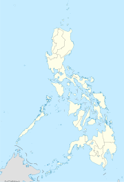
 Mount Pulag
 Luzon, Philippines
Coordinates 16°35′0.86″N 120°53′0.93″E / 16.5835722°N 120.8835917°ECoordinates: 16°35′0.86″N 120°53′0.93″E / 16.5835722°N 120.8835917°E Climbing First ascent Unknown Easiest route Hike Mount Pulag (or sometimes Mount Pulog) is the second highest mountain in the Philippines. It is Luzon’s highest peak at 2,922 meters above sea level. The borders between the provinces of Benguet, Ifugao, and Nueva Vizcaya meet at the mountain's peak.
Because of its high elevation, the climate on Mount Pulag is temperate with rains predominating the whole year. Rainfall on the mountain averages 4,489 mm yearly with August being the wettest month with an average rainfall of 1,135 mm. Snow has not fallen on its top in at least the past 100 years.
The mountain hosts 528 documented plant species. It is the natural habitat of the endemic Dwarf Bamboo, (Yushania niitakayamensis) and the Benguet pine (Pinus insularis) which dominates the areas of Luzon tropical pine forests found on the mountainside. Among its native wildlife are 33 bird species and several threatened mammals such as the Philippine Deer, Giant Bushy-Tailed Cloud Rat (“bowet”) and the Long-Haired Fruit Bat. Mount Pulag is the only place that hosts the 4 Cloud Rat species. It has one of the most diverse biodiversity of the Philippines, with the newly found (since 1896) 185 grams Dwarf cloud rat, Carpomys melanurus, a rare breed (endemic to the Cordillera) and the Koch pitta bird among its endangered denizens.[2][3]
On February 20, 1987, a large part of the mountain was designated as a National Park with Proclamation No. 75. This act aims to preserve the environment around the mountain due to threats from increased development such as conversion to agricultural lands, timber production, hunting, and increased tourism.
The indigenous people of Benguet consider the mountain to be a sacred place.
Contents
Hiking activity
As the highest mountain in Luzon, Mount Pulag attracts a lot of mountain climbers. Highlights of the climb include the montane forests and the grassland summit with its "sea of clouds" phenomenon. There are four major trails up the summit: the Ambangeg, Akiki, and Tawangan trails from Benguet and the Ambaguio trail from Nueva Vizcaya. These trails are managed by the Mount Pulag National Park, under the Department of Environment and Natural Resources.
The national park is open throughout the year. A permit is necessary. Depending on the trail, a climb may take 1–4 days, with the easiest being the Ambangeg trail. The difficulty level of the climb ranges from 3 to 7 out of 9 in the local classification system. No special equipment is required for the climb.[4]
The National Park is inhabited by different tribes such as the Ibalois, Kalanguya, Kankana-eys, Karao, Ifugaos and the Ilocanos.
It is the third highest mountain in the Philippines, next to Mount Apo and Mount Dulang-Dulang
Presidential helicopter crash
On 7 April 2009 a Philippine Air Force (PAF) Bell 412 of the Presidential Airlift Wing crashed at 6,900 feet above sea level in the Kabayan-Pulag pass between Mount Mangingihi and Mount Pulag in thick low cloud and fog. All eight aboard, including presidential aides, died in the crash and resultant fire.[5][6] Mount Pulag guides assisted in locating the wreckage and in the recovery of the bodies.
See also
- List of mountains in the Philippines
- List of Southeast Asian mountains
References
- ^ a b de Ferranti, Jonathan; Aaron Maizlish. "Philippine Mountains - 29 Mountain Summits with Prominence of 1,500 meters or greater". http://www.peaklist.org/WWlists/ultras/philippines.html. Retrieved 2011-01-31.
- ^ GMA NEWS.TV, NUJP members climb Mt. Pulag for press freedom
- ^ Inquirer.net, Team finds rare cloud rat breed after 112 years
- ^ PinoyMountaineer: Mt. Pulag
- ^ Deeper probe into presidential chopper’s crash sought
- ^ No survivors in chopper crash
External links
- Mt. Pulag, Pinoy mountaineer.
World Heritage Sites in the Philippines World Heritage Sites Baroque Churches of the Philippines (San Agustin Church · Paoay Church · Santa Maria Church · Miag-ao Church) · Puerto Princesa Subterranean River National Park · Rice Terraces of the Philippine Cordilleras ( Batad Rice Terraces · Bangaan Rice Terraces · Hungduan Rice Terraces · Mayoyao Central Rice Terraces · Nagacadan Rice Terraces) · Tubbataha Reef · Historic Town of Vigan
Tentative List Agusan Marsh Wildlife Sanctuary · Angono Triglyphs · Apo Reef Natural Park · Baroque Churches of the Philippines Extension (Boljoon Church · Guiuan Church · Loboc Church · Lazi Church · Tumauini Church) · Batanes Protected Landscapes and Seascapes · Butuan Archeological Sites · Chocolate Hills Natural Monument · Coron Island Natural Biotic Area · El Nido-Taytay Managed Resource Protected Area · Jesuit Churches of the Philippines (Guiuan Church · Baclayon Church · Loboc Church ) · Kabayan Mummy Burial Caves · Ligwasan Marsh · Mount Apo Natural Park · Mount Hamiguitan Range Wildlife Sanctuary · Mount Iglit-Baco National Park · Mount Malindang Range Natural Park · Mount Matutum Protected Landscape · Mount Pulag National Park · Neolithic Shell Midden Sites in Lal-lo and Gattaran Municipalities · Northern Sierra Madre Natural Park and outlying areas inclusive of the buffer zone · Paleolithic Archaeological Sites in Cagayan Valley · Panglao Island, Bohol · Petroglyphs and Petrographs of the Philippines · San Sebastian Church · Spanish Colonial Fortifications of the Philippines (Fuerza de Capul · Dauis Watchtower · Punta Cruz Fortification · Fuerza de San Andres · Fuerza de Sta. Isabel) · Taal Volcano Protected Landscape, Batangas · The Maranao Settlement of Tugaya · The Tabon Cave Complex and all of Lipuun · Turtle Islands Wildlife SanctuaryPrevious Nomination Historic Centre of Manila Intramuros · Town of TaalMount Apo • Mount Dulang-dulang • Mount Pulag • Mount Kitanglad • Mount Tabayoc • Mount Kalatungan • Mount Ragang • Mount Maagnaw • Mount Singakalsa • Mount AmuyaoCategories:- Mountains of the Philippines
- National parks of the Philippines


Wikimedia Foundation. 2010.