- Epifanio de los Santos Avenue
-
Epifanio de los Santos Avenue 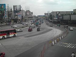
Length: 23.8 km (14.8 mi) North end: Monumento Rotonda in Caloocan Major
junctions:Diosdado Macapagal Boulevard/ in Pasay
Roxas Blvd in Pasay
Taft Ave in Pasay
SLEX at Magallanes in Makati
Ayala Avenue in Makati
Gil Puyat Ave (Buendia) in Makati
Shaw Blvd at Crossing in Mandaluyong
Ortigas Ave in Mandaluyong
Aurora Blvd at Cubao in Quezon City
Kamuning in Quezon City
Quezon Ave in Quezon City
North Avenue in Quezon City
Roosevelt/Congressional in Quezon City
NLEX/A. Bonifacio Avenue in Balintawak Quezon City
MacArthur Highway/Rizal Avenue Extension in Caloocan CitySouth end: SM Mall of Asia in Pasay 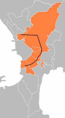 EDSA's location within Metro Manila The cities it passes through are indicated in orange.
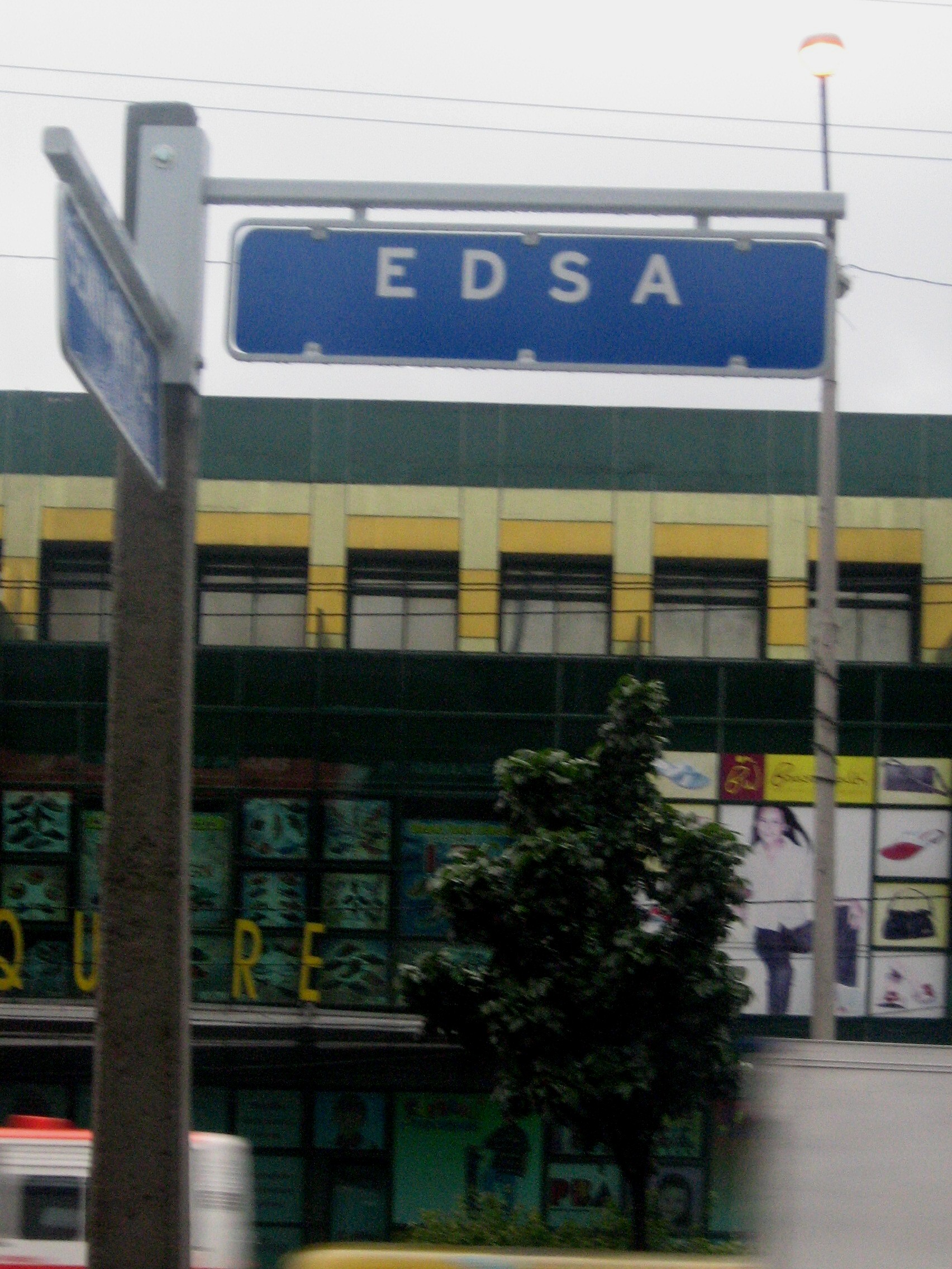
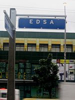 Street sign of EDSA in Quezon City.
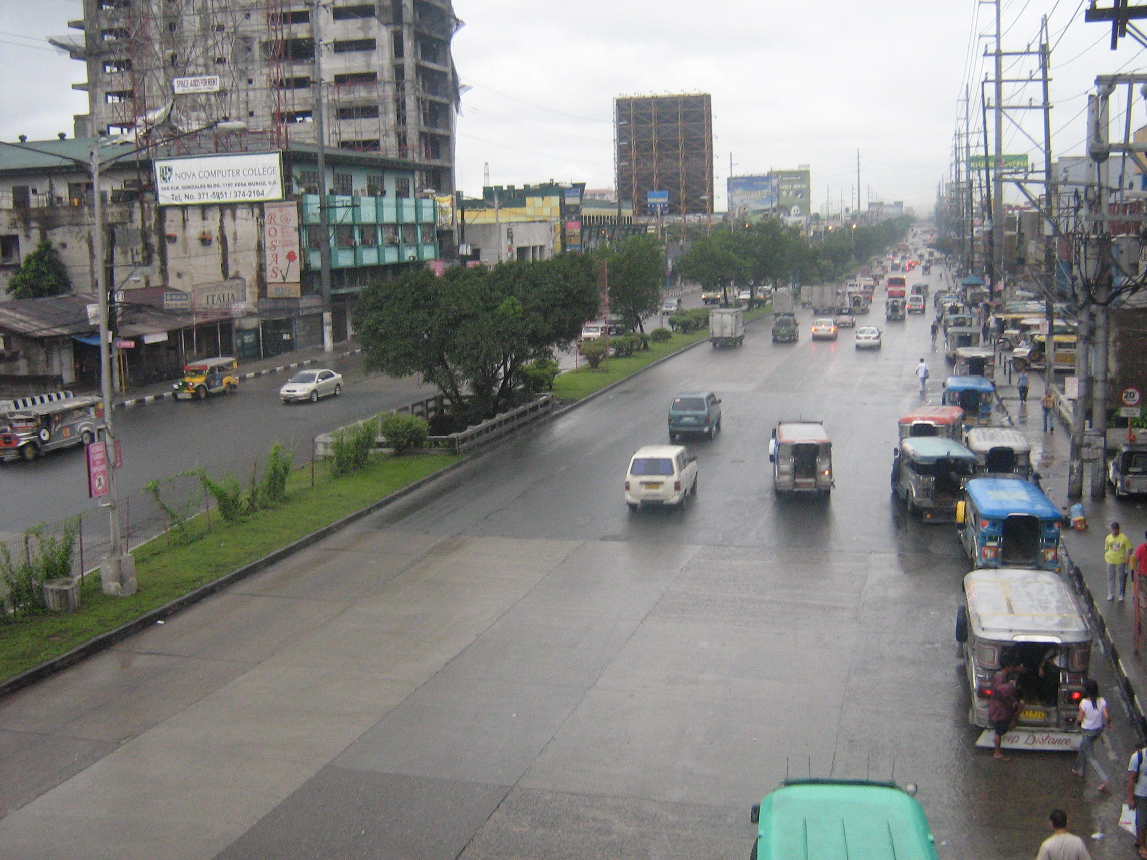
Epifanio de los Santos Avenue (EDSA, pronounced ed-sah), formerly known as Highway 54, is the main circumferential road and highway of Metro Manila in the Philippines. It is an important commuting artery between the northern and southern parts of the metropolitan area. EDSA is a partially-controlled access, mostly 10-lane divided highway (expressway), with three general lanes and the two outer lanes reserved for buses and other HOV traffic. EDSA has many interchanges along its length that eliminate the need for traffic lights, though traffic lights exist where there is insufficient space or funds for a complete interchange. EDSA handles 316,345 cars per section on average every day.[1] Stretching some 24 kilometres (15 mi), it is one of the longest avenues in the Philippines.
EDSA forms the majority portion of the Circumferential Road 4 (C-4) in Metro Manila. Although it never runs within (nor adjacent to) the city limits of Manila proper, it runs in a rough semicircle around the City of Manila and, from the south, passes through the cities of Pasay, Makati, Mandaluyong, Quezon City, and Caloocan. Its southern endpoint is at a roundabout near the SM Mall of Asia in Pasay and its northern terminus is at Monumento, a monument to Andrés Bonifacio, in Caloocan. When the avenue was constructed during the presidency of Manuel L. Quezon, it was named 19 de Junio (June 19), after the birthday of national hero José Rizal. It was later renamed Highway 54, and under Republic Act No. 2140 in 1959 was further renamed in honor of Epifanio de los Santos, a noted Filipino historian.[2]
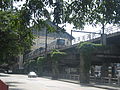
The Metro Rail Transit (MRT), Line 3 of the metropolis' railway system, runs along most of EDSA, from Taft Avenue in the south to North Avenue near the SM City North EDSA Mall in northern EDSA. The Light Rail Transit (LRT), Line 1, runs from the EDSA - North Ave. intersection in Quezon City to the Monumento roundabout in Caloocan City where the rail line turns left to Rizal Avenue Extension. The Light Rail Transit (LRT), Line 2 can be seen along the intersection EDSA and the rail line's path, Aurora Boulevard.
EDSA also figures prominently in the recent history of the Philippines for being the site of two peaceful demonstrations that toppled the administration of two Filipino presidents—the People Power Revolution of 1986 against Ferdinand Marcos and the EDSA Revolution of 2001 against Joseph Estrada.
Contents
Traffic management
Being the most important artery of the metropolis, EDSA handles a significant volume of the traffic that flows through the cities of Metro Manila. An average of 2.34 million vehicles go through EDSA every day.[3]
The lead agency that manages the flow of traffic along EDSA is the Metropolitan Manila Development Authority (MMDA), an agency that is under the Office of the President and is advised by the Metro Manila Mayors League. One of the MMDA's traffic management schemes that is in effect on EDSA, among other major thoroughfares, is the Unified Vehicular Volume Reduction Program, commonly known as the Number Coding Scheme. Many people observe that the cause of traffic jams on EDSA are erring bus and jeepney drivers especially as a multitude of the public utility vehicles they drive are unlicensed or "colorum". Subsequently, buses have been the target of other traffic management programs, like the MMDA's Organized Bus Route Program.[4][5]
Exits and major intersections
A list of exits, flyovers, underpasses, and major intersections along EDSA. There are no exit numbers along EDSA, as it is not an expressway.
Kilometre post Exit Name Exit Location Route description and remarks 0 Mall of Asia Roundabout Reclamation Area, Pasay A roundabout at the SM Mall of Asia marks the beginning of EDSA. Turning either direction on J.W. Diokno Boulevard provides access to the Mall of Asia. KM 1 Macapagal intersection This exit is a signalized intersection at Diosdado Macapagal Boulevard. Southbound takes you to Ninoy Aquino International Airport, Asia World City, the Manila-Cavite Expressway and Cavite. Northbound takes you to Star City Amusement Park and Manila. 1 Roxas Boulevard Intersection Pasay This exit at Roxas Boulevard was originally a fully signalized 4-lane intersection with a 4-lane flyover from Roxas Boulevard overhead, but due to the traffic jams it caused has been reconfigured with traffic cones and plastic highway barriers so as to allow you to go straight or turn right from EDSA. For NB EDSA travellers, exiting right takes you to Ninoy Aquino International Airport and Cavite, while Macapagal Boulevard can be used to access to NB Roxas Boulevard. And for SB EDSA travellers, exiting right takes you to Manila while Taft Avenue, Quirino Avenue and Airport Road can be used to access SB Roxas Boulevard to Cavite. KM 1 F.B. Harrison/Quirino Avenue This intersection with F.B. Harrison/Quirino Avenue has also been reconfigured so that going straight and turning right are your only choices. There are however plenty of nearby U-turn ramps. Southbound is another route to Cavitei Province and provides access to NAIA Domestic terminal and NAIA Terminal 3. Access from SB EDSA to SB Quirino Avenue can be obtained using Taft Avenue. Northbound takes you to Manila. 2 Taft Avenue Intersection This exit is a signalized intersection with Taft Avenue. Southbound takes you back to Quirino Avenue and NAIA Domestic terminal. Northbound Taft Avenue takes you to Manila and Quezon City. MRT Taft Avenue and LRT EDSA are located near this intersection. KM 2 Aurora Boulevard Flyover (EDSA-Tramo) Because of the MRT Tracks, there is no access to SB EDSA from Aurora Boulevard, but there is a flyover from EDSA that provides access to Aurora Boulevard. Aurora Boulevard provides access to NAIA Terminal 3, NAIA domestic terminal, and is another route to SLEX and the Skyway. EDSA-Evangelista (Southbound - Bangkal, Makati) KM 4 Magallanes/SLEX/Chino Roces (Pasong Tamo) Makati This exit provides access to the SLEX. There is a 2-way flyover for motorists wishing to stay on EDSA. NB EDSA travellers can keep right to access an intersection with the SLEX, on which northbound heads to Manila and southbound heads to Cavite, Laguna, and Batangas provinces. For SB EDSA Travellers, there is a separate flyover which splits into two. Keeping on the right takes you to Manila, while to the left takes you to SB SLEX to Santo Tomas, Batangas. There is also an exit on the southbound lanes on which you can access Chino Roces/Pasong Tamo. KM 5 Makati Underpass NB EDSA splits into two here. Keeping left will take you straight on EDSA and to Ayala Avenue, while to the right, Arnaiz/Pasay Road can be accessed. KM 5 Arnaiz Ave. (Pasay Road) This exit is a signalized intersection with Pasay Road, on which NB you can take into the Makati CBD and southbound to Dasmariñas Village. 5 Ayala Avenue/EDSA-Mckinley Although continuing straight from Arnaiz does provide access to this road, there is another exit from the NB Makati underpass before the intersection to access Ayala Avenue, Makati City's main thoroughfare, on which WB you can take to Makati CBD, the Ayala Triangle and to Manila, and EB you can take to Dasmariñas Village and Taguig Global City. There is also a flyover merging in from EB Ayala to NB EDSA. KM 5 Makati Underpass SB Keeping left takes you on an express underpass towards the Mall of Asia while keeping right allows you to access Ayala Avenue and Arnaiz/Pasay Road. 6 Gil Puyat Exit (Buendia) There is access to Gil Puyat (Buendia) WB from SB EDSA, while access from NB EDSA can be obtained either by using a U-turn slot or via Ayala Avenue. There is no access to the Kalayaan flyover from EDSA. KM 6 EB Kalayaan Flyover from Gil Puyat (Buendia) Makati - Kalayaan Flyover Buendia splits into two at the beginning of the Kalayaan Flyover. Keeping right takes you to SB EDSA towards Ninoy Aquino International Airport, SM Mall of Asia and Cavite province, while keeping left takes you to the Kalayaan flyover main lanes. Just a short way from the beginning, there is an exit which you can take to access NB EDSA towards Richmond/Guadalupe, Ortigas CBD, Cubao, NLEX and Monumento. About midway through the flyover, there is an exit that can take you to the main lanes of Kalayaan Avenue towards Pateros, while keeping straight takes you to 32nd St. and Taguig Global City. KM 6 WB Kalayaan Flyover from 32nd Street. At 32nd street near the border of Taguig and Makati City, 32nd St. splits into two. Keeping right takes you to Kalayaan Avenue and EDSA, while keeping left takes you to the Kalayaan Flyover main lanes, Gil Puyat Ave., and Makati City. KM 6 WB Kalayaan Flyover from Kalayaan Avenue The Kalayaan flyover from Kalayaan Avenue is a little different. Just before the 32nd Avenue intersection, there is an exit ramp that takes you to the Kalayaan Flyover main lanes, Buendia, and Makati City. Keeping straight on Kalayaan Avenue provides access to EDSA. Just before EDSA, Kalayaan Avenue splits into two. Keeping left takes you onto a separate flyover that provides access to SB EDSA towards Ninoy Aquino International Airport, SM Mall of Asia and Cavite province. Keeping right takes you to NB EDSA towards Richmond/Guadalupe, Ortigas CBD, Cubao, NLEX and Monumento. KM 7 Richmond Flyover/EDSA-Estrella Makati From EDSA, Estrella St. can be accessed using a flyover from the northbound lanes, and by an exit from the southbound lanes. There is no access to NB EDSA from Estrella Street. Estrella St. provides access to Richmond/Guadalupe and Mandaluyong City. KM 8 Guadalupe Interchange-Bridge This parclo interchange with J.P. Rizal Avenue near the Guadalupe Bridge provides access to the Guadalupe district. MRT Guadalupe is located here and crosses the Pasig River. KM 9 Boni Avenue Intersection/EDSA-Pioneer Mandaluyong -- Ortigas CBD Only right turns are allowed at this intersection with Boni Avenue, although Boni Avenue does have a two-lane underpass under EDSA. WB Boni Avenue heads to Mandaluyong City Center and Manila. EB Boni Avenue (Becomes Pioneer Avenue shortly after leaving EDSA) is an alternative route to Ortigas CBD. MRT Boni Avenue and Robinson's Pioneer are located here. KM 10 Shaw Blvd. Underpass/Intersection (EDSA-Crossing) There is an underpass under Shaw Boulevard at the intersection for those willing to stay on EDSA. Otherwise, keeping right will take you to Shaw Boulevard. A 4-lane flyover over EDSA and MRT Shaw Boulevard are located over this intersection. WB Shaw Blvd.takes you to Manila. EB takes you to Ortigas CBD, Pasig City, and the C-5. KM 13 Doña Julia Vargas Ave. Intersection (EDSA-Megamall) This exit on the northbound side provides access to D. J. Vargas Avenue, SM Megamall, Ortigas CBD and the C-5 Expressway. There is no access from SB EDSA or from the Shaw Blvd. underpass (which merges with EDSA just a short distance to the north) to this intersection. KM 15 Ortigas Flyover (EDSA-Shrine) San Juan The Westside is going to San Juan and Greenhills Shopping Center and the Eastside is going to Pasig City and Cainta, Rizal EDSA-White Plains (Northbound - People Power Monument) EDSA-Connecticut (Southbound - Greenhills, San Juan) KM 18 Santolan Flyover (Col. Bonny Serrano) Quezon City The Eastside is going to Eastwood City and Marikina City and the Westside is going to New Manila KM 20 Cubao Underpass (Aurora Blvd. Tunnel) The Eastside is going to C-5 Road, Marikina City and Antipolo City and the Westside is going to San Juan City KM 24 EDSA-Kamuning Flyover The Northeastside is going to Quezon Memorial Circle and the Southwestside is going to Timog Area. This flyover seen on TV Stations ABS-CBN and GMA Network for live traffic updates because ABS-CBN Broadcast Center and GMA Network Center located near the flyover. KM 27 Quezon Avenue Flyover The Northeastside is going to Fairview and the Southwestside is going to Manila. Quezon Avenue station of MRT 3 is located nearby. KM 29 North Avenue Intersection (SM North EDSA/TriNoma) The Eastside is going to Veterans Memorial Medical Center and the Southside is going to Quezon Avenue.North Avenue station of MRT 3 and the proposed North Avenue/Grand Central Terminal is located nearby. KM 31 Congressional-Roosevelt Intersection (EDSA-Muñoz) The Northside is going to Tandang Sora and the Southside is going to Quezon Avenue. Roosevelt Avenue station of LRT 1 is located near the intersection. KM 33 NLEx-Balintawak Cloverleaf (Camachile) The Northbound enters you to North Luzon Expressway going to Valenzuela City, Central Luzon, Cagayan Valley, Ilocos Region and Cordillera Administrative Region and the Southbound enters you to A. Bonifacio Avenue going to Manila. Balintawak station of LRT 1 is located nearby. EDSA-Caloocan (Bagong Barrio and East Grace Park) KM 35 Bonifacio Monument Roundabout (Monumento) Caloocan The Bonifacio Monument is the Northend of EDSA. The Samson Road is continuation of C-4 Road from Monumento to Navotas City. The Rizal Avenue goes to Manila and the MacArthur Highway goes to North/Central Luzon. This is also the marker of 1896 Philippine Revolution together with the Katipunan headed by Andres Bonifacio. Monumento terminal of LRT 1 is located at the corner of the avenue and Rizal Avenue Extension. Date Results September 28 to October 1, 2006 Typhoon Milenyo, most notably the ones at the Ortigas Avenue junction in Mandaluyong. After a month, some of the billboards were put up again, while others were confiscated by the Metro Manila Development Authority. November 30 to December 1, 2006 The number of billboard related incidents caused by Typhoon Milenyo led the government to plan the retraction and removal of billboards from Monumento to the SM Mall of Asia, as a precaution to Super Typhoon Reming which was forecast to pass over Metro Manila, potentially causing more damage. However, the typhoon did not directly hit the metropolis, but due to strong rain showers, many of the billboards remained. Mid-March 2007 During the May 14, 2007 elections, actor and UNESCO Commissioner Cesar Montano put a billboard up along EDSA as he was running for the senate. Since campaign advertising through billboards is considered illegal for any and all political candidates, the authorities removed his billboard located along the part of EDSA beside the Pasig River (Makati-Mandaluyong-EDSA Boundary), near Robinson's Pioneer. Montano confronted the authorities on the Guadalupe Bridge and talked with MMDA employees while they removed his billboard.[citation needed] April 2 to 10 , 2007 The billboard advertisements beside the Manila MRT were reported to have black paint thrown at them. On April 9, 2007, the MMDA removed the ads that were affected by the black paint. The government then planned to initiate a campaign to apprehend those who vandalized the billboards by means of advertising the offenses, and posted the advertisements from North Avenue, Quezon City to Taft Avenue in Pasay City. It was discovered later on that it was a criminal youth gang that was responsible for the billboard vandalisms. Gallery
-
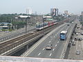
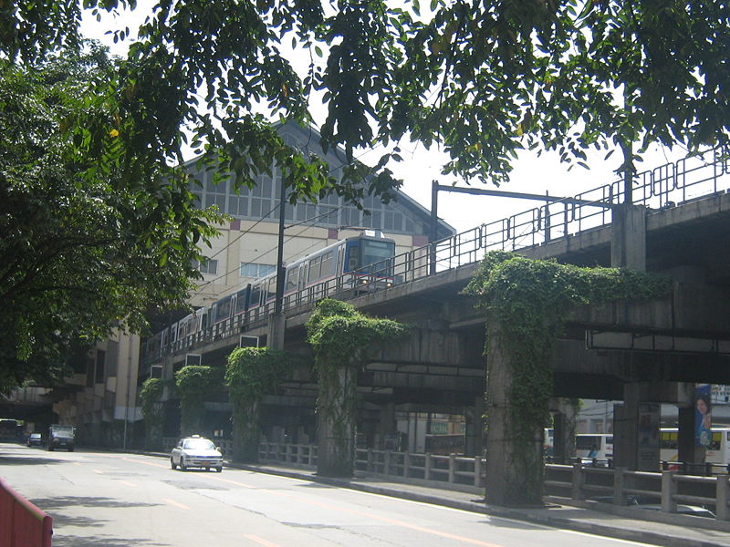
Northbound MRT train going out from the Shaw Boulevard Station while southbound vehicles pass through the Crossings Underpass.
-
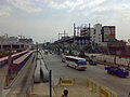
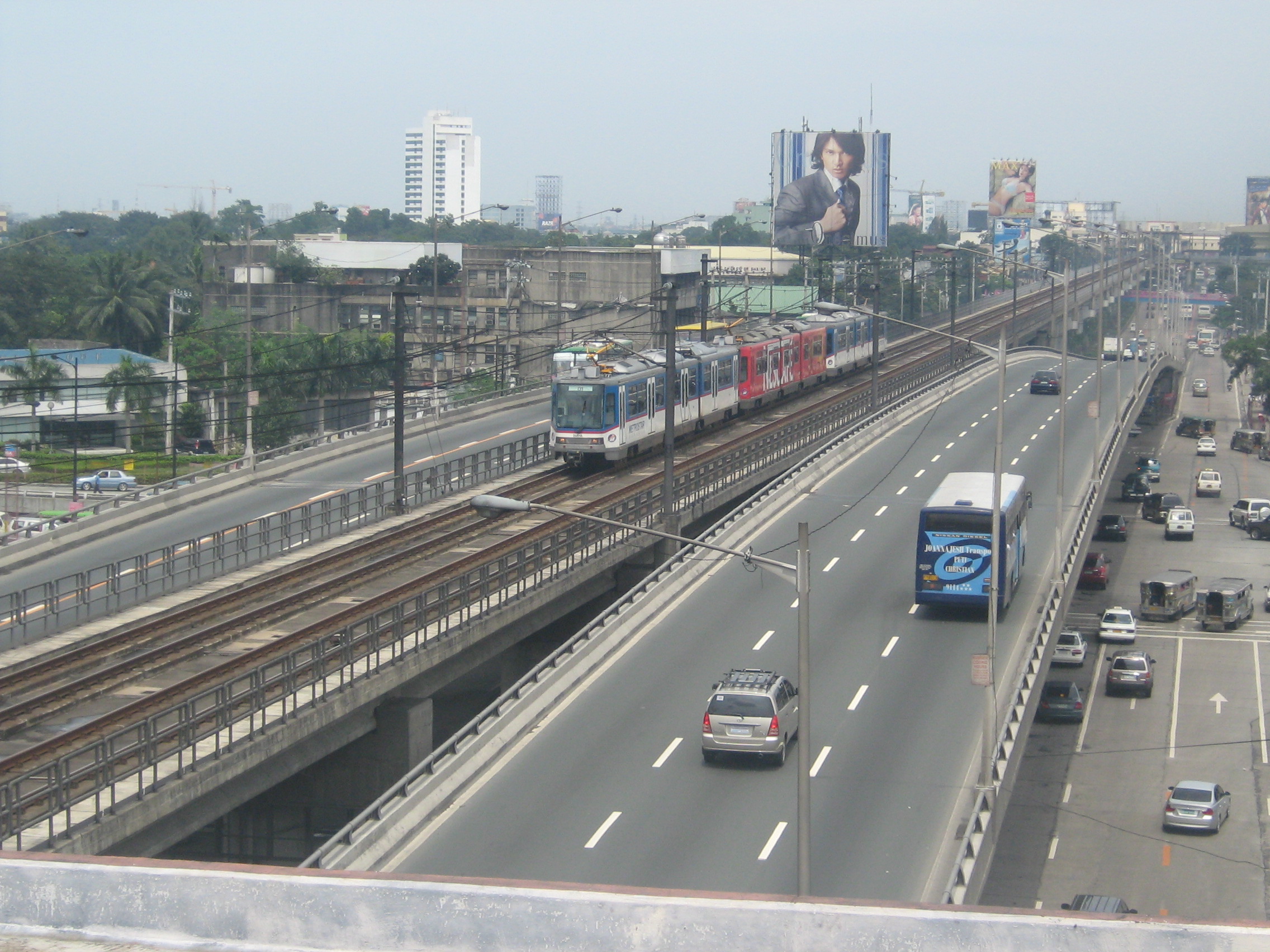
MRT Train in between the EDSA-Quezon Avenue Flyover.
-
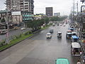
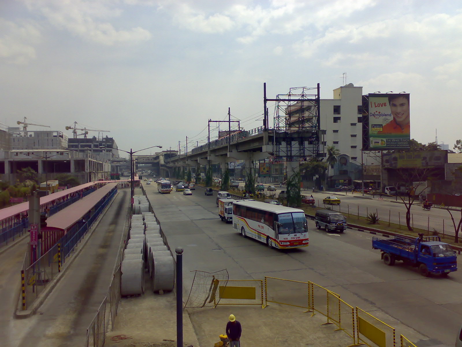
The end of the MRT tracks, looking south.
-
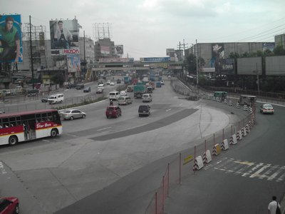
EDSA Northwest-bound to Balintawak, Quezon City.
References
- ^ Philippine Daily Inquirer July 7, 2009
- ^ Chan Robles Virtual Law Library - REPUBLIC ACT NO. 2140 - AN ACT CHANGING THE NAME OF HIGHWAY 54 IN THE PROVINCE OF RIZAL TO EPIFANIO DE LOS SANTOS AVENUE IN HONOR OF DON EPIFANIO DE LOS SANTOS, A FILIPINO SCHOLAR, JURIST AND HISTORIAN
- ^ Jao-Grey, Margarte (2007-12-27). "Too Many Buses, Too Many Agencies Clog Edsa". Philippine Center for Investigative Journalism. http://pcij.org/stories/2007/buses.html. Retrieved 2007-12-28.
- ^ MMDA Resolution No. 03-28
- ^ MMDA Resolution No. 04-01
See also
Transport connections Landmarks and Locations SM City North EDSA · National Council of Churches in the Philippines · TriNoma · GMA Network Center · Araneta Center · Camp Crame · Camp Aguinaldo · EDSA Shrine · Ortigas Center · People Power Monument · SM Megamall · Ayala Center · SM Mall of Asia · Bay CityEDSA Revolutions Transportation in the Philippines Transportation agencies Public utility vehicles Bus companies AB Liner · ALPS The Bus, Inc. · Baliwag Transit · Bonifacio Transport Corp. · CEM Trans Services, Inc. · Ceres Liner · Citylink Coach Services Inc. · Dagupan Bus Co., Inc. · De Leon Express · Dela Rosa Transit · DLTBCo · Dominion Bus Lines · EMBC · Farinas Transit Company · Fermina Express · Five Star Bus Company · G Liner · Genesis Transport Service Inc. · Greenline Express · Green Star Express Inc. · GV Florida Transport · HM Transport Inc. · Inocencio Aniceto Transportation · JAC Liner Inc. · JAM · Joanna Jesh Transport Corp. · Juaymah Maureen Transport · King of Kings Transport · Lilian Express · Partas · Peñafrancia Tours and Travel Transport Inc. · Philippine Rabbit · Philtranco · Santrans · Saulog Transit Inc. · Vallacar Transit Corporation · Victory Liner · Viron TransitMajor highways A. Soriano Highway · Aguinaldo Highway · C-5 · Commonwealth Avenue · EDSA (C-4) · Governor's Drive · Halsema Highway · MacArthur Highway · Maharlika Highway · Manila-Cavite Expressway (Coastal Road) · Marikina-Antipolo Highway · NAIA Expressway · North Luzon (NLEx) · Quirino Highway · Sayre Highway · Subic-Clark-Tarlac (SCTEx) · Skyway · South Luzon (SLEx) · Southern Tagalog Arterial Road (STAR Tollway)Railways International airports Airlines Air Philippines · Cebu Pacific · Interisland Airlines · Pacific Pearl Airways · Philippine Airlines · PAL Express · Sky Pasada · South East Asian Airlines · Spirit of Manila · Tair Airways · Zest AirwaysWater transportation Shipping lines Cebu Ferries · Cokaliong Shipping Lines · Gothong Lines · Gothong Southern · Lite Shipping Corporation · Montenegro Lines · Negros Navigation · Roble Shipping Inc. · Sulpicio Lines · SuperFerry · Supercat Fast Ferry Corporation · Trans-Asia Shipping LinesCategories:- Roads in the Philippines
- Metro Manila
- Quezon City
-

Wikimedia Foundation. 2010.