- Manila-Cavite Expressway
-
For the other Radial Road 1 or R-1, see Roxas Boulevard.
Manila-Cavite Expressway (CAVITEx)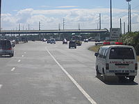
Aguinaldo Boulevard
Coastal Road
Radial Road 1
CAVITEXRoute information Length: 12.5 km (7.8 mi) Major junctions North end: Roxas Boulevard in Parañaque City Pacific Avenue in Asia World City, Don Galo, Parañaque City
Victor Medina Street in Kabihasnan, San Dionisio, Parañaque City
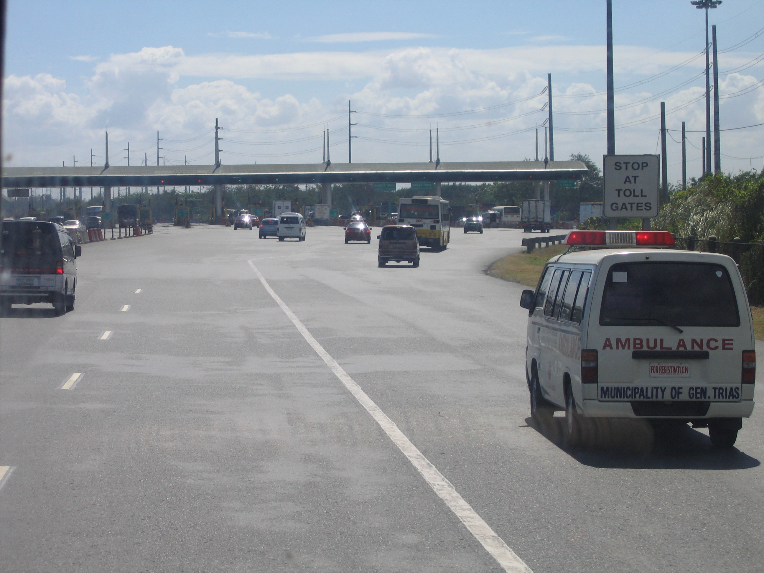
Zapote-Alabang Road in Longos, Zapote 5, Bacoor, CaviteSouth end: Kawit, Cavite Location Major cities: Parañaque and Las Piñas in Metro Manila Towns: Bacoor and Kawit in Cavite Highway system The Manila-Cavite Expressway or Aguinaldo Boulevard is a 6.6 km (4.1 mi) tollway/expressway in the Philippines. It is considered part of the Radial Road 1 (R-1) of Metro Manila. It is owned and operated by the Public Estates Authority Tollway Corporation (PEATC), a government owned and / or owned corporation and a subsidiary of the Public Estates Authority, an office under the Office of the President. It is also nicknamed the Coastal Road because of its vicinity to the Manila Bay.
At the north end, it feeds into and from Roxas Boulevard in the city of Parañaque in Metro Manila, also part of R-1. At the south end, it connects to Kawit, Cavite
In 2011, the extension going to Kawit, Cavite, which is named as CAVITEX, is already open to the public, where it will eventually connect to C-6, the now-under-construction Bulacan-Rizal-Manila-Cavite Regional Expressway and to the proposed Cavite-Laguna Expressway. Meanwhile, when the C-5 circumferential road and the NAIA Expressway is extended southward, it will also eventually be connected to the expressway as well. It will be the street alignment of the Manila LRT Yellow Line South Extension when completed in Paranaque City. It will have 2 stations, namely: Asia World and Ninoy Aquino International Airport.
There are currently no true interchanges along this tollway (although there are a number of at-grade "exit points" along the northbound length, mostly property access), and there is a single toll barrier about midway. Vehicles are charged a flat toll rate based on class. Though the toll facility currently has no ability for electronic toll collection, PEATC is currently researching its viability for the expressway.
Contents
Toll
(PhP 22 for class 1 vehicles, PhP 43 for class 2, PhP 65 for class 3)
Class Amount 1 PhP 22.00 2 PhP 43.00 3 PhP 65.00 Exits
These are the status of the exits of Manila Cavite Expressway. On the expressway segment, exit numbers start at 9. As of now there is no official 'KM 0.' Officially, the stretch of road north of NAIA Road is Roxas Boulevard, however there are a few important intersections on that short section up to EDSA. Exit numbers currently are not posted anywhere on the expressway.
Exit list
Kilometer No. Exit Interchange type Location Remarks 9 NAIA Road Intersection Intersection Parañaque This intersection is located at the end of the Manila-Cavite Expressway. NAIA Road provides access to Ninoy Aquino International Airport Terminals 1 and 2 and Domestic Terminal. 9 Southbound Caltex service station This service station on the southbound lanes has a Caltex gas station and a Star Mart convenience store, located just after the NAIA Road Intersection. 10 Asia World City entrance This is an entrance ramp located before the toll barrier, providing access to Asia World City. An exit ramp to this road remains closed and the exit roadway has been grown over with plants. 12 Kabihasnan entrance ramp Las Piñas This entrance ramp with a toll barrier on the northbound lanes is located on Victor Medina Street. This entrance ramp provides access from Quirino Avenue and Ninoy Aquino Avenue of the nearby Kabihasnan Area. 13 Las Piñas Toll Barrier The only Toll Barrier/Plaza along the expressway. 15 Las Piñas U-Turn Ramp U-Turn Ramp Bacoor, Cavite A U-Turn ramp on the expressway allows you to turn around to head back towards Manila, but it might be removed when the Zapote Trumpet Interchange is complete. 15 Zapote Exit Intersection (Future: Trumpet) This exit provides access to Real Street/Alabang-Zapote Road which heads towards the Alabang area in Muntinlupa. This is where the expressway section ends, and redirects onto a short 4-lane road with intersections and property access. It is being converted into a decent trumpet interchange while the expressway is being extended from here through land reclamation. 16 Alabang-Zapote Flyover This exit on the Alabang-Zapote Road is a 4-lane overpass over Quirino Avenue (different from the other Quirino Avenue [C-2] in Malate). Staying on the main road takes you to Quirino Avenue, on which southbound can take you to Bacoor and northbound can take you back to Manila. 17 Aguinaldo Highway Intersection Continuing south on Aguinaldo Highway can take you to Imus, Dasmariñas, Trece Martires, and further on to Tagaytay City. 23 Kawit Toll Barrier Kawit, Cavite This is the second toll barrier in the R-1 System. 24 Kawit Interchange This exit in Kawit, Cavite marks the end of the Manila-Cavite Expressway. This also serves as a shortcut going to Noveleta, Cavite, Tanza, Cavite and Cavite City, Cavite. External links
 Philippine Expressways
Operational Bataan Provincial Expressway (BPEx) • Manila-Cavite Expressway (CAVITEx) • Metro Manila Skyway (MMSW) • NAIA Expressway • North Luzon Expressway (NLEx) • South Luzon Expressway (SLEx) • Southern Tagalog Arterial Road (STAR Tollway) • Subic-Clark-Tarlac Expressway (SCTEx) • Subic-Tipo Expressway (NLEx Segment 7)Planned Cavite-Laguna Expressway (CALA) • Cebu Trans-Axial Expressway • Tarlac-Nueva Ecija-Aurora Expressway (TNAEx) • North Luzon West Expressway (NLWE) • North Luzon East Expressway (NLEE)Under construction Bulacan-Rizal-Manila-Cavite Regional Expressway (C-6) • Tarlac-Pangasinan-La Union Expressway (TPLEx)Transportation in the Philippines Transportation agencies Public utility vehicles Bus companies AB Liner · ALPS The Bus, Inc. · Baliwag Transit · Bonifacio Transport Corp. · CEM Trans Services, Inc. · Ceres Liner · Citylink Coach Services Inc. · Dagupan Bus Co., Inc. · De Leon Express · Dela Rosa Transit · DLTBCo · Dominion Bus Lines · EMBC · Farinas Transit Company · Fermina Express · Five Star Bus Company · G Liner · Genesis Transport Service Inc. · Greenline Express · Green Star Express Inc. · GV Florida Transport · HM Transport Inc. · Inocencio Aniceto Transportation · JAC Liner Inc. · JAM · Joanna Jesh Transport Corp. · Juaymah Maureen Transport · King of Kings Transport · Lilian Express · Partas · Peñafrancia Tours and Travel Transport Inc. · Philippine Rabbit · Philtranco · Santrans · Saulog Transit Inc. · Vallacar Transit Corporation · Victory Liner · Viron TransitMajor highways A. Soriano Highway · Aguinaldo Highway · C-5 · Commonwealth Avenue · EDSA (C-4) · Governor's Drive · Halsema Highway · MacArthur Highway · Maharlika Highway · Manila-Cavite Expressway (Coastal Road) · Marikina-Antipolo Highway · NAIA Expressway · North Luzon (NLEx) · Quirino Highway · Sayre Highway · Subic-Clark-Tarlac (SCTEx) · Skyway · South Luzon (SLEx) · Southern Tagalog Arterial Road (STAR Tollway)Railways International airports Airlines Air Philippines · Cebu Pacific · Interisland Airlines · Pacific Pearl Airways · Philippine Airlines · PAL Express · Sky Pasada · South East Asian Airlines · Spirit of Manila · Tair Airways · Zest AirwaysWater transportation Shipping lines Cebu Ferries · Cokaliong Shipping Lines · Gothong Lines · Gothong Southern · Lite Shipping Corporation · Montenegro Lines · Negros Navigation · Roble Shipping Inc. · Sulpicio Lines · SuperFerry · Supercat Fast Ferry Corporation · Trans-Asia Shipping LinesMajor roads in Cavite Coastal Road/CAVITEx (R-1) · Aguinaldo Highway · Governor's Drive · A. Soriano Highway · Daang Hari · C.M. Delos Reyes Avenue · Tirona Highway (25) · Molino Road · South Luzon Expressway (R-3) · Cavite-Laguna Expressway · Bulacan-Rizal-Manila-Cavite Regional Expressway (C-6)Categories:- Toll roads in the Philippines
- Transportation in the Philippines
Wikimedia Foundation. 2010.