- Metro Manila Skyway
-
Metro Manila Skyway
South Metro Manila Skyway Project
North Metro Manila Skyway Project
NLEx-SLEx Connector Road ProjectRoute information Length: 16.3 km (10.1 mi)
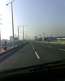
including Stage 2Major junctions North end: South Luzon Expressway, Barangay San Isidro, Makati City South end: South Luzon Expressway and Bunye Road, Alabang, Muntinlupa City Location Major cities: Makati City, Pasay City, Parañaque City, Muntinlupa City, Manila (later expansion), and Caloocan City (later expansion) Highway system  On the northbound lane of the Skyway.
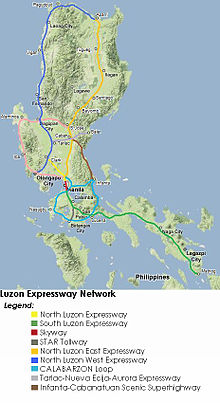 Luzon's Expressway Network. The Skyway is colored red on the map.
The Metro Manila Skyway is an elevated highway crossing over much of the existing South Luzon Expressway as of the moment. It is located within the Metro Manila portion of the SLEX and crosses through Makati City, Pasay City, Parañaque City, and Muntinlupa City. The Skyway begins in Barangay San Isidro, Makati City, and ends in Barangay Alabang, Muntinlupa City. In the future, it will extend further to the North Luzon Expressway via Manila and Caloocan City.
Contents
History
With the opening of the Skyway system, Filipino motorists are treated to a toll road network as traffic at the South Luzon Expressway considerably improved with the additional roadway capacity, rehabilitated roads, upgraded and newly constructed facilities.
On November 27, 1995, PT CITRA, an investor, entered into a Supplemental Toll Operation Agreement (STOA) with the Republic of the Philippines, through the Toll Regulatory Board (TRB), as grantor, and the Philippine National Construction Corporation (PNCC) as operator. The STOA was the result of negotiations among the parties which officially began on October 31, 1994 with the organization of the Technical Working Group composed of representatives from the Board of Investments (BOI), the Department of Finance (DOF), AIA Capital as financial adviser, the Department of Public Works and Highways (DPWH), the TRB, the PNCC, and the PT CITRA Group.
Under the STOA, CMMTC was mandated to finance, design and construct stage 1 of the South Metro Manila Tollway Project, consisting of both an elevated expressway from Bicutan to Gil Puyat and integrating into it the upgrade and the rehabilitation of the at-grade portion of the South Metro Manila Tollway project, consisting of both an elevated expressway from Nichols to Alabang, are considered as an integrated system of the South Metro Manila Tollway : Stage 1. The STOA was duly approved by the former Philippine President Fidel V. Ramos on April 7, 1996.
In January 1997, TRB and CMMTC, together with the project contractor Hutama RSEA JO. Inc. independent consultants to the TRB Pertconsult International Philippines, consulting engineers Renardet S.A., Inter-Structure System, Inc., Design Science Incorporated, DMJM International USA, and design consultants Pacific Consultants International, in association with J.P. Cancio & Associates, completed a survey for rehabilitation works required on the at-grade portion of the SLEX from Nichols to Alabang. CMMTC has spent $32,746,652.19 in the Skyway Project Phase 1.
Construction began on August 24, 1995. Gil Puyat Avenue (Buendia), Makati, Magallanes Village, Skyway Toll Plazas A and B and Bicutan Exits were first to be completed on December 26, 1997. The Don Bosco Exit began its construction on November 17, 2001 and was completed on January 3, 2002. NAIA Terminal 3 Exit was in construction between September 5, 2004 and 2010.
On February 2007, the Chinese Prime Minister Wen Jiabao together with the PNCC and the Philippine Government approved and signed the extended STOA.
At present, the Skyway System is now being operated by the Skyway Operations and Maintenance Corporation (SOMCo.), which replaced the PNCC Skyway Corporation in its tollway management and other related functions.
On April 2, 2009, Citra Metro Manila Tollways Corp. announced it will start construction on the second stage of the Skyway by the end of the week[1]. By June 2009 the construction of new pilars is going on.
On May 4, 2010, The Skyway Stage 2 is 50% done and Citra Metro Manila Tollways Corp. rotated highest pierhead in Sucat area.
On July 25, 2010, The Skyway Stage 2 is 65% done, DMCI has finished concreting 134 of the required 238 spans, and has started asphalt overlay.
On December 15, 2010, The Bicutan-Sucat portion of Stage 2 finally opened to the public. The Skyway reverted its toll rates back to its 2007 levels last December 22, 2010. By this time, motorists can use this portion for free.
On April 6, 2011, Hillsborough exit ramp, Alabang toll plaza, and South Station Exit were opened to the public. It is toll-free until April 25. And the existing toll plazas in Nichols had stopped collecting transactions instead, the toll plazas in Bicutan, Sucat and Alabang will collect fees. The temporary ramp in Bicutan from/going to SLEX was closed and was replaced by the new ramp in front of Hillsborough, which allows traffic to enter and exit the Skyway from the service roads.
Stage two will extend the existing 9.5-kilometer Gil Puyat (Buendia)-Bicutan elevated toll road by about seven kilometers, from Bicutan to Alabang. The construction area at the median section of the toll road in Bicutan will be initially extended to Sucat and fenced off with concrete barriers.
Stage three is a proposed 13-kilometer project extending from Gil Puyat (Buendia) to Mindanao Avenue, connecting North Luzon Expressway to South Luzon Expressway via Segments 9 and 10 of the NLEX Phase 2.
Skyway's new toll rates will occur on April 26, 2011.
Skyway's operator and functions
The rehabilitated at-grade portion of the South Luzon Expressway (SLEX) from Nichols to Alabang and the elevated Expressway from Buendia to Bicutan is now being called the Metro Manila Skyway System. It is operated by the Skyway Operations and Maintenance Corporation (SOMCo), a company of the existing PNCC – concession holder, Citra Metro Manila Tollways Corporation. SOMCo took over the operations and maintenance of the Skyway from the former operator, PNCC Skyway Corporation, effective January 2008 and was established in compliance to the provision stipulated in the July 2007 Amended Supplemental Toll Operators Agreement (A-STOA) between the PNCC, Citra Metro Manila Tollways Corp. and the Toll Regulatory Board (TRB), which gave the management of the 35-kilometer toll road to Citra.
Starting 2008, SOMCo is in charge of the three major operational functions, mainly: the traffic safety and security, the maintenance of facilities, and the toll collection.
Metro Manila Skyway projects and maintenance
South Metro Manila Skyway project stages
South Metro Manila Skyway is composed of Stages 1 and 2 of the whole Metro Manila Skyway Project.
Stage 1
Stage 1 involves the rehabilitation of the Magallanes-Alabang at-grade portion and the construction of a 6 lane, 10 kilometer elevated expressway from Gil Puyat (Buendia) to Bicutan. Stage 1 started on April 7, 1995 and was completed and opened on October 1999.
Stage 2
Stage 2 involves the construction of a 7-kilometer Elevated Expressway from Bicutan to Alabang's South Station, which began in the 2nd quarter of 2009 and was completed in April 2011. The Bicutan to Sucat segment opened on December 15, 2010, while the new Alabang toll plaza, and the Hillsborough and Alabang South Station exit ramps opened on April 6, 2011.
North Metro Manila Skyway Project/Connector Road project
North Metro Manila Skyway/Connector Road is composed of the Stage 3 of the whole Metro Manila Skyway Project.
Stage 3
Stage 3 or also called as Segment 11 in the NLEx Phase 2 project involves the construction of a 13.24 kilometer Elevated Expressway from Buendia (Skyway Stage 1) to the C-3 Road which will connect to the NLEx via Segment 10 of the NLEx Phase 2 project.
Motorists may soon enjoy streamlined driving from the North Luzon Expressway (NLEX) to the South Luzon Expressway (SLEX) with plans under way for an elevated road connecting both highways.
The government has reportedly accepted an unsolicited proposal from Metro Pacific Tollways Development Corp. (MPTDC) to build the 13.24-kilometer road. MPTDC is a subsidiary of Metro Pacific Tollways Corp. (MPTC), which runs NLEX.
Known as the Connector Road project, the elevated expressway will have a distance of 13.24 kilometers with 10.54 kilometers right over the Philippine National Railways tracks and the remaining 2.7 kilometers over Osmeña Highway.
It will be connected in the north to Segment 10, which will soon be constructed through the cities of Caloocan and Valenzuela. In the south, it will be linked to the Skyway near Sen. Gil Puyat Avenue (Buendia) in Makati City. Once completed, the Connector Road will have four entry and exit points: C-3 Road in Caloocan, España Blvd. and Quirino Avenue in Manila, and Gil Puyat (Buendia) in Makati.
Construction of the project is estimated to cost P17 billion, but as an "all-elevated" structure, right-of-way acquisition shall be reduced to an estimated cost of only P2.41-billion. Construction is anticipated to start in 2012 when NLEX Segments 9 and 10 are complete.
Future expansion
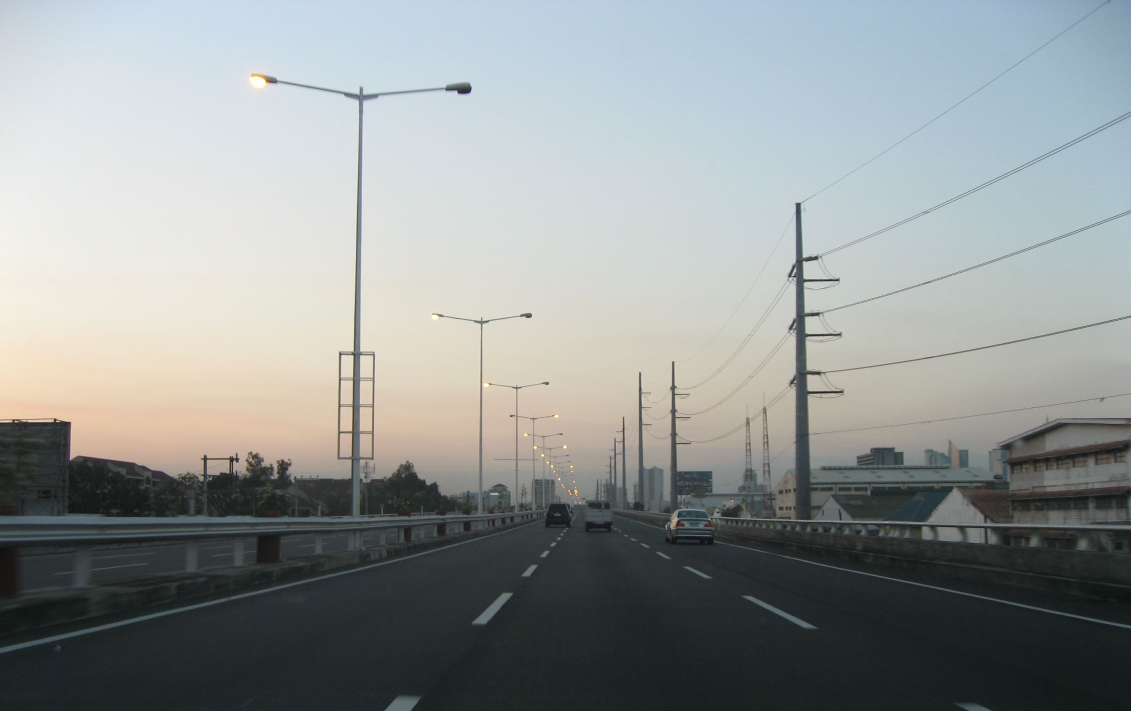
 On the southbound lane of the Skyway.
On July 23, 2007, President Gloria Macapagal-Arroyo announced in her State of the Nation Address (SONA) that the Metro Manila Skyway will be extended and link the missing segment from Bicutan to Alabang, also called the Metro Manila Skyway Phase 2.
The road widening in Filinvest Exit, its future exit, Putatan Temporary Exit Ramp (near Shell Southbound – Muntinlupa) is now almost complete (See South Luzon Expressway). Initially, the construction of the Phase 2 and painting of the posts was started at the San Martin de Porres Temporary Exit Ramp. Now, the construction of the Phase 2 is the further rotation of beams and placing girders since after the pillar construction reached Alabang, but it is expected to be complete by May 2011. The completion of Bicutan to Sucat section of the elevated toll road, including the slip ramps and opening to traffic is on December 2010. The construction is part of the South Luzon Expressway's Expansion and Upgrading Project of the Philippine Government.
When Phase 2 is complete, the San Martin de Porres Temporary Exit will be removed so the vehicles will exit in Sucat and Alabang, as its exits, going to the South Luzon Expressway.
The PNCC Skyway Corporation awarded the FF Cruz Construction Corporation as the main contractor responsible for the Phase 2 Project. Unfortunately, due to delays of pillar construction, DMCI is now the main contractor for Phase 2 which replaced FF Cruz since March 2009.
Metro Manila Skyway Phase 3 will extend the Skyway northwards and link the missing segment from Gil Puyat to Mindanao Avenue. It will be connected to North Luzon Expressway. But this phase is still in planning stages due to right-of-way problems. Currently, the government has reportedly accepted an unsolicited proposal from Metro Pacific Tollways Development Corp. (MPTDC) to build the 13.24-kilometer road. MPTDC is a subsidiary of Metro Pacific Tollways Corp. (MPTC), which runs NLEX. The proponent is taking a feasibility study for possible right-of-way via the tracks of the Philippine National Railways.
Technical specifications
- Name: Metro Manila Skyway
- Concession Holder: Citra Metro Manila Tollways Corporation
- Operator: Skyway Operations and Maintenance Corporation (SOMCo.)
- Length: 17 km
- Concession starting date: August 24, 1995 (it will start after the rehabilitation, modernization, and extension of the Alabang-Santo Tomas segment)
- Concession ending date: 2010
- Highway exits: 10
- Exit ramps: 3
- Toll plazas: 2
- Height: 11 meters (San Martin De Porres-Bicutan, Don Bosco-Gil Puyat, Makati CBD Exit and Hillsborough-Alabang), 43 meters (Bicutan-Toll A, and Sales-Don Bosco), normal (Toll A-B), 19 meters (Bicutan Exit, Sucat)
- Spurs: 3 (Makati CBD, Sales, and Bicutan); 6 (including Sucat, Hillsborough, Alabang, and Filinvest - for future expansion)
Exits
- Exits are numbered by kilometer post, with Rizal Park in Manila designated as Kilometer 0. It starts with KM6 because this is a part of the SLEx system
Current Exits/Entrance
Kilometer No. Exit Location Remarks 6 Buendia (Gil Puyat) Exit Ramp Makati City This is an Exit ramp from/going to SLEx. 7 Makati Exit This exit leads to a 4-lane spur road then curves left and descends to merge onto Amorsolo Street in the business village of Salcedo. Accessible only for northbound motorists. 7 Don Bosco Exit This exit on the northbound Skyway provides access to the Don Bosco Street intersection on the main SLEX. 9 Magallanes Exit This ramp is an access to the Skyway for southbound and to the SLEx for the Northbound. 9 NAIA Terminal 3 Exit Pasay City This exit leads to an elevated expressway called NAIA Expressway leading to the NAIA 3 terminal, it can be accessed from both Northbound and Southbound lanes of the Skyway. 14 Bicutan Exit Parañaque City This is an exit leading to Doña Soledad Avenue in Bicutan, Parañaque City. 18 Dr. A. Santos Exit (Sucat Exit) Muntinlupa City This is an exit leading to Dr. A. Santos Ave. or Sucat Road. 19 Skyway Alabang Main Toll Plaza A This replaced the former Skyway toll plaza in Nichols, Pasay City. 19 Skyway Alabang Main Toll Plaza B This is the second toll plaza. 20 Hillsborough Exit/Entry Ramp This replaced the San Martin de Porres Temporary Exit Ramp. This serves as the entry and exit point for motorists on the service roads. 22 Alabang South Station Exit/Entry Ramp This is an Entry/Exit Ramp to the Alabang South Station in Alabang, Muntinlupa City. It also leads motorists to the Alabang-Zapote Road. Future Exits/Entrance
Kilometer No. Exit Location Remarks TBA Manila North Harbor Exit (NLEX Segment 10) Caloocan City This will be an entry to Manila North Harbor and NLEX via NLEX Segments 10 and 9 (C-5 North Extension). TBA C-3 Road Exit/Entry Ramp This will be an Entry/Exit Ramp at C-3 Road in Grace Park, Caloocan City. TBA España Exit/Entry Ramp Manila This will be an Entry/Exit Ramp at España Boulevard in Sampaloc, Manila. TBA Quirino Exit/Entry Ramp This will be an Entry/Exit Ramp at Pres. Qurino Avenue in Malate, Manila. Former Exits/Entrance
Kilometer No. Exit Location Remarks 10 Skyway Nichols Toll Plaza A Pasay City The former Main Toll Plaza for cash and E-Pass Users, it is situated at both lanes. 10 Skyway Nichols Toll Plaza B The former Main Toll Plaza for E-Pass Users only situated on the Northbound lane. 15 San Martin de Porres Temporary Exit Ramp Parañaque City This was the temporary ramp leading down to SLEx before the construction of Skyway Stage 2. It was then removed when the permanent ramp in Hillsborough was opened to the public. Toll Fees (VAT-inclusive)
Class Amount (current as of October 17, 2011) Class 1
(Cars, Motorcycles, SUVs)PhP 164 Class 2
(Buses, Light Trucks)PhP 329 Class 3
(Heavy Trucks)PhP 493 See also
References
Links
South Luzon Expressway Provinces Cities and Municipalities Makati City • Pasay City • Parañaque City • Muntinlupa City • San Pedro • Biñan City • Carmona • Santa Rosa • Cabuyao • Calamba City • Santo Tomas • Tanauan City • Malvar • Lipa City • Ibaan • Batangas CitySLEx-Gil Puyat-Alabang Toll Road
(Metro Manila Skyway System)Buendia (Gil Puyat) • Magallanes • Sales • C5 • Merville • Bicutan • Sucat (Dr. A. Santos) • AlabangSLEx Toll Road 1 (Alabang Viaduct) AlabangSLEx Toll Road 2
(Alabang-Calamba Segment)Filinvest • Susana Heights • San Pedro • Southwoods • Carmona • Greenfield City/UNILAB • Sta. Rosa • Greenfield City/ETON City/Asia Brewery Inc. (Malitlit) • Cabuyao • Silangan • Canlubang • Batino • Calamba City (Turbina)SLEx Toll Road 3A
(Calamba-Sto. Tomas Segment)Santo Tomas (STAR Tollway)SLEx Toll Road 3B
(STAR Tollway)Santo Tomas • Tanauan City (Sambat) • Malvar (Bulihan) • Sto. Toribio • Lipa City (Tambo) • Ibaan (Malainen) • Batangas City (Balagtas)SLEx Toll Road 4
(Extension to Lucena City)Alaminos • San Pablo City • Tiaong • Candelaria • Sariaya • Lucena CityToll Barriers Nichols • Alabang • Calamba • SaimsimInvestors and Companies Citra Metro Manila Tollways Corporation • Skyway Operations and Maintenance Corporation • Manila Toll Expressway Systems • South Luzon Tollways Corp • STAR Infrastructure Development Corporation • STAR Tollway Corporation • Philippine National Construction Corporation Philippine Expressways
Operational Bataan Provincial Expressway (BPEx) • Manila-Cavite Expressway (CAVITEx) • Metro Manila Skyway (MMSW) • NAIA Expressway • North Luzon Expressway (NLEx) • South Luzon Expressway (SLEx) • Southern Tagalog Arterial Road (STAR Tollway) • Subic-Clark-Tarlac Expressway (SCTEx) • Subic-Tipo Expressway (NLEx Segment 7)Planned Cavite-Laguna Expressway (CALA) • Cebu Trans-Axial Expressway • Tarlac-Nueva Ecija-Aurora Expressway (TNAEx) • North Luzon West Expressway (NLWE) • North Luzon East Expressway (NLEE)Under construction Bulacan-Rizal-Manila-Cavite Regional Expressway (C-6) • Tarlac-Pangasinan-La Union Expressway (TPLEx)Transportation in the Philippines Transportation agencies Public utility vehicles Bus companies AB Liner · ALPS The Bus, Inc. · Baliwag Transit · Bonifacio Transport Corp. · CEM Trans Services, Inc. · Ceres Liner · Citylink Coach Services Inc. · Dagupan Bus Co., Inc. · De Leon Express · Dela Rosa Transit · DLTBCo · Dominion Bus Lines · EMBC · Farinas Transit Company · Fermina Express · Five Star Bus Company · G Liner · Genesis Transport Service Inc. · Greenline Express · Green Star Express Inc. · GV Florida Transport · HM Transport Inc. · Inocencio Aniceto Transportation · JAC Liner Inc. · JAM · Joanna Jesh Transport Corp. · Juaymah Maureen Transport · King of Kings Transport · Lilian Express · Partas · Peñafrancia Tours and Travel Transport Inc. · Philippine Rabbit · Philtranco · Santrans · Saulog Transit Inc. · Vallacar Transit Corporation · Victory Liner · Viron TransitMajor highways A. Soriano Highway · Aguinaldo Highway · C-5 · Commonwealth Avenue · EDSA (C-4) · Governor's Drive · Halsema Highway · MacArthur Highway · Maharlika Highway · Manila-Cavite Expressway (Coastal Road) · Marikina-Antipolo Highway · NAIA Expressway · North Luzon (NLEx) · Quirino Highway · Sayre Highway · Subic-Clark-Tarlac (SCTEx) · Skyway · South Luzon (SLEx) · Southern Tagalog Arterial Road (STAR Tollway)Railways International airports Airlines Air Philippines · Cebu Pacific · Interisland Airlines · Pacific Pearl Airways · Philippine Airlines · PAL Express · Sky Pasada · South East Asian Airlines · Spirit of Manila · Tair Airways · Zest AirwaysWater transportation Shipping lines Cebu Ferries · Cokaliong Shipping Lines · Gothong Lines · Gothong Southern · Lite Shipping Corporation · Montenegro Lines · Negros Navigation · Roble Shipping Inc. · Sulpicio Lines · SuperFerry · Supercat Fast Ferry Corporation · Trans-Asia Shipping LinesCars of the Philippines Categories:- Toll roads in the Philippines

Wikimedia Foundation. 2010.