- National Register of Historic Places listings in Polk County, Wisconsin
-
Buildings, sites, districts, and objects in Polk County listed on the National Register of Historic Places
-
- This National Park Service list is complete through NPS recent listings posted November 10, 2011.[1]
This document is intended to provide a comprehensive listing of entries in the National Register of Historic Places that are located in Polk County, Wisconsin. The locations of National Register properties, the latitude and longitude coordinates of which are included below, may be seen in a Google map.[2]
[3] Landmark name [4] Image Date listed Location City or town Summary 1 Cushing Land Agency Building 
September 1, 2005 106 S. Washington St.
45°24′37″N 92°38′37″W / 45.410278°N 92.643611°WSt. Croix Falls established in 1854 by Caleb Cushing, a Massachusetts lawyer, politician, and land speculator, the company handled real estate transactions in Polk, Burnett, Washburn, and Barron counties [1] 2 Dalles Bluff Site 
September 5, 1981 Address Restricted St. Croix Falls 3 First Baptist Church 
March 12, 2008 201 3rd Ave.
45°19′19″N 92°42′21″W / 45.321944°N 92.705833°WOsceola masonry building built in 1910 4 Frederic Depot March 21, 2003 210 Oak St. W
45°39′36″N 92°28′06″W / 45.66°N 92.468333°WFrederic 5 Geiger Building-Old Polk County Courthouse 
December 2, 1985 201 Cascade St.
45°19′15″N 92°42′21″W / 45.320833°N 92.705833°WOsceola served as county courthouse from 1882 to 1898. It had previously been a brewery and saloon. Beer storage area was used as county jail.[2] 6 Alvah A. Heald House 
December 2, 1985 202 Sixth Ave.
45°19′25″N 92°42′11″W / 45.323611°N 92.703056°WOsceola 7 Lamar Community Center March 1, 1982 NE of St. Croix Falls
45°25′26″N 92°34′09″W / 45.423889°N 92.569167°WSt. Croix Falls 8 Minneapolis, St. Paul and Sault Saint Marie Railway Depot 
December 13, 2000 114 Depot Rd.
45°19′03″N 92°42′30″W / 45.3175°N 92.708333°WOsceola built 1916 to replace a wooden structure. The brick structure was fancier than other Soo Line stations in towns of similar size. The Osceola Historical Society has restored it and uses it for interpretive historical education.[3] 9 Osceola Commercial Historic District 
December 13, 2000 Roughly along Cascade St., from First Ave. to Third Ave.
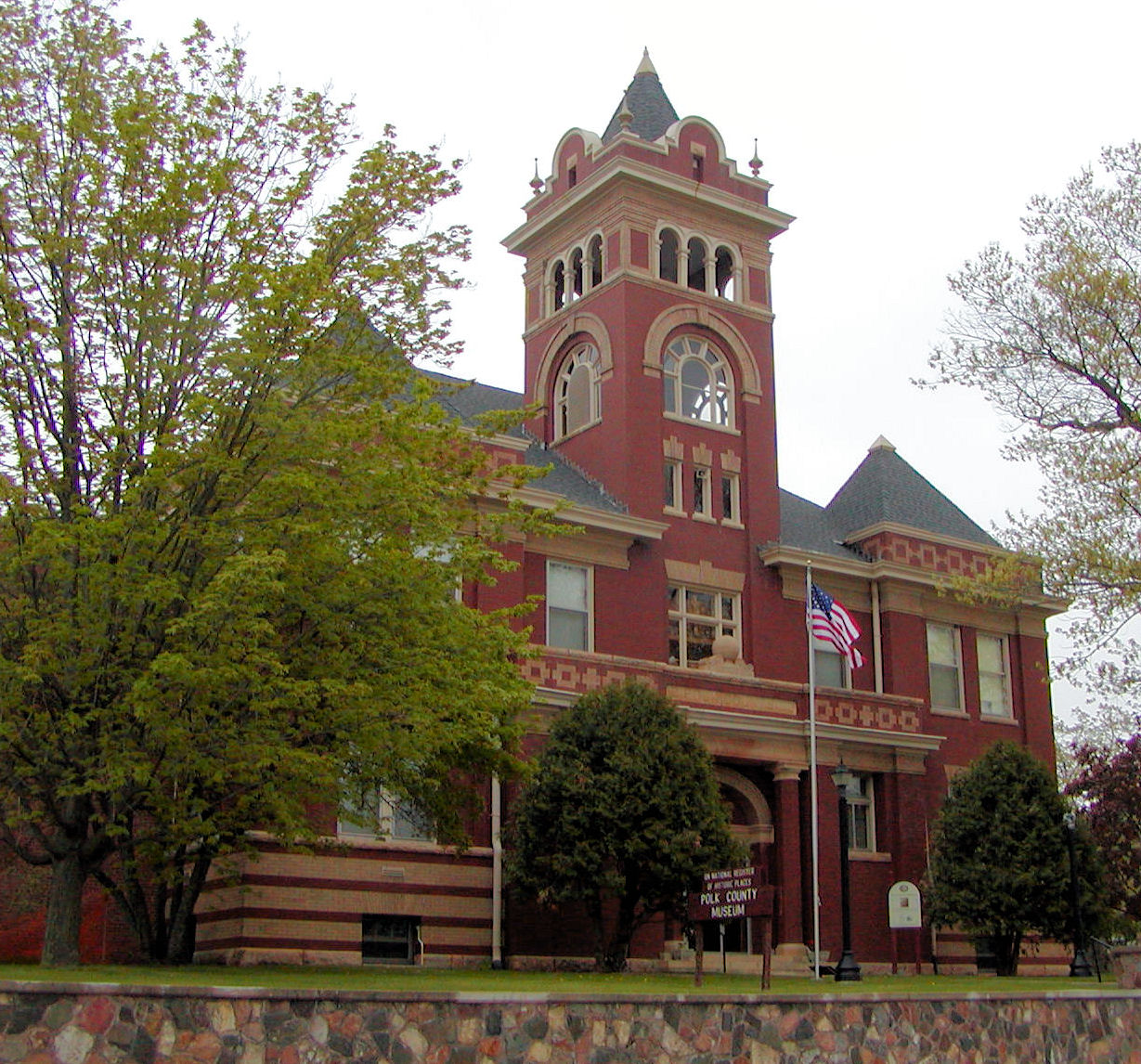
45°19′15″N 92°42′21″W / 45.320833°N 92.705833°WOsceola 10 Polk County Courthouse 
March 9, 1982 Main St.
45°27′07″N 92°27′08″W / 45.451944°N 92.452222°WBalsam Lake courthouse built in 1899 was converted into three floors of museum galleries featuring a general store, blacksmith shop, barbershop, kitchen, hardware store, bedroom, parlor, ethnic exhibits, military room, and the Native American room with wigwam 11 Seven Pines Lodge December 8, 1978 SE of Lewis of WI 35
45°41′46″N 92°22′57″W / 45.696111°N 92.3825°WLewis 12 St. Croix Falls Auditorium July 20, 2007 201 N Washington St
45°24′45″N 92°38′39″W / 45.4125°N 92.644167°WSt. Croix Falls 13 Thomas Henry Thompson House 
March 8, 1984 205 South Adams St.
45°24′41″N 92°38′39″W / 45.411389°N 92.644167°WSt. Croix Falls References
- ^ "National Register of Historic Places: Weekly List Actions". National Park Service, United States Department of the Interior. Retrieved on November 10, 2011.
- ^ The latitude and longitude information provided is primarily from the National Register Information System, and has been found to be fairly accurate for about 99% of listings. For 1%, the location info may be way off. We seek to correct the coordinate information wherever it is found to be erroneous. Please leave a note in the Discussion page for this article if you believe any specific location is incorrect.
- ^ Numbers represent an ordering by significant words. Various colorings, defined here, differentiate National Historic Landmark sites and National Register of Historic Places Districts from other NRHP buildings, structures, sites or objects.
- ^ "National Register Information System". National Register of Historic Places. National Park Service. . http://nrhp.focus.nps.gov/natreg/docs/All_Data.html.
Municipalities and communities of Polk County, Wisconsin Cities 
Villages Balsam Lake | Centuria | Clayton | Clear Lake | Dresser | Frederic | Luck | Milltown | Osceola | Turtle Lake‡
Towns Alden | Apple River | Balsam Lake | Beaver | Black Brook | Bone Lake | Clam Falls | Clayton | Clear Lake | Eureka | Farmington | Garfield | Georgetown | Johnstown | Laketown | Lincoln | Lorain | Luck | McKinley | Milltown | Osceola | St. Croix Falls | Sterling | West Sweden
CDP Lewis
Unincorporated
communitiesAtlas | Bunyan | Clam Falls | Cushing | Deronda | East Farmington | Eureka Center | Fox Creek | Lamar | Lykens | Nye | Range | Richardson | Sand Lake | Ubet | Wanderoos | West Denmark | West Sweden | Wolf Creek
Footnotes ‡This populated place also has portions in an adjacent county or counties
U.S. National Register of Historic Places Topics Lists by states Alabama • Alaska • Arizona • Arkansas • California • Colorado • Connecticut • Delaware • Florida • Georgia • Hawaii • Idaho • Illinois • Indiana • Iowa • Kansas • Kentucky • Louisiana • Maine • Maryland • Massachusetts • Michigan • Minnesota • Mississippi • Missouri • Montana • Nebraska • Nevada • New Hampshire • New Jersey • New Mexico • New York • North Carolina • North Dakota • Ohio • Oklahoma • Oregon • Pennsylvania • Rhode Island • South Carolina • South Dakota • Tennessee • Texas • Utah • Vermont • Virginia • Washington • West Virginia • Wisconsin • WyomingLists by territories Lists by associated states Other Categories:- Polk County, Wisconsin
- Lists of historic places in Wisconsin
-


Wikimedia Foundation. 2010.