- National Register of Historic Places listings in Muskogee County, Oklahoma
-
 Location of Muskogee County in Oklahoma
This is a list of the National Register of Historic Places listings in Muskogee County, Oklahoma.
This is intended to be a complete list of the properties and districts on the National Register of Historic Places in Muskogee County, Oklahoma, United States. The locations of National Register properties and districts for which the latitude and longitude coordinates are included below, may be seen in a Google map.[1]
There are 40 properties and districts listed on the National Register in the county, including 1 National Historic Landmark.
-
- This National Park Service list is complete through NPS recent listings posted November 10, 2011.[2]
Current listings
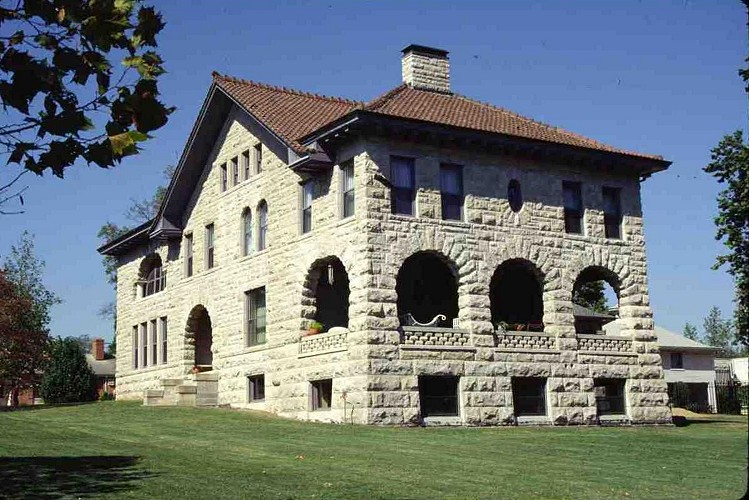
[3] Landmark name [4] Image Date listed Location City or town Summary 1 Administration Building-Post Hospital November 14, 1985 803 Garrison Ave.
35°48′24″N 95°15′11″W / 35.806667°N 95.253056°WFort Gibson 2 Central Baptist Church 
September 25, 1984 515 N. 4th St.
35°45′12″N 95°22′12″W / 35.753333°N 95.37°WMuskogee 3 Cherokee National Cemetery March 19, 1979 1.5 miles (2.4 km) east of Fort Gibson
35°47′49″N 95°13′45″W / 35.796944°N 95.229167°WFort Gibson 4 Commandant's Quarters 
November 14, 1985 905 Coppinger Ave.
35°48′32″N 95°15′08″W / 35.808889°N 95.252222°WFort Gibson 5 V. R. Coss House 
May 2, 1984 1315 W. Okmulgee St.
35°45′11″N 95°23′04″W / 35.753056°N 95.384444°WMuskogee 6 Dragoon Commandant's Quarters March 13, 1980 409 Creek St.
35°47′53″N 95°15′26″W / 35.798056°N 95.257222°WFort Gibson 7 W.E.B. DuBois School September 28, 1984 Off U.S. Route 69
35°40′05″N 95°25′24″W / 35.668056°N 95.423333°WSummit 8 Escoe Building July 14, 1983 228-230 N. 2nd St.
35°44′58″N 95°22′08″W / 35.749444°N 95.368889°WMuskogee 9 First Baptist Church September 25, 1984 6th and Denison Sts.
35°45′10″N 95°22′26″W / 35.752778°N 95.373889°WMuskogee 10 F.B. Fite House and Servant's Quarters October 6, 1983 443 N. 16th St.
35°45′29″N 95°23′09″W / 35.758056°N 95.385833°WMuskogee 11 Grant Foreman House September 19, 1973 1419 W. Okmulgee St.
35°45′12″N 95°23′12″W / 35.753333°N 95.386667°WMuskogee 12 Fort Davis November 23, 1971 2.5 miles northeast of Muskogee
35°47′00″N 95°19′35″W / 35.783333°N 95.326389°WMuskogee 13 Fort Gibson 
October 15, 1966 Lee and Ash Sts.
35°48′24″N 95°15′33″W / 35.806667°N 95.259167°WFort Gibson 14 Kendall Place Historic District December 16, 2005 Roughly bounded by W. Okmulgee St., S. 11th St., Elgin St., an alley north of Columbus St., and S. 14th and S. 16th Sts.
35°45′17″N 95°23′05″W / 35.754722°N 95.384722°WMuskogee 15 Manhattan Building 
August 11, 1983 325 W. Broadway
35°44′57″N 95°22′18″W / 35.749167°N 95.371667°WMuskogee 16 Manual Training High School for Negroes June 22, 1984 704 Altamont St.
35°45′24″N 95°22′08″W / 35.756667°N 95.368889°WMuskogee 17 George A. Murphy House May 2, 1984 1321 W. Okmulgee St.
35°45′11″N 95°23′05″W / 35.753056°N 95.384722°WMuskogee 18 Muskogee County Courthouse August 23, 1984 216 State St.
35°45′01″N 95°22′59″W / 35.750278°N 95.383056°WMuskogee 19 Muskogee Depot and Freight District December 6, 2006 Roughly bounded by Columbus Ave., S. Main St., Elgin Ave., and S. 5th St.
35°44′52″N 95°22′26″W / 35.747778°N 95.373889°WMuskogee 20 Nancy Taylor No. 1 Oil Well Site November 15, 1989 Haskell Lake Rd., west of U.S. Route 64
35°50′33″N 95°43′54″W / 35.8425°N 95.731667°WHaskell 21 Nash-Swindler House July 13, 1979 Maple and Jackson Sts.
35°47′48″N 95°14′54″W / 35.796667°N 95.248333°WFort Gibson 22 Officer's Quarters November 14, 1985 907 Coppinger Ave.
35°48′33″N 95°15′06″W / 35.809167°N 95.251667°WFort Gibson 23 Oktaha School August 24, 1978 Off U.S. Route 69
35°34′35″N 95°28′17″W / 35.576389°N 95.471389°WOktaha 24 A.W. Patterson House 
May 2, 1984 1320 W. Okmulgee St.
35°45′12″N 95°23′04″W / 35.753333°N 95.384444°WMuskogee 25 Post Adjutant's Office November 14, 1985 905 Garrison Ave.
35°48′31″N 95°15′15″W / 35.808611°N 95.254167°WFort Gibson 26 Post Blacksmith Shop 
November 14, 1985 905 Garrison Ave.
35°48′32″N 95°15′14″W / 35.808889°N 95.253889°WFort Gibson 27 Pre-Statehood Commercial District October 6, 1983 Main, Broadway, Okmulgee, and 2nd Sts.
35°45′01″N 95°22′10″W / 35.750278°N 95.369444°WMuskogee 28 Railroad Exchange Building August 11, 1983 2nd and Court Sts.
35°44′59″N 95°22′10″W / 35.749722°N 95.369444°WMuskogee 29 Andrew W. Robb House May 11, 1982 1321 Boston
35°44′43″N 95°23′07″W / 35.745278°N 95.385278°WMuskogee 30 St. Thomas Primitive Baptist Church March 3, 2004 5th St., north of its junction with Chimney Mountain Rd.
35°40′09″N 95°25′28″W / 35.669167°N 95.424444°WSummit 31 Seawell-Ross-Isom House January 30, 1978 Beauregard and Elm Sts.
35°48′14″N 95°15′24″W / 35.803889°N 95.256667°WFort Gibson 32 Severs Hotel September 12, 1982 200 N. State St.
35°44′55″N 95°22′13″W / 35.748611°N 95.370278°WMuskogee 33 Sheltered Shelter District December 15, 1978 Address Restricted Warner 34 Surety Building September 4, 1986 117 N. 3rd
35°44′57″N 95°22′17″W / 35.749167°N 95.371389°WMuskogee 35 Taft City Hall September 28, 1984 Elm and Seminole Sts.
35°45′40″N 95°32′42″W / 35.761111°N 95.545°WTaft 36 A. C. Trumbo House May 2, 1984 1321 W. Broadway St.
35°45′13″N 95°23′01″W / 35.753611°N 95.383611°WMuskogee 37 Union Agency October 6, 1970 Agency Hill in Honor Heights Park
35°46′00″N 95°25′00″W / 35.766667°N 95.416667°WMuskogee 38 United States Post Office and Courthouse 
March 24, 2000 111 N. 5th
35°44′58″N 95°22′31″W / 35.749444°N 95.375278°WMuskogee 39 Ward Chapel AME Church September 25, 1984 319 N. 9th St.
35°45′16″N 95°22′41″W / 35.754444°N 95.378056°WMuskogee 40 J.C. Welch House May 2, 1984 1403 W. Okmulgee St.
35°45′13″N 95°23′10″W / 35.753611°N 95.386111°WMuskogee See also
- List of National Historic Landmarks in Oklahoma
- National Register of Historic Places listings in Oklahoma
References
- ^ The latitude and longitude information provided in this table was derived originally from the National Register Information System, which has been found to be fairly accurate for about 99% of listings. For about 1% of NRIS original coordinates, experience has shown that one or both coordinates are typos or otherwise extremely far off; some corrections may have been made. A more subtle problem causes many locations to be off by up to 150 yards, depending on location in the country: most NRIS coordinates were derived from tracing out latitude and longitudes off of USGS topographical quadrant maps created under the North American Datum of 1927, which differs from the current, highly accurate WGS84 GPS system used by Google maps. Chicago is about right, but NRIS longitudes in Washington are higher by about 4.5 seconds, and are lower by about 2.0 seconds in Maine. Latitudes differ by about 1.0 second in Florida. Some locations in this table may have been corrected to current GPS standards.
- ^ "National Register of Historic Places: Weekly List Actions". National Park Service, United States Department of the Interior. Retrieved on November 10, 2011.
- ^ Numbers represent an ordering by significant words. Various colorings, defined here, differentiate National Historic Landmark sites and National Register of Historic Places Districts from other NRHP buildings, structures, sites or objects.
- ^ "National Register Information System". National Register of Historic Places. National Park Service. . http://nrhp.focus.nps.gov/natreg/docs/All_Data.html.
U.S. National Register of Historic Places Topics Lists by states Alabama • Alaska • Arizona • Arkansas • California • Colorado • Connecticut • Delaware • Florida • Georgia • Hawaii • Idaho • Illinois • Indiana • Iowa • Kansas • Kentucky • Louisiana • Maine • Maryland • Massachusetts • Michigan • Minnesota • Mississippi • Missouri • Montana • Nebraska • Nevada • New Hampshire • New Jersey • New Mexico • New York • North Carolina • North Dakota • Ohio • Oklahoma • Oregon • Pennsylvania • Rhode Island • South Carolina • South Dakota • Tennessee • Texas • Utah • Vermont • Virginia • Washington • West Virginia • Wisconsin • WyomingLists by territories Lists by associated states Other Municipalities and communities of Muskogee County, Oklahoma City 
Towns Boynton | Braggs | Council Hill | Fort Gibson‡ | Haskell | Oktaha | Porum | Summit | Taft | Wainwright | Warner | Webbers Falls
CDPs River Bottom | Sand Hills | Simms | Sour John
Unincorporated
communitiesBacone | Beland | Briartown | Chase | Crekola | Georgetown | Grandview Heights | Hyde Park | Keefeton | Martin | McLain | Pumpkin Center
Footnotes ‡This populated place also has portions in an adjacent county or counties
Categories:- Muskogee County, Oklahoma
- National Register of Historic Places in Oklahoma by county
- Buildings and structures in Muskogee County, Oklahoma
-


Wikimedia Foundation. 2010.