- National Register of Historic Places listings in La Plata County, Colorado
-
 Location of La Plata County in Colorado
This is a list of the National Register of Historic Places listings in La Plata County, Colorado. It is intended to be a complete list of the properties and districts on the National Register of Historic Places in La Plata County, Colorado, United States. The locations of National Register properties and districts for which the latitude and longitude coordinates are included below, may be seen in a Google map.[1]
There are 14 properties and districts listed on the National Register in the county.
-
- This National Park Service list is complete through NPS recent listings posted November 10, 2011.[2]
Listings county-wide
[3] Landmark name [4] Image Date listed Location City or town Summary 1 Colorado Ute Power Plant September 29, 1983 14th St. and the Animas River
37°16′44″N 107°52′47″W / 37.278889°N 107.879722°WDurango 2 Denver and Rio Grande Western Railroad Locomotive No. 315 October 24, 2008 479 Main Ave. Durango 3 Durango High School October 20, 2001 201 E. 12th St.
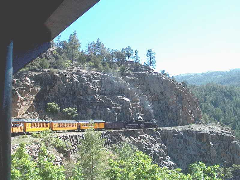
37°16′36″N 107°52′39″W / 37.276667°N 107.8775°WDurango 4 Durango Rock Shelters Archeology Site February 11, 1985 Address Restricted Durango 5 Durango-Silverton Narrow-Gauge Railroad 
October 15, 1966 Right-of-way between Durango and Silverton
37°17′51″N 107°42′39″W / 37.2975°N 107.710833°WDurango 6 East Third Avenue Historic Residential District October 11, 1984 E. 3rd. Ave. between 5th and 15th Sts.
37°16′26″N 107°52′37″W / 37.273889°N 107.876944°WDurango 7 La Plata County Fairgrounds August 12, 1991 2500 Main Ave.
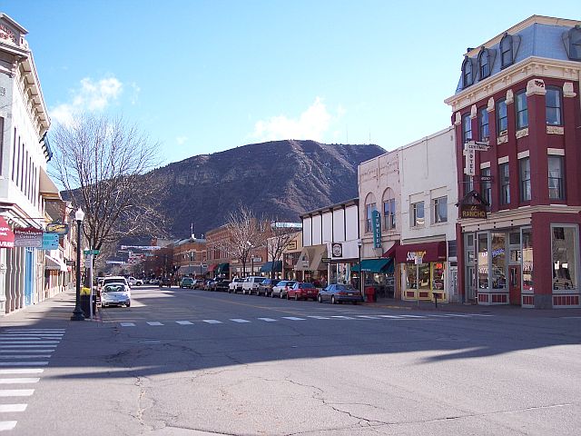
37°17′33″N 107°52′22″W / 37.2925°N 107.872778°WDurango 8 Main Avenue Historic District 
August 7, 1980 Main Ave.
37°16′23″N 107°52′48″W / 37.273056°N 107.88°WDurango 9 Newman Block October 15, 1979 801-813 Main Ave.
37°16′21″N 107°52′50″W / 37.2725°N 107.880556°WDurango 10 Ochsner Hospital May 4, 1995 805 5th Ave.
37°16′16″N 107°52′30″W / 37.271111°N 107.875°WDurango 11 Rochester Hotel February 29, 1996 726 E. 2nd Ave.
37°16′17″N 107°52′44″W / 37.271389°N 107.878889°WDurango 12 Smiley Junior High School November 27, 2002 1309 E. 3rd Ave.
37°16′39″N 107°52′34″W / 37.2775°N 107.876111°WDurango 13 Spring Creek Archeological District May 21, 1983 Address Restricted Bayfield 14 Ute Mountain Ute Mancos Canyon Historic District May 2, 1972 Address Restricted Durango See also
- List of National Historic Landmarks in Colorado
- National Register of Historic Places listings in Colorado
References
- ^ The latitude and longitude information provided in this table was derived originally from the National Register Information System, which has been found to be fairly accurate for about 99% of listings. For about 1% of NRIS original coordinates, experience has shown that one or both coordinates are typos or otherwise extremely far off; some corrections may have been made. A more subtle problem causes many locations to be off by up to 150 yards, depending on location in the country: most NRIS coordinates were derived from tracing out latitude and longitudes off of USGS topographical quadrant maps created under the North American Datum of 1927, which differs from the current, highly accurate WGS84 GPS system used by Google maps. Chicago is about right, but NRIS longitudes in Washington are higher by about 4.5 seconds, and are lower by about 2.0 seconds in Maine. Latitudes differ by about 1.0 second in Florida. Some locations in this table may have been corrected to current GPS standards.
- ^ "National Register of Historic Places: Weekly List Actions". National Park Service, United States Department of the Interior. Retrieved on November 10, 2011.
- ^ Numbers represent an ordering by significant words. Various colorings, defined here, differentiate National Historic Landmark sites and National Register of Historic Places Districts from other NRHP buildings, structures, sites or objects.
- ^ "National Register Information System". National Register of Historic Places. National Park Service. . http://nrhp.focus.nps.gov/natreg/docs/All_Data.html.
U.S. National Register of Historic Places Topics Lists by states Alabama • Alaska • Arizona • Arkansas • California • Colorado • Connecticut • Delaware • Florida • Georgia • Hawaii • Idaho • Illinois • Indiana • Iowa • Kansas • Kentucky • Louisiana • Maine • Maryland • Massachusetts • Michigan • Minnesota • Mississippi • Missouri • Montana • Nebraska • Nevada • New Hampshire • New Jersey • New Mexico • New York • North Carolina • North Dakota • Ohio • Oklahoma • Oregon • Pennsylvania • Rhode Island • South Carolina • South Dakota • Tennessee • Texas • Utah • Vermont • Virginia • Washington • West Virginia • Wisconsin • WyomingLists by territories Lists by associated states Other Municipalities and communities of La Plata County, Colorado City 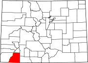
Towns CDP Southern Ute
Unincorporated
communitiesIndian
reservationCategories:- National Register of Historic Places in Colorado by county
- La Plata County, Colorado
-

Wikimedia Foundation. 2010.