- Main Avenue Historic District (Durango, Colorado)
-
Main Avenue Historic District
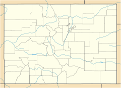

Location: Main Ave., Durango, Colorado Coordinates: 37°16′23″N 107°52′48″W / 37.27306°N 107.88°WCoordinates: 37°16′23″N 107°52′48″W / 37.27306°N 107.88°W Area: 34 acres (14 ha) Architect: Multiple Architectural style: Late 19th And 20th Century Revivals, Late Victorian Governing body: FOREST SERVICE NRHP Reference#: 80000907[1] Added to NRHP: August 07, 1980 Main Avenue Historic District in Durango, Colorado is a 34-acre (14 ha) historic district that was listed on the National Register of Historic Places in 1980. In 1980 it included 86 buildings deemed to contribute to the historic character of the area.[1]
It includes the Newman Block, at 801-813 Main Ave., which was separately listed on the NRHP in 1979.[1]
References
- ^ a b c "National Register Information System". National Register of Historic Places. National Park Service. 2009-03-13. http://nrhp.focus.nps.gov/natreg/docs/All_Data.html.
U.S. National Register of Historic Places Topics Lists by states Alabama • Alaska • Arizona • Arkansas • California • Colorado • Connecticut • Delaware • Florida • Georgia • Hawaii • Idaho • Illinois • Indiana • Iowa • Kansas • Kentucky • Louisiana • Maine • Maryland • Massachusetts • Michigan • Minnesota • Mississippi • Missouri • Montana • Nebraska • Nevada • New Hampshire • New Jersey • New Mexico • New York • North Carolina • North Dakota • Ohio • Oklahoma • Oregon • Pennsylvania • Rhode Island • South Carolina • South Dakota • Tennessee • Texas • Utah • Vermont • Virginia • Washington • West Virginia • Wisconsin • WyomingLists by territories Lists by associated states Other  Category:National Register of Historic Places •
  Portal:National Register of Historic PlacesCategories:
- Historic districts in Colorado
- National Register of Historic Places in Colorado
- Geography of La Plata County, Colorado
- Colorado Registered Historic Place stubs

Wikimedia Foundation. 2010.