- Ashley (Bristol ward)
-
Coordinates: 51°28′26″N 2°34′55″W / 51.4739°N 2.5819°W
Ashley, Bristol 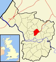
Boundaries of the council ward, shown within BristolPopulation 11,168 [1] OS grid reference ST598755 Unitary authority Bristol Ceremonial county Bristol Region South West Country England Sovereign state United Kingdom Post town BRISTOL Postcode district BS2, BS6, BS7 Dialling code 0117 Police Avon and Somerset Fire Avon Ambulance Great Western EU Parliament South West England UK Parliament Bristol West List of places: UK • England • Bristol Ashley is one of thirty-five council wards in the city of Bristol in the United Kingdom. The ward contains the areas of Ashley Down, Baptist Mills, Montpelier, St Andrew's, St Paul's and St Werburghs.[2]
Contents
Politics
Ashley is part of the Bristol West parliamentary constituency, which elects one Member of Parliament. The incumbent Member of Parliament is Stephen Williams MP, a Liberal Democrat.
On Bristol City Council, Ashley sends two councillors. Currently, these are Cllr Dr Jon Rogers, a liberal democrat, and Cllr Gus Hoyt of the Green party. Cllr Hoyt was elected in May 2011, following Cllr Rogers' re-election in 2009.
Ashley Down
Main article: Ashley DownAshley Down is an area sandwiched between Bishopston, Horfield and St Werburghs. The main artery is the Ashley Down Road. Ashley Down is the home of the City of Bristol College, Brunel Campus, once the Muller Homes orphanage, built between 1845 and 1849.
It is also the location of the Gloucestershire County Cricket ground.
Baptist Mills
Baptist Mills is a small area, which is located between St Werburghs and Easton. It was home to a brass works between 1700 and 1840,[3] and a pottery between 1840 and 1891.[4] The area is now often regarded as part of St Werburghs. In the 19th Century part of Baptist Mills was also known as Botany Bay and regarded[who?] as a fairly lawless area.
Montpelier
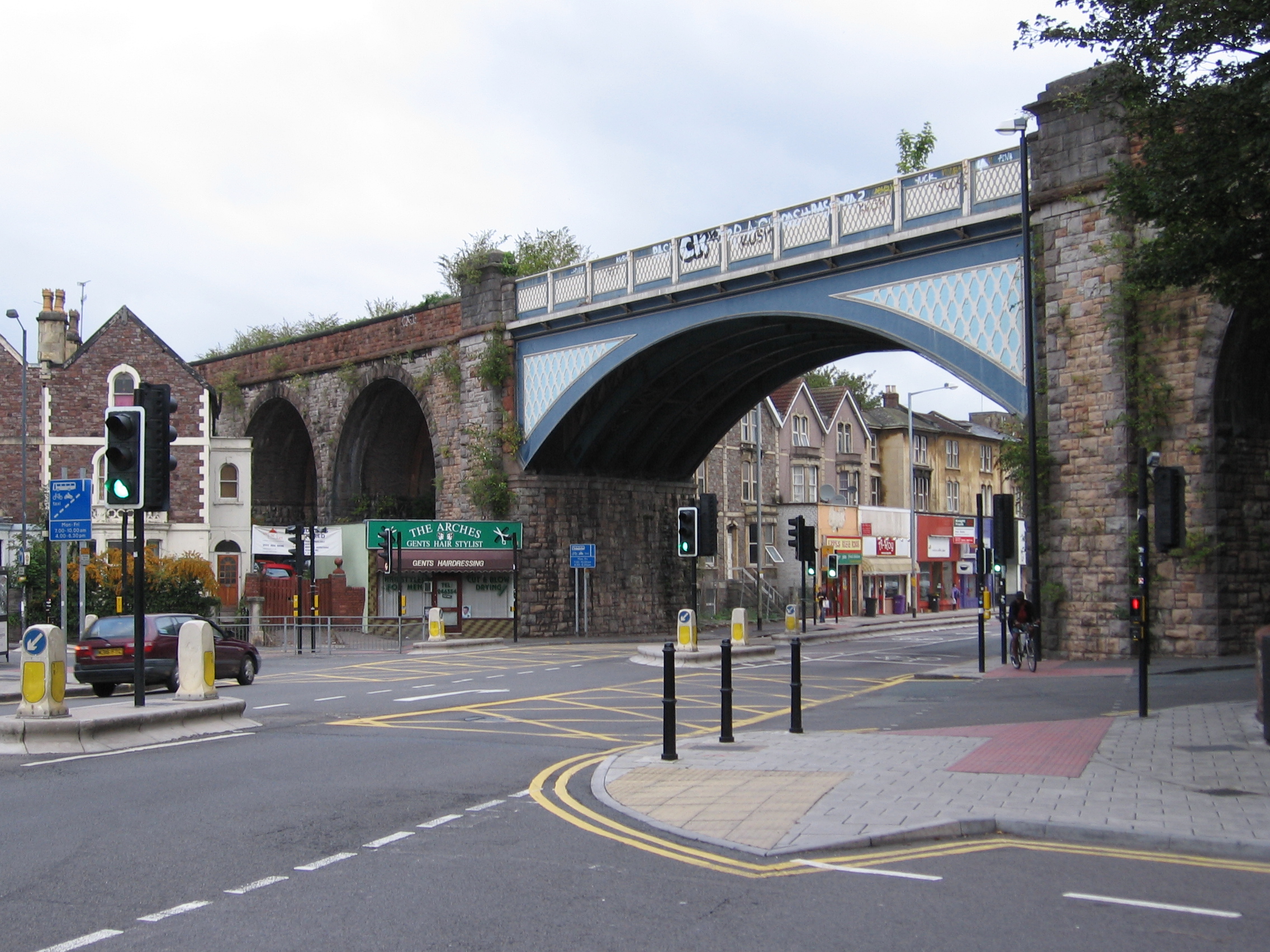
 The railway bridge is a local landmark in Montpelier.
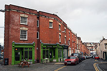 A view along Picton Street
Montpelier is an area of North Bristol. It is bounded by the Cheltenham Road to the west, St Paul's to the south, St Werburghs to the east and St Andrew's to the north. It has its own railway station, and a reputation for being bohemian and 'alternative'. Picton Street is a haven for lovers of organic and vegetarian cuisine. Picton Street was built and named in honour of Sir Thomas Picton who, as Captain Picton, in 1783 endeared himself to Bristolians by bravely facing the rebellious 75th Battalion on College Green and averting a military mutiny. There is also a double-bayed villa in the street named after him, Picton Lodge.
St Andrew's
St Andrew's is a suburb of Bristol situated about 3 km (1.9 mi) north of the city centre. The area was developed in the late 19th century as St Andrew's Park Estate, and consists mostly of large Victorian villas, with some inter-war housing and some rebuilding following enemy action in World War II.
The area is roughly bounded by the Severn Beach Railway Line, Gloucester Rd and Sommerville Rd; however as is often the case the boundary is debatable: According to the Ordnance Survey map this area is Montpelier, whereas according to the National Gazetteer of 1868 Montpelier is a hamlet within the Parish of St Andrew's. St Andrew's church, which gave the area its name, was in St Andrew's Road, Montpelier. It was demolished in 1969.
In the middle part of the 20th century the area became unfashionable and many of the houses were converted to multiple occupation. However during the 1990s living in the City Centre became fashionable once again and consequently these houses are now being converted back into family homes, their owners once again taking pride in them and restoring their period features.
St Andrew's is well-served by public transport, with frequent buses to all parts of the city from Gloucester road, buses to UWE's Frenchay Campus and a local train service from Montpelier Station to Bristol Temple Meads, Clifton, Avonmouth and Severn Beach.
St Andrew's Park
St Andrew's Park is at the heart of the area. The park was laid out in 1895,[5] and is home to events such as 'Music in the Park' during the summer (although this event stopped in 2006 due to council regulation), and 'Carols in the Park' at Christmas. Most of the events and input on the parks organisation is overseen by the voluntary organisation 'Friends of St Andrew's Park'
The park features a well-sized children's play area (extended and refurbished in 2010), permanent paddling pool (serviced and used only in the summer months), tea rooms (open in summer and during special events) and public toilets (limited opening hours). Despite being located on a hilly incline, the park is well used for football and frisbee throughout the year, as well as juggling, stilt walking, tightrope walking and other circus skills.
On April 30th 1941 a Wellington bomber on a night training flight crashed in the park after hitting balloon barrage cables. There is now a memorial to the crash in the park. See www.wellingtont2905.co.uk
St Paul's
Main article: St Paul's, BristolSt Paul's is an inner suburb of Bristol, England, situated just north east of the city centre and west of the M32. In the early 18th century it was laid out as one of Bristol's first suburbs.
St Werburghs
 St Werburghs Church
St. Werburghs is an area in central north-east Bristol, England. Surrounded by the M32 motorway, railway embankments and allotment slopes it has the feel of a green village in the inner city. The area became known as St.Werburghs when St Werburgh's Church was relocated (and substantially rebuilt) to Mina Road in this district from Corn Street, Bristol in 1879. Before then the northern part was Ashley Vale and the southern part Baptist Mills.
It is now a Climbing Centre by Undercover Rock and the St Werburghs city farm.References
- ^ "Ashley". 2001 Census Ward Information Sheet. http://www.bristol.gov.uk/WardFinder/pdfs/ashley-wis.pdf. Retrieved 2007-02-21.
- ^ Bristol City Council. "Ashley ward map" (PDF). http://www.bristol.gov.uk/WardFinder/pdfs/ashleymap-high.pdf. Retrieved 2007-10-31.
- ^ "The Brass Industry" (HTML). Living Easton. http://www.cems.uwe.ac.uk/~rstephen/livingeaston/local_history/brass1.html. Retrieved 2007-10-31.
- ^ "Baptist Mills Pottery" (HTML). Living Easton. http://www.cems.uwe.ac.uk/~rstephen/livingeaston/local_history/baptist_mills_pottery.html. Retrieved 2007-10-31.
- ^ Bristol City Council: Parks and open spaces: St Andrew's Park
External links
- George Muller entry at Christian Biography Resources
- Narrative of the Lord's Dealings with George Müller
- Joshua and Susan Bolitho's story
- Geograph of the Ashley Down area
- Montpelier Website
- Montpelier Village's Website
- Friends of St Andrews Park Website
Categories:- Districts of Bristol
- Wards of Bristol


Wikimedia Foundation. 2010.