- Cotham, Bristol
-
Coordinates: 51°27′55″N 2°36′04″W / 51.4653°N 2.6012°W
Cotham 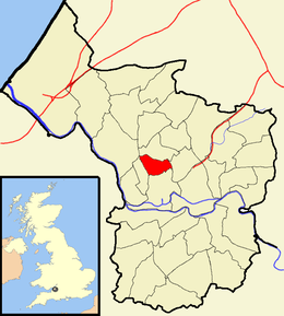
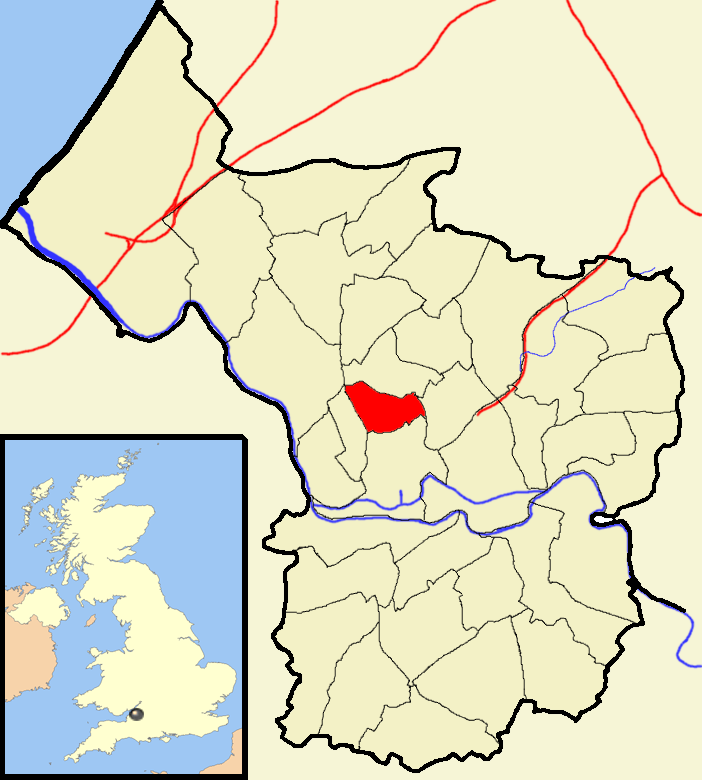
Boundaries of the city council ward.Population 10,902 [1] OS grid reference ST583742 Unitary authority Bristol Ceremonial county Bristol Region South West Country England Sovereign state United Kingdom Post town BRISTOL Postcode district BS6 Dialling code 0117 Police Avon and Somerset Fire Avon Ambulance Great Western EU Parliament South West England UK Parliament Bristol West List of places: UK • England • Bristol Cotham is the name of both a council ward of the city of Bristol in the United Kingdom, and a suburb of the city that falls within that ward. The ward comprises the Cotham suburb, and a small portion of Redland, which is another Bristol suburb.[2]
Contents
Cotham
Cotham is an affluent, leafy inner-suburb of Bristol, England, situated between Clifton and St Pauls, and similar in character to Redland. During the Census 2001, Cotham had a resident population of 10,902.
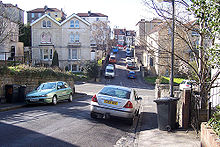 A street scene in Cotham.
It is a cosmopolitan residential area with large old houses (many of which are used as hotels and bed and breakfast accommodation, or divided into flats) and a selection of small independent shops. It also contains the comprehensive Cotham School (formerly Cotham Grammar School).
The top of Saint Michael's Hill in Cotham was the historical city limits of Bristol, and the traditional location for hangings. Between 1555 and 1557, three Marian martyrs were burned to death here for their religious beliefs. The gallows form one quadrant of the crest of the local Rugby club, Cotham Park RFC.
Cotham Church was originally built, in 1842-43 by William Butterfield in a Gothic Revival style, as Highbury Congregational chapel. It was Butterfield's first commission, obtained through his family connection with William Day Wills of the tobacco industrialists W. D. & H. O. Wills . The apse, tower, south transept and school were added in 1863 by Edward William Godwin. Since 1975 it has been an Anglican church.
Politics
Cotham is part of the Bristol West parliamentary constituency, which elects one Member of Parliament. The incumbent Member of Parliament is Stephen Williams MP, a Liberal Democrat.
On Bristol City Council, Cotham sends two councillors. Currently, these are Anthony Negus and Neil Harrison, both Liberal Democrats.[3]
Redland
Main article: Redland, BristolA small portion of the Redland suburb is within the Cotham ward, however the majority of it falls in the Redland ward. Notable places in the Cotham ward include Redland High School for Girls Junior School and Redland railway station.
References
- ^ "Cotham". 2001 Census Ward Information Sheet. http://www.bristol.gov.uk/WardFinder/pdfs/cotham-wis.pdf. Retrieved 2007-02-21.
- ^ Bristol City Council. "Cotham ward map" (PDF). Ward finder. http://www.bristol.gov.uk/WardFinder/pdfs/cothammap-high.pdf. Retrieved 2007-11-07.
- ^ Bristol City Council. "Cotham ward map". Ward finder. http://www.bristol.gov.uk/ccm/content/Council-Democracy/Elected-Representatives/councillor-finder.en?Task=ward&WardId=8. Retrieved 2009-09-15.
External links
Categories:- Districts of Bristol
- Wards of Bristol

Wikimedia Foundation. 2010.