- Marsden Mounds
-
Marsden Mounds
16 R 13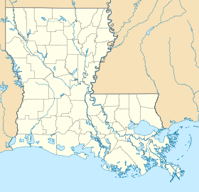
 Marsden MoundsLocation within Louisiana today
Coordinates: 32°29′10.8996″N 91°29′29.997″W / 32.486361°N 91.49166583°W Location Country:  USA
USARegion: West Carroll Parish, Louisiana Nearest town: Delhi, Louisiana History Culture: Poverty Point culture, Troyville-Coles Creek culture First occupied: 1500 BCE Abandoned: 1200 CE Excavation and maintenance Responsible body: private Architecture Architectural styles: platform mounds, embankment, plaza Marsden Mounds (16 R 13) is an archaeological site with components from the Poverty Point culture (1500 BCE) and the Troyville-Coles Creek period (400 to 1200 CE). It is located in Richland Parish, Louisiana near Delhi[1] It was added to the NRHP on August 4, 2004 as NRIS number 04000803.[2] It is the type site for the Marsden Phase (500-600 CE) of the Tensas Basin and Natchez Bluff regions local chronology.
Contents
Site description
The earthworks at the site include a group of five platform mounds and two portions of an earthen embankment. Mounds A, B, C and D (which are between 3 feet (0.91 m) and 5 feet (1.5 m) in height) are located along the eastern edge of Maçon Ridge with a section of the embankment connecting three of them. The largest mound at the site, Mound E, measures 13 feet (4.0 m) in height, with the base being 150 feet (46 m) by 150 feet (46 m) and a summit of 130 feet (40 m) by 130 feet (40 m). It and another portion of embankment are located across a large plaza 300 feet (91 m) to the southwest of the other mounds. During investigations at the site artifacts from the Poverty Point culture were found under some of the mounds showing that people occupied this are at least as early as 1500 BC during the Archaic period. Radiocarbon dating of charcoal samples from one of the smaller mounds have been dated 400 and 1200 CE during the Late Woodland Troyville-Coles Creek period. The site part of the Poverty Point Reservoir State Park and is open to the public and accessible by foot.[1]
See also
References
- ^ a b "Indian Mounds of Northeast Louisiana:Marsden Mounds". http://www.crt.state.la.us/archaeology/moundsguide/marsden.html. Retrieved 2011-10-20.
- ^ "National Register of Historic Places". http://nrhp.focus.nps.gov/natreghome.do?searchtype=natreghome. Retrieved 2011-10-17.
External links
- Marsden Mounds - Louisiana Historical Markers on Waymarking.com
- Best Louisiana State Parks to Visit in the Spring
 Coles Creek and Plum Bayou cultures
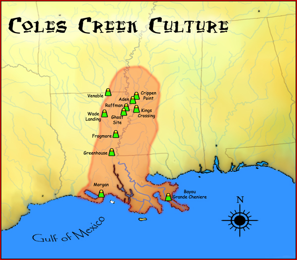
Late Woodland period · List of archaeological periods (North America) Coles Creek sites Aden Site · Balmoral Mounds · Churupa Plantation Mound · Coles Creek Site · Crippen Point site · Cypress Grove Mound · DePrato Mounds · Greenhouse Site · Filhiol Mound Site · Fisher Site · Flowery Mound · Frogmore Mound Site · Ghost Site Mounds · Greenhouse Site · Insley Mounds · Kings Crossing Site · Lamarque Landing Mound · Marsden Mounds · Mazique Archeological Site · Mott Mounds · Mound Plantation · Peck Mounds · Raffman Site · Scott Place Mounds · Shackleford Church Mounds · Sundown Mounds · Transylvania Mounds · Troyville Earthworks · Venable Mound · Wade Landing Mound ·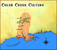
Coastal Coles Creek sites Atchafalaya Basin Mounds (16SMY10) · Bayou Black Mound (16TR78) · Bayou Cypremont (16SMY7) · Bayou Grande Cheniere Mounds · Bayou L’Ours Site · Bayou Portage Mounds · Bayou Sorrel Mounds (16IV4) · Clovelly Site (16LF64) · Cypress Point Site (16VM112) · Eagle Point Site (16IB123) · Gibson Mounds (16TR5) · Greenwood Cemetery Site (16SMY10) · Kleinpeter Mounds · Little Cheniere Site (16CM22) · Little Pecan Island Site (16CM43) · Jerry Haas Site (16SJ51) · Machias Lake (16SB2) · Morgan Mounds (16VM9) · Pecan Mounds (16SM37) · Pennison Mounds (16AS16) · Portage Mounds (16SM5) · Richeau Field Site (16TR82) · Schwing Place Mound (16IV13) · Southwest of Cut Off Lagoon (16SB50) · St. Gabriel Mounds (16IV128) · Temple Mounds Site (16LF4) ·Plum Bayou sites Chandler Landing Site · Coy Site (3LN20) · Dogtown Site · Hayes Site (35CS196) · Maberry Site · Roland Site (3AR30) · Toltec Mounds ·Related topics · Eastern Agricultural Complex · Fourche Maline culture · Mississippian culture · Natchez · Plaquemine culture · Platform mound · Taensa · Troyville culture · U.S. National Register of Historic Places Topics Lists by states Alabama • Alaska • Arizona • Arkansas • California • Colorado • Connecticut • Delaware • Florida • Georgia • Hawaii • Idaho • Illinois • Indiana • Iowa • Kansas • Kentucky • Louisiana • Maine • Maryland • Massachusetts • Michigan • Minnesota • Mississippi • Missouri • Montana • Nebraska • Nevada • New Hampshire • New Jersey • New Mexico • New York • North Carolina • North Dakota • Ohio • Oklahoma • Oregon • Pennsylvania • Rhode Island • South Carolina • South Dakota • Tennessee • Texas • Utah • Vermont • Virginia • Washington • West Virginia • Wisconsin • WyomingLists by territories Lists by associated states Other  Category:National Register of Historic Places •
  Portal:National Register of Historic PlacesCategories:
- Poverty Point culture
- Troyville culture
- Coles Creek culture
- Archaeological sites in Louisiana
- Geography of West Carroll Parish, Louisiana


Wikimedia Foundation. 2010.