- Cooch Behar Airport
-
Cooch Behar Airport
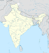
কোচবিহার বিমানবন্দরIATA: COH – ICAO: VECO Location of airport in India Summary Airport type Public Operator Airports Authority of India Serves Cooch Behar Location Cooch Behar, India Elevation AMSL 138 ft ft / 42 m msl m Coordinates 26°30′00″N 089°40′00″E / 26.5°N 89.6666667°E Runways Direction Length Surface ft m 04/22 3,500 1,067 Asphalt Sources[1] Cooch Behar Airport (IATA: COH, ICAO: VECO)[1] is located at Cooch Behar, West Bengal, India and serves the greater Assam-Bengal border area.[2]
Contents
Facilities
The airport is located at an elevation of 138 feet (42 m) above mean sea level. It has one runway designated 04/22 with an asphalt surface measuring 3,500 by 100 feet (1,067 × 30 m) without Instrument landing system.[3] The first commercial flight from Cooch Behar will be almost fully packed when it lands in Calcutta tomorrow as the air service from this small north Bengal town resumes after 18 years.
The 18-seater Dornier 228 aircraft of Northeast Shuttles is expected here from Guwahati at 7.40am. It will take off with 13 passengers from here at 8am to reach Netaji Subhas Chandra Bose International Airport in Calcutta at 9.20am. On the return trip, the take-off time from Calcutta is 10am with a touch down at Cooch Behar at 11.20. The flight will leave 10 minutes later for Guwahati where it is expected at 12.20pm.
While a Guwahati-Cooch Behar one-way trip will cost Rs 1,500, a ticket from the Assam capital to Calcutta will come for Rs 6,500 for one person.
Airlines and destinations
No Scheduled services at this time.
Charter airlines
Airlines Destinations Northeast Shuttles Kolkata, Guwahati [4][5] References
- ^ a b "ICAO Location Indicators by State" (PDF). International Civil Aviation Organization. 2006-01-12. http://www.icao.int/anb/aig/Taxonomy/R4CDLocationIndicatorsbystate.pdf.
- ^ http://www.aai.aero/allAirports/cooch_behar.jsp
- ^ http://worldaerodata.com/wad.cgi?id=IN00481&sch=VECO
- ^ http://www.telegraphindia.com/1090923/jsp/siliguri/story_11529688.jsp
- ^ http://www.deccanair.com/shuttlemap.html
External links
- Cooch Behar Airport information on flightstats [1]
See also
- List of airports by ICAO code
- List of airports in West Bengal
- List of airports in India
Cooch Behar district topics General Cooch Behar Airport • Cooch Behar Palace • Dooars • Indo-Bangladesh enclaves • Jagaddipendra Narayan • Koch Bihar • Koch dynasty • North Bengal • Uttar Banga Krishi ViswavidyalayaSubdivisions Community development blocks Cooch Behar I • Cooch Behar II • Dinhata I • Dinhata II • Sitai • Sitalkuchi • Mathabhanga I • Mathabhanga II • Mekhliganj • Haldibari • Tufanganj I • Tufanganj IIRivers Transport Lok Sabha constituencies Vidhan Sabha constituencies Mekliganj • Mathabhanga • Cooch Behar Uttar • Cooch Behar Dakshin • Sitalkuchi • Sitai • Dinhata • Natabari • TufanganjSee also Cities and towns in Cooch Behar district • People from Cooch Behar district • Villages in Cooch Behar districtOther districts Bankura • Bardhaman • Birbhum • Dakshin Dinajpur • Darjeeling • Hooghly • Howrah • Jalpaiguri • Kolkata • Malda • Murshidabad • Nadia • North 24 Parganas • Paschim Medinipur • Purba Medinipur • Purulia • South 24 Parganas • Uttar DinajpurCategories:- Airports in West Bengal
- Indian airport stubs
Wikimedia Foundation. 2010.


